I took Friday off work for a long weekend visiting my parents in their new home in Kendal. I drove up after dinner on the Thursday night on fairly quiet roads to arrive around 9:45pm with just time for a short chat and supper drink before bed.
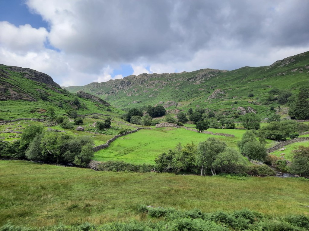
Friday morning was showery but forecast to brighten up for the afternoon, so we had a leisurely morning and a prompt lunch before driving to Grasmere for an afternoon walk. Even on a weekday, it was pretty busy in the Lakes, and we only just found space in the free parking layby on the main road. Plenty of others had chosen to follow the same route as us, up Easedale to Easedale Tarn, but the valley was still quite peaceful and the surrounding fells looked good in the sunshine. We admired the waterfall on Sourmilk Gill as we climbed, with Tarn Crag gradually coming into view above and eventually the tarn itself.
EasedaleWaterfall on Sourmilk Gill
It was breezy by the tarn so we didn’t stop long there, dropping down slightly for our snack break. We returned by the same route, with views of Helm Crag and Fairfield ahead, and took the short detour into Grasmere village to pick up some gingerbread before heading home.
Easedale TarnLooking towards Helm Crag and Fairfield
Saturday’s forecast was for continuous heavy rain. I was keen to attend a parkrun but by the time I went to bed had not managed to decide between heading west to Millom, north to Penrith, or south to Morecambe Prom. I got up early to leave all options open and, reviewing the overnight radar data and morning forecast, decided that Penrith had been the driest and had the lowest chance of rain. It didn’t seem promising as I drove through persistent rain over Shap Summit, but pleasingly it cleared about five miles south of Penrith. It had clearly not been a very wet night there, as I found on my warm-up that the course was not even puddly, whereas I had seen that it had flooded during the previous week’s parkrun!
The River Eamont, by the parkrun course
Hoping for a good time on the flat, gravel-surfaced course, I decided to set off at about 19-minute pace and see what happened. I was really pleased that I was able to cling on to that speed all the way and finish in 19:09 – my best since before the pandemic. I had passed the 5km mark in 18:57. Drizzle started to blow in as I caught my breath, so I didn’t hang around for long before setting off back to Kendal.
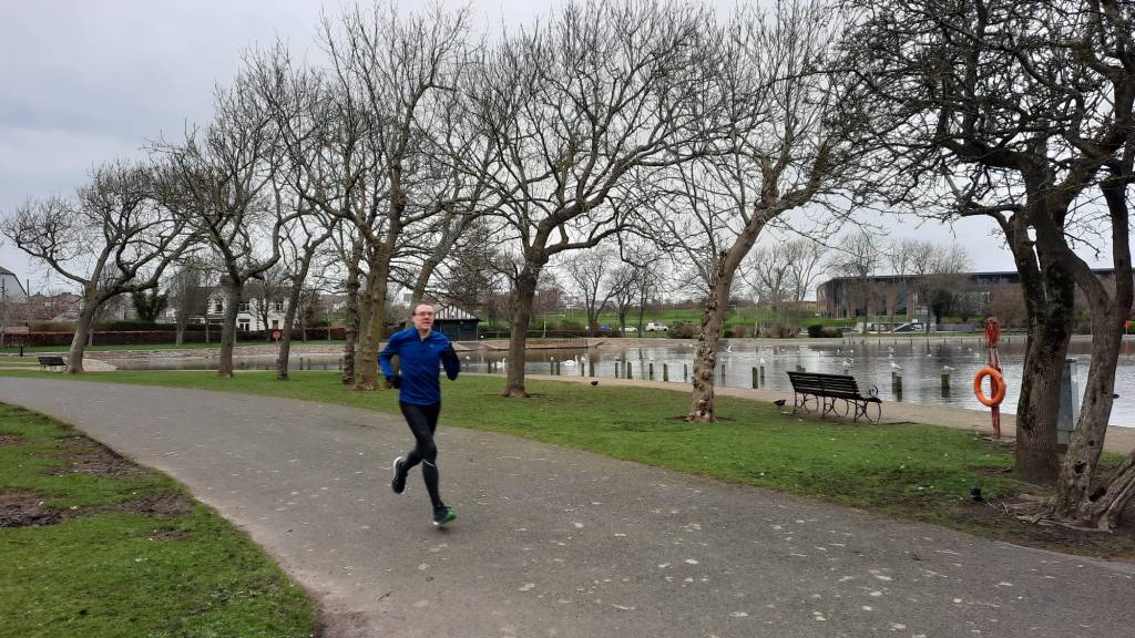
It actually stayed fairly dry for much of the day. We went out for a local walk through Kendal Parks after lunch, and only got caught in one short shower. It was good to explore the immediate surroundings of my parents’ new house a little.
Mum and Dad above Kendal Parks
Sunday had been supposed to be a better day than Saturday but actually turned out much wetter, the rain barely stopping at any point. We had a game of Scrabble in the morning, then an early lunch, then got our waterproof jackets and trousers on for an afternoon stroll down to the River Kent. Plenty of water was flowing around the big meander and over the weir at Watercrook, with even the ducks choosing to stay on the bank!
The weir at Watercrook
After enjoying roast dinner with my parents, I had a wet but undelayed evening drive back to Derby. Overall, not a good weekend to have chosen to be in Cumbria, but I was glad that I’d taken the Friday off and enabled that one good outing to the Lake District! There’s a map of our route up Easedale here, and a few more photos here.
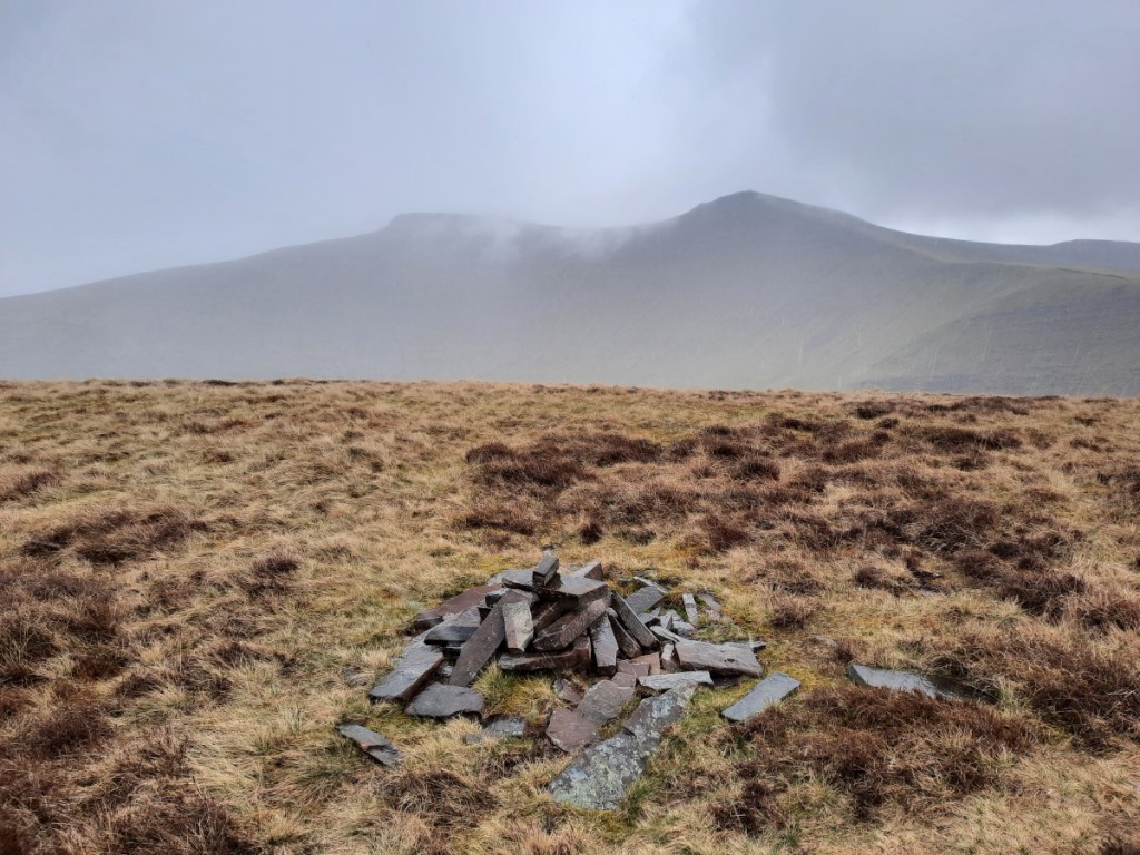
Steve organised another Gentian Club day walk in the White Peak, this time starting in Hartington. Nine of us met a little before 10am by the village green. I thought Steve’s proposed route along the upper Manifold and Dove valleys was a bit flat for a hillwalking club, so I staged a mini rebellion by offering to lead a hillier version, which didn’t meet any objections!
We set off by crossing the Dove valley to Sheen, then dropping back down to the Manifold valley near Brund. From there, we followed the Manifold Trail, mostly quite close to the river, north to the village of Longnor. We had passed lots of DofE groups around Sheen, but it was much quieter by the Manifold, the grassy path being fairly clear but not heavily trodden.
The view towards Wolfscote Hill, from near Sheen
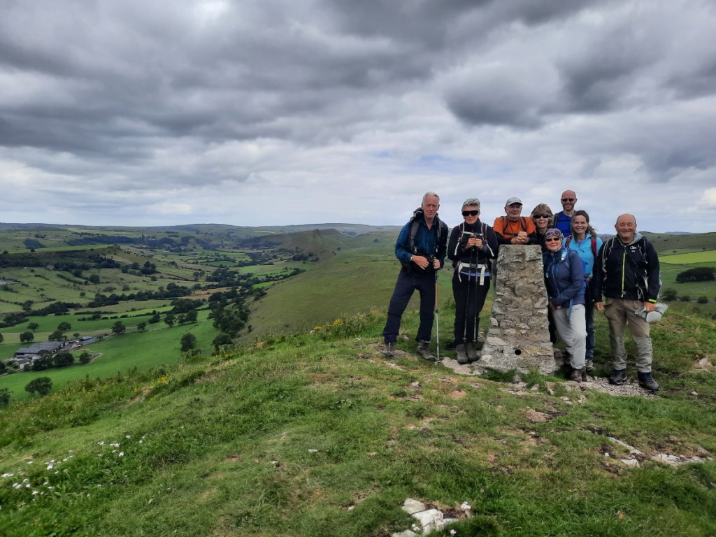
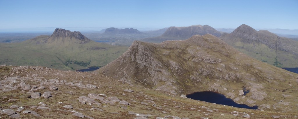
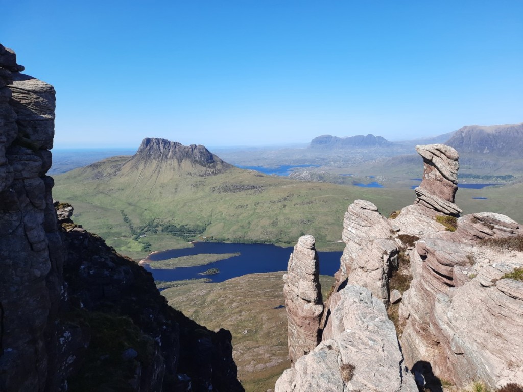
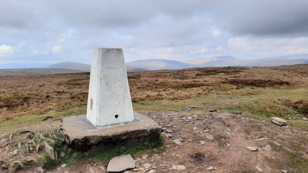
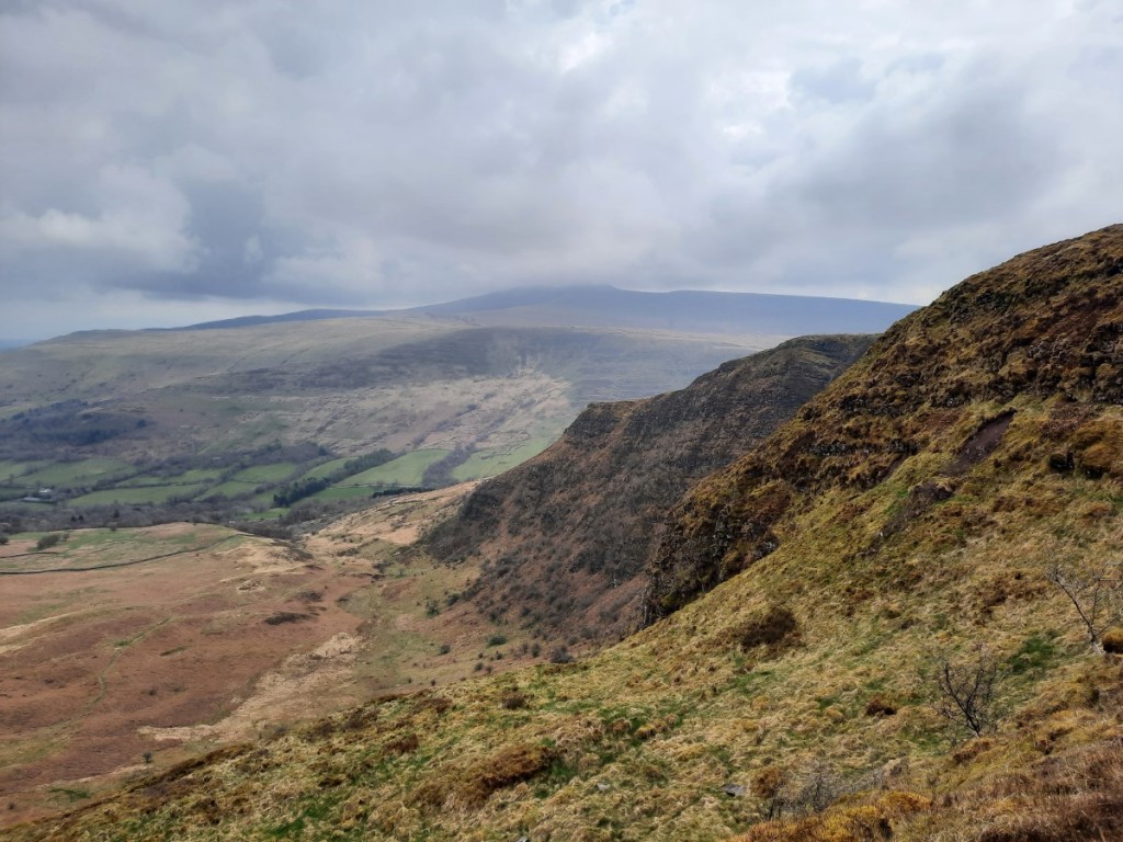
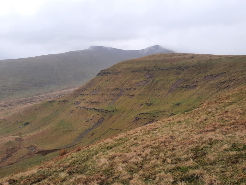
Once we’d crossed the ridge above Longnor, we gained views of the ‘Dragon’s Back’ hills: the reef atolls of Chrome Hill and Parkhouse Hill. Further to the right was the first summit I had suggested including, High Wheeldon. We crossed the valley via Beggar’s Bridge then ascended the very steep grassy slopes to the summit, enjoying the views from the trig point before dropping down a few metres to find shelter for lunch. The hill was a new Ethel for Steve and others (but not for me).
Aldery Cliff and High WheeldonThe upper Dove valley, with Chrome Hill on the rightThe group on the summit: Steve, Debbie, Steve, Chris, Helen, Rich, Claire and Martin
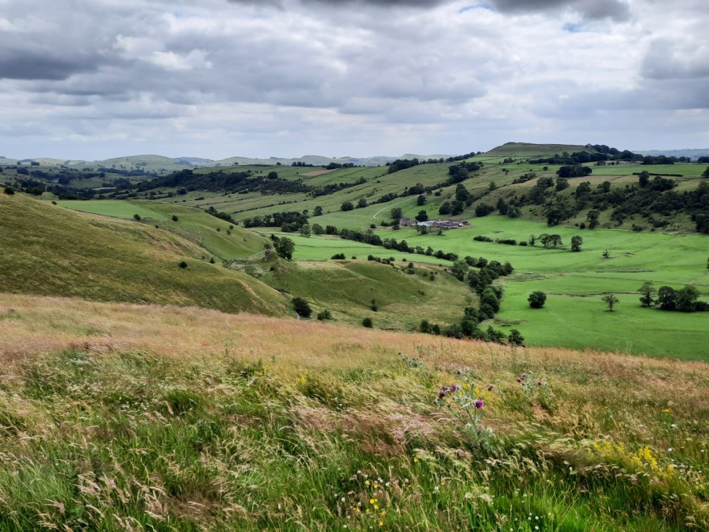
We then followed the well-marked (but unmapped) permissive path southeast along the ridge above Crowdicote. From there, the continuation, still occasionally waymarked but less well walked, made a traverse across the upper slopes of the access land towards Pilsbury Hill. The ungrazed meadows with lots of wild flowers gave pleasant easy walking, with views of the old motte and bailey at Pilsbury Castle, and towards Sheen Hill beyond. After that, we just had a short ascent between limestone outcrops to the tumulus at the summit of Pilsbury Hill, another Ethel.
Looking over Pilsbury Castle to Sheen Hill
Once across the next road, we were back on public footpaths most of the way to Carder Low, our final Ethel of the afternoon, with just a short pathless ascent required to reach the summit. Luckily the one dry-stone wall we needed to cross could be surmounted harmlessly at a section that had already collapsed, and there was another convenient gap on our descent route.
Debbie and Chris ascending Carder Low
That just left a couple of kilometres along the footpath and lane back to Hartington, where most of us had a drink at the Charles Cotton pub before heading home.
Another good day out with a great bunch of people. We were lucky with the weather, with a nice cooling breeze and warm sunny spells, and the few ominous grey clouds not producing any rain. A map of our route can be seen here, and my full photo album is available here.
This month’s Gentian weekend trip went to the quiet and remote hills of Mid-Wales, staying in the rustic, off-grid hostel at Dolgoch. Unusual for me to spend a weekend so relatively close to home in so unfamiliar an area! Claire, a recent new member from Nottingham on her second club meet, had asked to share a lift with me so we both got an early finish from work on the Friday afternoon and met at my house at 3pm. Conversation made the journey pass quickly and the traffic didn’t cause major delay so, after a stop for fish and chips in Knighton, we arrived at Dolgoch soon after 7pm.
I slept fairly poorly in the unfamiliar bed of an excessively warm dormitory. We gathered for breakfast together, as usual, at 7:30am, then shared our route ideas for the day. Mick and I had actually come up with near-identical plans to head up Drygarn Fawr, but agreed that it was best to keep it as two groups, mine faster and his a little more leisurely. Seven others decided to join me.
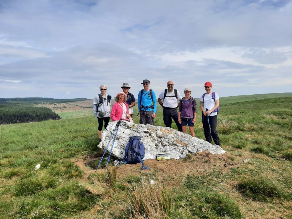
We walked directly from the hostel, ascending via the easy forest tracks up to Bryn Crwn, then up easy grassy slopes onto Drum Nantygorlan, which had an unusual large block of quartz at its summit. The large summit cairn of Drygarn Fawr was just visible, pointing above Drum yr Eira to the east.
The view from the hostelThe group on Drum Nantygorlan: Julia, Anne, Martin, Rich, Simon, Sheena and Claire
I had imagined we would head fairly directly across the valley of Nant y Rhestr towards Drygarn Fawr, but given the fair weather we opted instead for a more circuitous (but gentler) route via Cerrig Llwyd y Rhestr. Rough paths led us up to that craggy top, then a quad-bike track led us back south along the ridge past numerous boundary stones. After many weeks of dry weather, the bogs were very firm and progress was unusually easy!
Dry bogs on the ridge to Drygarn Fawr
Soon we were at the summit of Drygarn Fawr, passing the trig point to reach the huge beehive-shaped western cairn. Simon and Claire followed my example by climbing the cairn, while the others were content to watch from below. Then we had a leisurely lunch with hazy views of the Brecon Beacons to the south, and Plynlimon to the north. A few other walkers passing the summit were the only others we would see all day.
Simon on the cairnThe group on Drygarn Fawr
After lunch, we took a scenic detour along to the second large cairn at the east end of the summit ridge, with its distinctive white top, then returned to the main summit. We descended southwest, following the well-worn path to the edge of the forest, as Ruth and I had done on our backpack of the Dragon’s Back race route a couple of years ago. Keen to avoid the heavily-overgrown bridleway down to Llanerch-yrfa, we took the forest tracks on the other side of the valley – not strictly a right of way, but clearly well used.
Llanerch-yrfa Forest
Rather than follow the Devil’s Staircase road all the way back to the hostel, we took a slightly extended route to the top of the pass via some forest tracks on the north side, which just left around 1.5km of descent on the tarmac. We had made good time and were back at the hostel soon after 3pm for tea and good solar-heated showers. A dense congregation of midges soon drove us indoors after we had initially sat on the rear terrace overlooking the river! Route map: https://www.plotaroute.com/route/2290934
The evening followed its usual format, with a three course meal accompanied by drinks from the Gentian bar, then conversation and a bit of ceilidh music by John, Sue and Sheena in the later evening. I headed to bed around 10pm, finding the dormitory less hot than the previous night, but for some reason I didn’t sleep significantly better!
After Sunday breakfast, we did a bit of cleaning and tidying before setting off on our walks for the day. This time, I offered a circular route starting a short distance west of the hostel, taking in a section of the Cambrian Way, while Mick proposed breaking the drive home with a walk up the Radnor Forest hills. Four opted to join me, and we reconvened at the summit of Bwlch Esgair Gelli after a few minutes’ drive.
The walk started easily with a descent of the quiet road towards Nantymaen. There we picked up the Cambrian Way – totally pathless and unevident on the ground – over the undulating ridges of Esgair Cerrig and Esgair Wynt.
Claire, Rich, Sheena and Anne on Esgair Wynt
Beyond there, we reached the end of a better track down the Doethie valley. After a mile or so, we passed the hostel at Ty’n-y-cornel, Dolgoch’s twin hostel, and took advantage of its public tea-making facilities before having first lunch on the terrace and a bit of a chat with the warden.
The next section of the walk, following the Doethie valley downstream, was the most attractive of the day. Shortly after leaving Ty’n-y-cornel, we left the heavily-eroded byway to follow a more attractive contouring bridleway across the bracken-covered slopes below Foel Fraith. We passed a few backpackers heading the opposite direction. A few rolls of thunder were audible in the distance, but never brought rain. The steep valley gave excellent views in both directions, with scattered deciduous trees around the river, and larger coniferous plantations further downstream.
The Doethie valleyClaire in the Doethie valley
We then climbed steeply up to the left to pass over the ridge to Nant-llwyd and continued along bridleways from there to the small chapel at Soar y Mynydd. It was a nice surprise to find a church service in progress, the visiting congregation singing with characteristically-Welsh gusto (and in Welsh). We paused for second lunch nearby but were soon driven away by gathering midges, and followed the lane north for a couple of kilometres below the forest of Esgair Ganol. To return to the cars, we headed up the grassy slopes onto the broad ridge of Gamallt, tussocky in places, but with intermittent sheep trods and quad-bike tracks to help our progress. A heavy flurry of rain sent us diving for our waterproofs, but petered out before we’d finished putting them on! Route map: https://www.plotaroute.com/route/2290936
Looking back down into the Doethie valley
Back at Bwlch Esgair Gelli, we said our goodbyes then set off back home. I had offered Sheena a lift back to Wolverhampton to enable her to join our group for the day, so that was the first stop, before dropping Claire back to her car at my house. TMS coverage of the first Ashes Test provided the entertainment, despite rain having stopped play! It stayed dry in Wales but was pretty wet through England – welcome rain for the plants and reservoirs!
In summary, another very enjoyable weekend away with the Gentian Club. It was great to explore a new area, the remote Doethie valley being a particular highlight. Think I’ll have to wait until October for my next similar weekend away though!
As ever, I spent Spring Bank Holiday week in the Highlands. Even after all these years, it doesn’t lose any of its appeal! With Graham-bagging not always seeming the most exciting option on good-weather days, I interspersed a few new ticks with return visits to some of my favourite Munros and Corbetts, and I expect that’s how the pattern will continue through my Graham project.
To help make the Friday-night drive more manageable, I worked from my parents’ new house in Kendal that day, and was able to get away around 3pm for the drive up to Aviemore. Ruth had departed earlier in the campervan with Josh, and had warned of long delays on the M6 and A6 south of Penrith, so I decided the least bad option was to take the scenic route via Windermere and the Kirkstone Pass – not fast roads but I reached Penrith without sitting in any queues, probably more quickly and certainly more pleasantly than the alternatives!
The rest of the drive was straightforward, stopping for dinner in Perth and arriving at Cairngorm Lodge SYHA by 9pm. Once I’d checked in and chosen my bunk, I sought out Ruth and Josh in their van on the adjacent campsite to make plans for the next day. I would have camped myself but the Loch Morlich campsite is so expensive that it was £10 per night cheaper to have a dormitory bed in the hostel!
Saturday dawned overcast and breezy. The three of us headed to Aviemore parkrun, which turned out to be a very enjoyable course along the Speyside Way, with views of the Cairngorms. Until the turn-around point at half way, I shared the lead with one other runner, but he pulled up soon after that – presumably injured – and by the end I had a lead of over 90 seconds to the next runner. It had been more than three years since the last time I was First Finisher at a parkrun! Ruth finished in 6th place overall, surprisingly only 3rd woman!
Aviemore parkrun finish!
Afterwards, Ruth and Josh went for a bike ride, while I opted for a high walk in the Cairngorms. I parked by the ski centre at Coire Cas and, once I’d escaped the mess of ski infrastructure, enjoyed my walk up onto the plateau via the Fiacaill ridge. A short climb then led me to the windy summit of Cairn Gorm, which became clear of cloud as I approached.
I then made the long but easy traverse to Ben Macdui, with good views over Coire an t-Sneachda and towards Beinn Mheadhoin, passing quite a few other walkers and crossing a few large snow patches. The summit was in mist, so I didn’t linger long before heading back north on the direct path back to Coire Cas. Breaks in the cloud gave intermittent views over the Lairig Ghru to Cairn Toul and Braeriach. Route map: https://www.plotaroute.com/route/2266510
Coire an t-SneachdaCairn Gorm
Back at the hostel, I showered and had a cup of tea before joining Ruth and Josh in the campervan for dinner. The Farrows and Hobbs-Ballses had also arrived and set up camp, so it was good to catch up with them too.
Sunday was the appointed day for Ruth’s Corbett completion on nearby Meall a’ Bhuachaille, which had been my own first Corbett, way back in January 2005, when a few of us from CUHWC did some winter skills training in the area! The group congregated at the Visitor Centre at 10am, including some from Ruth’s work plus a selection of Old Duffers and bagging friends, and quite a few of their young children. It was good that Amy + girls were able to join us, giving a chance to catch up with her too. My own choice of final Corbett last year, Streap, was a more typical example (i.e. largely pathless) and would not have been so family friendly!
The ascent route was straightforward, along the forest tracks to the Green Lochan and Ryvoan Bothy, then more steeply up the well-walked hill path to the summit. The day grew increasingly sunny, and we enjoyed good views of the main Cairngorm plateau. We had celebratory prosecco and lunch at the summit, very warm with barely a breeze! Then it was just a short walk down to the bealach and directly from there down paths to Glen More. Route map: https://www.plotaroute.com/route/2269501
Looking towards Cairn GormThe summit party (photo borrowed from Ruth)
In the evening, some of the group reconvened on the beach by Loch Morlich for a relaxing barbecue in the sunshine.
On Monday, I had arranged to meet Ruth and Josh by the east end of Loch Droma – a 90-minute drive further northwest – for a walk up Cona Mheall and Beinn Dearg. When they arrived, we did a quick car faff to drop my car at our finish point, at the other end of the loch and save a little road walking at the end of the day. Then we set off north across the rough hillside to pick up a small path past Loch a’ Gharbhrain and down to the Allt a’ Gharbhrain. We had read that this river can become uncrossable in spate, but after the very dry recent weather it was a trivial crossing with a wide range of flat stepping stones to choose from!
We continued over rougher ground beside Loch Coire Lair then diagonally up the slopes of Leac an Tuadh, crossing a few steep slabs higher up to reach the foot of Coire Granda. From there, the south ridge of Cona Mheall looked a very unlikely walkers’ route but, as the book had described, the steep climb up to its crest did not involve any significant scrambling, with plenty of easy lines between the crags and buttresses. The views over Loch a’ Choire Ghranda were suitably grand as we clambered up and then traversed the narrow arete to the summit of Cona Mheall!
Cona Mheall above Coire LairRuth and Josh above Leac an TuadhBeinn Dearg over Coire GrandaCoire Granda
After lunch in the lee of some rocks on the eastern side of the hill, we continued down to the bealach, then up the well-walked path to Beinn Dearg, passing three others as we climbed – the only others we would see that day. The descent via the SSE ridge to Loch nan Eilean gave more fine views over the corrie. After another short drop down to re-cross the Allt a’ Gharbhrain, we were just left with a short crossing of Meall Feith Dhiongaig, on easy ATV tracks, to reach the car at the dam. A great day out in these dramatic hills, by a far superior route to the standard approach up Gleann na Sguaib! Route map: https://www.plotaroute.com/route/2268302
Beinn Dearg from the bealachCona Mheall over Coire Granda
We then drove the final few miles to the campsite at Ardmair Point, pausing en route through Ullapool to pick up supplies for the next few days.
Ruth and Josh decided to go for another bike ride on Tuesday, so I made it a Graham-bagging day. First on my list was Beinn Ghobhlach, a dramatic-looking hill on the peninsula between Loch Broom and Little Loch Broom. It’s only 4 miles from the campsite as the crow flies, but the drive to its foot at Badrallach required a less convenient 50-minute drive via Braemore Junction! I parked near the end of the road then set off on a rising traverse to reach the small lochans on the west ridge of Cnoc a’ Bhaid-rallaich. These, and the larger Loch na h-Uidhe and Loch na Coireig beyond, gave a great foreground to the views of Beinn Ghobhlach.
Beinn Ghobhlach
First, though, I headed up the very attractive rocky ridge to the Cnoc, which is a sub-2000-foot Marilyn in its own right, and was excited to see a couple of golden eagles flying above the bealach.
Little Loch Broom
After a snack at the summit, I descended easily to Loch a’ Bhealaich before zigzagging west then east up the slopes beyond to reach the summit of Beinn Ghobhlach. The summit itself was clear, and gave sunny views inland, but a low cloud was hanging to the northwest and obscuring views further down the peninsula. This gradually lifted and cleared as I walked around the rim of Coire Dearg, and I could see clearly over the Summer Isles as I began the descent. The pinnacles of An Teallach also put in an appearance, above a layer of cloud to the south! I dropped down all the way to the coast path, then followed that back to Badrallach. Route map: https://www.plotaroute.com/route/2269492
Loch na Coireig and Loch na h-Uidhe, with Little Loch Broom beyondThe coast, from Beinn GhobhlachCoire Dearg, and An Teallach in the distance
With plenty of the afternoon remaining, and plenty of energy in the legs, I broke the drive back to Ardmair with a shorter walk up another Graham, Meall Doire Faid, above Braemore Junction. My ascent route followed paths past Home Loch then up to the northern bealach before an easy scramble up the northwest ridge. The summit was unremarkable but a great viewpoint for the Fannaichs, Fisherfield, An Teallach, Beinn Dearg and Coigach. I descended more directly down the southwestern slopes to the car. Route map: https://www.plotaroute.com/route/2269498
Views of An Teallach and Ben More Coigach, from Meall Doire Faid
On Wednesday, Ruth and Josh fancied a scramble around the horseshoe of An Teallach. It’s my favourite of all Scottish mountains, so I was very happy to make my third ever visit! We drove back around via Braemore Juntion to park at Corriehallie, with cloud above but an expectation that it would soon burn off. Sure enough, by the time we had walked up the track and lower slopes of Sail Liath, it was breaking up to reveal patches of blue sky. Nearing the summit of that Munro Top, we were above what remained of the cloud layer, giving some dramatic views over the Fisherfield hills, particularly Beinn Dearg Mor.
Beinn Dearg MorFisherfield
As we continued along the ridge towards Corrag Bhuidhe, the clouds dispersed altogether, exactly as forecast. The pinnacles, as usual, gave excellent exposed scrambling on grippy rock, and incredible airy views over the corrie up to the two Munro summits. We had the whole ridge to ourselves, only meeting a few others near the summit of Sgurr Fiona – they had all come up by the easier path from Dundonnell.
An TeallachCorrag BhuidheRuth on the ridgeLooking back to Corrag Bhuidhe
It didn’t take long to traverse to Bidein a’ Ghlas Thuill, enjoying the views back to the pinnacles as we went. Then we were just left with the quick descent on small paths down Glas Tholl back to the road. Route map: https://www.plotaroute.com/route/2270892
Sgurr FionaAn Teallach
Thursday was another cycling day for Ruth and Josh, and another Graham day for me. As the morning was rather grey, and expected to brighten from the south, I opted for the easier and less interesting of my two objectives first – Beinn Bhreac, above Inverlael. Good forest tracks then upland 4×4 tracks led me very easily up to 500m on the hillside, just leaving a couple of kilometres over short grass, with the help of an ATV track, to the flat 667m summit with a small lochan. The cloud was gradually rising to give glimpses of Seana Bhraigh and the Beinn Dearg hills, although their summits only came fully into view as I descended (by the same route). It was clearer over the more-distant Fannaichs though. By the time I reached the top of the forest, I could also see An Teallach to the west. Although 14km and nearly 700m ascent, the whole walk only took me 3 hours, thanks to the very easy tracks most of the way! Route map: https://www.plotaroute.com/route/2272268
Brightening skies over the Beinn Dearg hills
My second objective for the day was Beinn an Eoin, a craggy Graham just north of Ben More Coigach. My route started near the eastern end of Loch Lurgainn, where the one parking place was already taken so I had to begin 1km further up the road than planned. The map shows forest on the approach to Cioch Beinn an Eoin, but in reality it’s now just scattered trees. The ground remains very rough though, with various stump-holes evident! I was pleased to reach that eastern top of the ridge and have a late lunch break there in the sunshine.
Stac Pollaidh
The ridge up to the main summit of Beinn an Eoin gave superb views over Lochan Tuath to Ben More Coigach to the south, as well as north to all the other famous Assynt hills, most prominently Stac Pollaidh and Cul Beag. A steep descent and reascent led me to Sgorr Tuath, the north top, from where it was a relatively easy descending traverse south and east, around the end of the ascent ridge to reach the road and car. Route map: https://www.plotaroute.com/route/2272270
Sgurr an FhidhleirBen More CoigachAssynt from Beinn an EoinStac Pollaidh and Suilven, from Sgorr Tuath
For Friday’s walk, I was joined by Ruth and Josh on the twin Grahams of Ben More Coigach and Sgurr an Fhidhleir, the former dominating the view north from our campsite and thus an obvious objective for the trip! To enjoy the most logical horseshoe route, we drove all the way around three and a half sides of the hill to end up at the end of the road at Culnacraig, again not far from camp as the crow flies.
An unexpectedly good path led from there up into the corrie, and making easy work of the first 300m ascent. We then traversed across the ravine of Allt nan Coisiche to reach the end of the Garbh Choireachan ridge – another one that looked daunting but just required walking and optional easy scrambling in reality. As we continued along the ridge towards the summit of Ben More Coigach, we passed one of Ruth’s colleagues’ wife and son running the opposite way – small world (although we had seen their van in the car park so it wasn’t a total surprise!).
Loch Broom, from Garbh ChoireachanThe ridge to Ben More Coigach
We took the scenic detour to the viewpoint of Speicein Coinnich before continuing northwest, down and back up to the pointy summit of Sgurr an Fhidhleir, surrounded on three sides by huge cliffs. This gave splendid views of Beinn an Eoin (that I had climbed the previous day) and the other Assynt hills beyond.
Beinn an Eoin, from Speicein CoinnichRuth and Josh below Sgurr an FhidhleirLooking between Sgurr an Fhidhleir and Beinn an Eoin to Stac PollaidhBeinn an Eoin
Ruth’s knee was getting sore, so she and Josh descended slowly by the direct path while I took the scenic route over Beinn nan Caorach and reached Culnacraig not long after them. Route map: https://www.plotaroute.com/route/2274247 We broke the drive back to camp with a stroll on the white sandy beach and dunes at Achnahaird Bay. In the evening we popped into Ullapool for fish and chips, although we returned to camp to eat them as the seafront was a construction zone with nowhere to sit!
Achnahaird Bay
On Saturday, Ruth and Josh opted for a short walk up Stac Pollaidh and potter around Achmelvich, while I preferred a bigger hill-day and headed further north to the triple Corbett of Quinag. My previous visit had been in showers and poor visibility, so I hoped for better views this time but was disappointed that, even with a late-ish start, the morning mist was not showing much sign of breaking up as I set off from the car park. As I climbed, bright skies above gave the impression that the cloud was not thick, but it was only in the final few metres to the summit of Spidean Coinich that I broke free into the sunshine above an inversion! Banks of cloud drifting around meant there were only fleeting glimpses of the other two Corbetts.
Inversion on Spidean Coinich
After enjoying the cloudscape and chattign with a few others on the summit for a while, I continued along the narrow ridge down to Bealach a’ Chornaidh, then up the broader ridge to the second Corbett, Sail Ghorm. This was similarly situated just above a sea of cloud, which enjoyed as I ate my lunch in the sunshine.
Mist swirling around the ridge of Sail GhormSail Gharbh
The cloud finally began to break up more significantly as I made the final traverse to the third and highest summit, Sail Gharbh, giving intermittent views of both the other tops, which continued to improve as I descended to the bealach and corrie. Returning to the car mid-afternoon, it was finally getting properly sunny. Still, I had had a much better experience on Quinag to last time, even without the hoped-for views of Canisp and Suilven. Route map: https://www.plotaroute.com/route/2274248
Spidean Coinich
Sunday was mostly spent on the 9 hour drive home. I got up quite early and was on the road by 7:45am and parked up just off the A9 at Lynebeg by 9am for a quick walk up the Graham, Carn na h-Easgainn. This must be one of the easiest Grahams as the ascent is only 3km and 300m climb, with a large track all the way. I was surprised to overtake two women near the summit, and not to have the place entirely to myself, particularly as the cloud was low and there were no views to be enjoyed that early in the day. They assured me that the views over Inverness were good! I think it cleared an hour or so later, as it was certainly clear everywhere by the time I was driving past the high Cairngorms. Sadly a later start was not really an option for me with the long drive to do. Route map: https://www.plotaroute.com/route/2276711
Woods on the lower slopes of Carn na h-Easgainn
The roads were flowing well and I made it home by about 7:30pm after a lunch stop in Perth and dinner stop at Sandbach services. This week will certainly live long in the memory as one of my best ever summer weeks in the Highlands – sunshine most days and never any significant wind or rain, but enough breeze in camp to keep the midges at bay! That capped with great walks on some of the finest hills in the country made it a brilliant holiday.
My full photo album is available on Google Photos here.
Summer has definitely arrived this weekend in Derbyshire, so I celebrated with two days of walking and running in the Peak District.
Saturday started at Monsal Trail parkrun. I haven’t run it officially before – only a freedom parkrun on the old Bakewell parkrun course before it was re-branded post-Covid. It was a warm and sunny morning but the trees lining the trail offered frequent shade. I reached the 5k mark in around 19:45 but couldn’t quite get to the finish line under 20 minutes this time, clocking 20:01 in the results. At least I managed to get ahead of the man in the inflatable alien costume, even if only after 4km!
Monsal Trail parkrun
After parkrun, it was only a few minutes’ drive down to Baslow to start my day’s walk. I had planned to take in a few of the woodlands below the various eastern Edges in hope of some good displays of bluebells and spring foliage, and I was not disappointed!
Yeld Wood
Following my circuitous ascent to Wellington’s Monument, I followed the traversing paths below Baslow and Curbar Edges, finding more bluebells among last year’s dead bracken.
Scattered bluebells below Baslow EdgeHeading through the woods below Curbar EdgeCurbar Edge
Then I continued along Froggatt Edge and down through Hay Wood to Nether Padley, before ascending Padley Gorge, with beautiful dappled sunshine among the oak trees. Some of the faster runners of the Hathersage Hurtle race were descending as I climbed.
Dappled sunshine in Padley Gorge
Once I’d escaped the woods, I followed paths to Longshaw Lodge and there turned south to return to Baslow via White Edge and Baslow Edge, with super long-distance views over the moorland and the Derwent Valley. A map of my route is available here.
White EdgeCurbar Edge from Baslow Edge
Ruth drove down to my house in the late afternoon. We ate together, then spent the evening comparing plans for the next Peak Raid MapRun event, which we would tackle the next morning. The race started in the small village of Combs, northwest of Buxton. I’ve explored Combs Moss in the past but not really the valley and village to the west.
My route was generally clockwise, up onto Combs Moss and south along the edges, then back north past Combshead and Allstone Lee farms. I then zigzagged west on various little-used footpaths through the farmland to pass over the southern shoulder of Ladder Hill, looping back down to the shore of Combs Reservoir for the final stretch back to Combs village. The terrain gave more technical running and more challenging navigation than the first race of this year’s series, so I covered about 1.5km less in the two hours, but was pleased to set the highest score so far on this course, having visited 29 of the 35 controls and finished with 2 minutes to spare.
My Peak Raid route
Ruth’s route started similarly but omitted the big loop around Ladder Hill – good enough to be the leading female runner so far. We had lunch in the small park by the finish line, then took a short recovery stroll back down to Combs Reservoir. After that, we drove up onto the Cowlow road for another short walk onto the end of Combs Edge, to appreciate the scenery at leisure and take a few photos, before heading back to Hilton.
Combs EdgeRuth above Combs Reservoir
Two cracking days on and around the eastern and western gritstone edges in the sunshine! More photos can be found on Google Photos here.
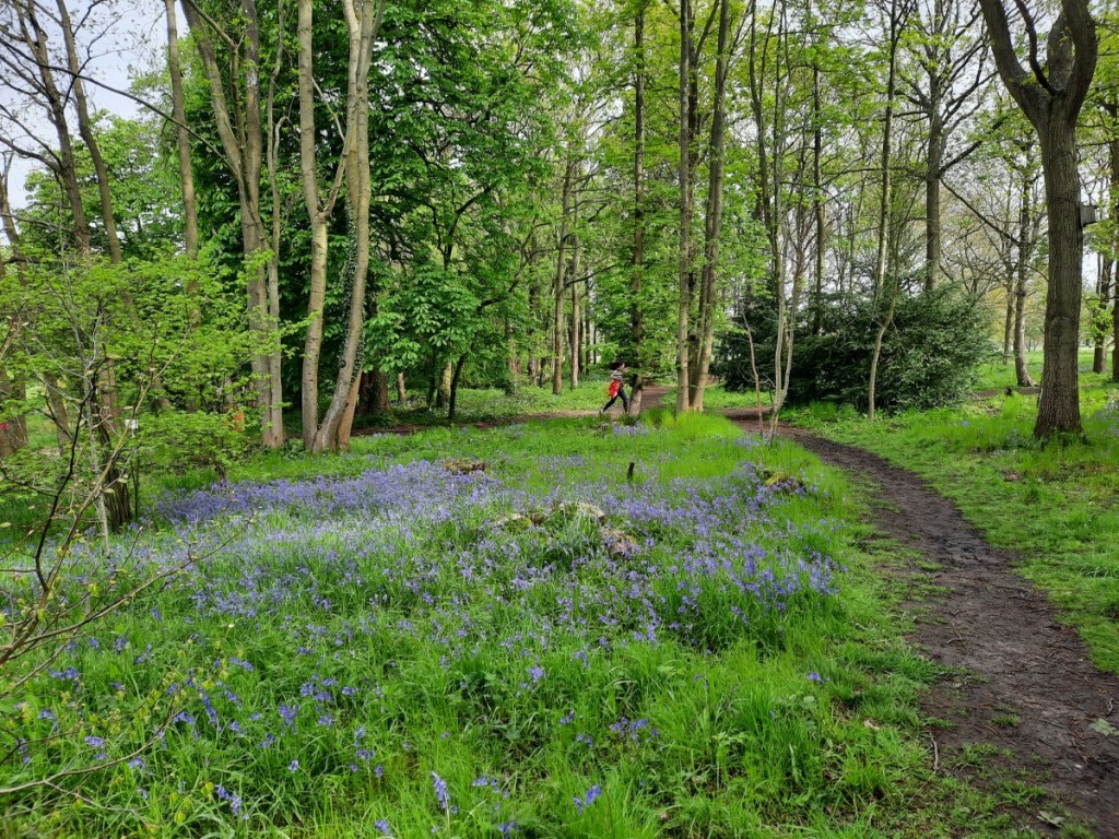
I had wondered about going for a backpacking trip to Mid-Wales, but the wet forecast made it clear that was unlikely to be a very enjoyable experience, so I opted for another local weekend instead. I was keen to visit a new parkrun on Saturday and, given the royal connection, Market Bosworth Country Park seemed the obvious choice among the various options within 45 minutes’ drive. That choice was further corroborated when the parking marshal commented, on handing me my ticket, that there were lots of bluebells to enjoy around the course this week!
It was an undulating mixed-terrain course, with a long section of uneven grass in the first kilometre, then mostly dirt trails thereafter, with a few muddy patches. With hindsight, I went off too hard at the start and paid for it on the uphills in the final 2km! Given my sub-20 run at similarly-hilly Rosliston the previous week, I was a little disappointed with the time of 20:27, even if about 15s of that was beyond the 5km mark. It was an attractive location for a run though, and there was indeed a good display of bluebells in the woods on the western half of the course.
After the run, I picked up my phone from the car to grab a few bluebell photos, jogged back to the car park machine to make my payment just before the hour was up, and headed straight home to arrive just before 10:30, thereby only missing the first few minutes of the Coronation parade to Westminster Abbey. I enjoyed watching the rest of the historical event. Rain from lunchtime onwards discouraged any further outdoor ventures.
Bluebells in Market Bosworth Country Park, and a passing parkrunner
Sunday was the one sunny day of the weekend. I spent it on a day walk from Monyash with the Gentian Club, led by Steve. We had a fairly leisurely start, meeting at 10am on the village green. Our route went all the way down Lathkill Dale as far as Alport, with lots of spring foliage and flowers to enjoy as well as the usual crystal-clear river waters and limestone crags. Helen did a good job of identifying many of the wild flowers for us, as well as a few birds and butterflies.
Heading down the upper section of Lathkill DaleFurther down Lathkill DaleA short pause by the waterfall
We then headed up Bradford Dale past Youlgreave to pick up the Limestone Way back over the fields to Monyash. With a little bit of post-running soreness in my knee, the easy pace was quite welcome to avoid further damage. I enjoyed the good company and conversation as usual. We stopped for a quick drink at a café before heading home. A map of our route can be seen here.
Looking over Lathkill DaleCales Dale
Monday was even wetter than Saturday afternoon, so I had a fairly lazy day. There was a relatively dry spell around midday which I used for a stroll around Hilton Nature Reserve. Other than that, just a few chores and band rehearsal later to end the day.
Hilton Nature ReserveBluebell woods
A few more photos from the weekend are available on Google Photos here.
I stayed close to home for the Bank Holiday weekend, joined by Ruth for Saturday and Sunday. We started Saturday at Rosliston parkrun, me running hard to finish in 19:59 (my fastest Rosliston parkrun since 2019) while Ruth jogged around with Jo, pushing Claire in the buggy on Jess’ first 5k parkrun.
After bacon sandwiches in the café for second breakfast, Ruth and I headed off to Wootton for an afternoon stroll. It was only a short climb up from the village to the ridge of the Weaver Hills, where we followed the fence-line at the edge of the open access land to reach the summit. As our arrival coincided exactly with that of a large rambling group, we didn’t linger by the trig point but descended west to pick up the little-used and overgrown public footpath through the Wredon quarries.
Heading up onto the Weaver Hills
Better footpaths led us south through farmland and woods – the bluebells not yet at their best – to reach the very attractive and well-maintained grounds of Wootton Park. We paused for lunch below Ramshorn with extensive views south over the Churnet Valley and Staffordshire plains, and faint sounds of thrill-seekers at nearby Alton Towers.
Wootton Park
We continued through the parkland and past a few ornamental lakes to pass Wootton Lodge, today the home of Lord Bamford (handy for the JCB Headquarters and factories in Rocester), which just left a short climb up through the woods back to Wootton village. A map of our route can be seen here.
One of the lakesWootton Lodge
On Sunday, we headed to Great Longstone to have a go at the first of this year’s Peak Raid MapRun events. I chose an anticlockwise route, heading northeast up onto Longstone Edge then steeply down into Coombs Dale. Then I continued generally west, over High Fields and Middleton Moor, finishing with a crossing of Longstone Moor – the only pathless running of the day – and a long zigzagging descent back to Great Longstone. I was pleased that my pace matched my plan and I finished just over 4 minutes inside the two-hour time limit, having visited 31 of the 35 controls. That puts me in 2nd place for now. Ruth also had a good run, 12th place overall and 1st female. We will see how many others can get ahead of us before the event closes at the end of August.
Once we’d got our breath back, and eaten our lunch back at the car, we went for a leg-loosening stroll over to the fields Monsal Head then back along the Monsal Trail – see map here.
Upperdale from Monsal HeadMonsal Dale from the viaduct
I was busy with the band on Bank Holiday Monday, playing at the Castle Donington May Market. We played two sets in the Market Place, and I also enjoyed listening to the Leicestershire and Rutland Pipe Band.
Pipe band in Castle Donington
A good varied weekend, and only a week until the next Bank Holiday! More photos are available here.
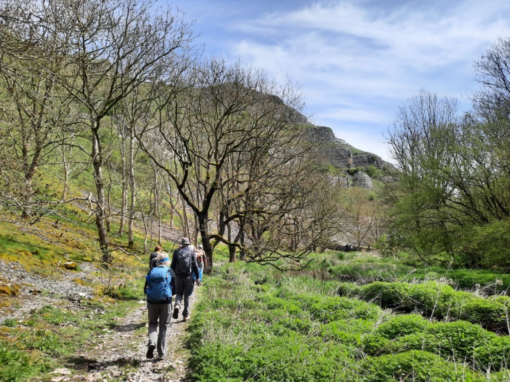
Hard to believe it’s almost six months since the last Gentian trip to South Wales (the Annual Dinner meet in November)! This time we were based further southwest, at the well-appointed Clyngwyn Bunkhouse near Ystradfellte. With quite a few other long weekends coming up, I decided not to take the Friday off work this time, and didn’t regret that decision when Friday morning was a very wet one in Derby! Nonetheless, I was able to get away from work reasonably promptly, just before 4pm, and it was a very welcome surprise that I didn’t encounter any major delays on my journey down the M42 and M5 at rush hour!
I paused for dinner at Ross-on-Wye and arrived at the bunkhouse soon after 7:30. Most of the others had already arrived – some having walked on Pen y Fan – but a few were out at the pub for dinner. As usual, the evening passed quickly with good conversation over a couple of glasses of wine. It was good to meet a couple of enthusiastic new members – Claire and Julia – on their first meet.
With the forecast showing dry weather until mid afternoon, my proposed Saturday walk taking in three of the nearby central-Beacons hills proved pretty popular, with eight others signing up. We started a few miles up the lane at Plas-y-gors, and walked up easy grassy slopes to our first objective, Fan Llia, and its slightly lower neighbour, Fan Dringarth. A post-glacial landslip on the east side of the ridge gave a nice foreground for photos looking towards Pen y Fan and down to Ystradfellte Reservoir.
Looking towards Pen y Fan, from Fan Dringarth
Our descent onto the spur of Bryn Melyn was pathless but pretty easy ground, picking up sheep trods further down. Once we’d crossed the lane, it was a fairly steep ascent back up to Fan Nedd via its northeast ridge, topped with a large cairn where we paused for a snack.
Looking towards Fan Gyhirych from the northeast ridge of Fan NeddThe group on Fan Nedd (Simon, Julia, Claire, Wendy, Simon, Sheena, Petra and Martin)
After a short detour to the summit, with its dragon-emblazoned trig point, we continued down to Bwlch y Duwynt to join the large track onto Fan Gyhirych. Further up, we struck off to the right to keep on the crest of the northern cwm, where we stopped for lunch with great views looking back past the morning’s hills towards Pen y Fan.
Looking down to Cray ReservoirLooking back from our lunch spot
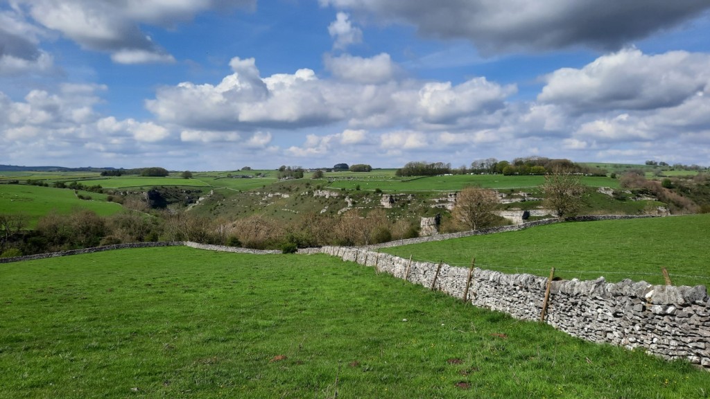
After visiting the trig point, we headed south on the surprisingly large and well-maintained gravel track, passing a couple of small quarries before climbing back up slightly and over the fence onto Carreg Cadno. This area has many limestone outcrops on the hilltop, and a huge network of caves beneath! The Beacons Way provided easy walking from there down to the River Nedd, where we joined the Sarn Helen Roman Road for the final stretch back to the cars. A few spots of rain fell now and then over the final hour or so, but never justified waterproofs.
Sarn Helen Roman Road
We returned to the bunkhouse and had a couple of hours to shower and relax over a few cups of tea before the club AGM at 6pm. This was an uncontroversial meeting, all done in less than half an hour, but did include election of a new Chair and Meet Booking Secretary. Dinner followed, with Greek salad to start, then a very tasty beef bourguignon for the meat-eaters, followed by pashka prepared by Wendy – apparently a traditional Easter dessert in Eastern Europe and Russia.
Sunday’s mountain forecast was a bit more showery, but we rose to find blue skies and the regular forecast showing it should stay dry until lunchtime. I thought that would be enough to tempt a few others to join my planned walk around the Glyn Tarell skyline over Fan Fawr. I was mistaken though, and ended up doing the walk solo while most others just did a short stroll around the classic waterfalls walk. The lack of enthusiasm among hillwalkers for making the most of all opportunities to walk up hills, having driven many hours from home to do so for the weekend, continues to bemuse me, even if I’ve learned not to be surprised by it! The phenomenon is certainly not unique to the Gentian Club!
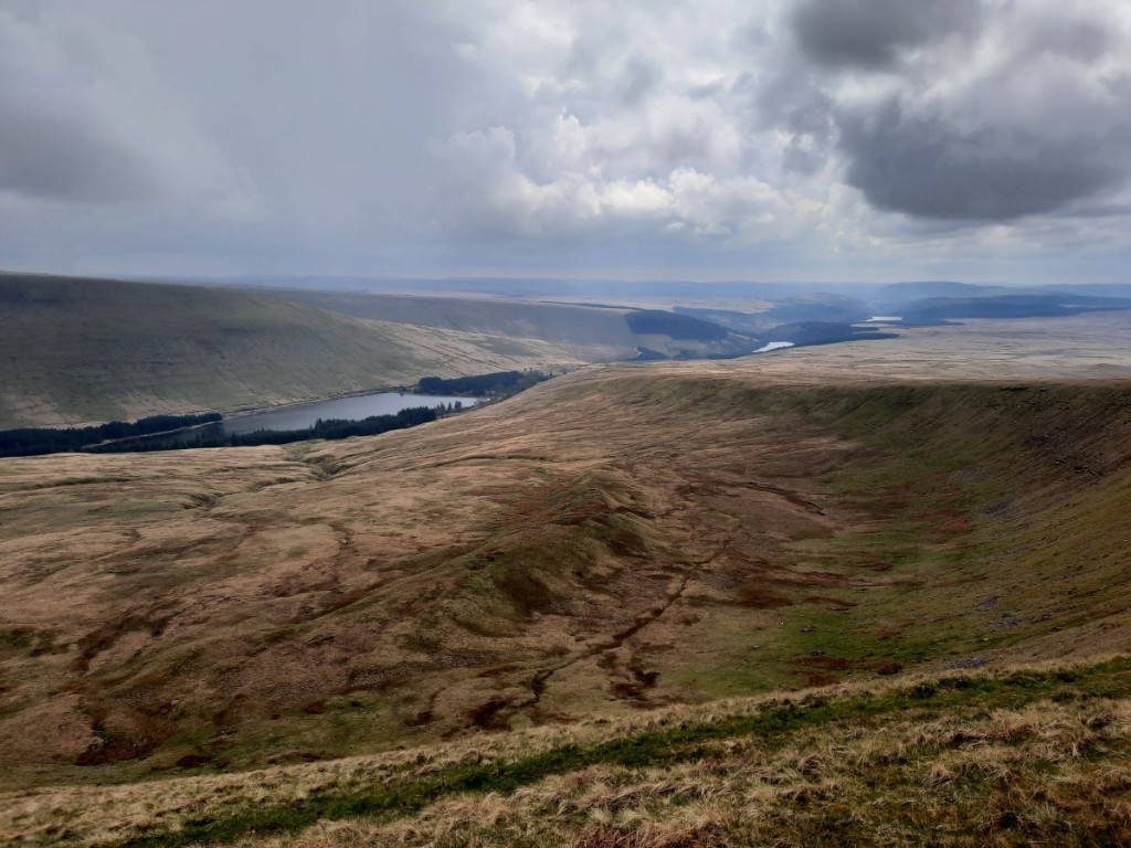
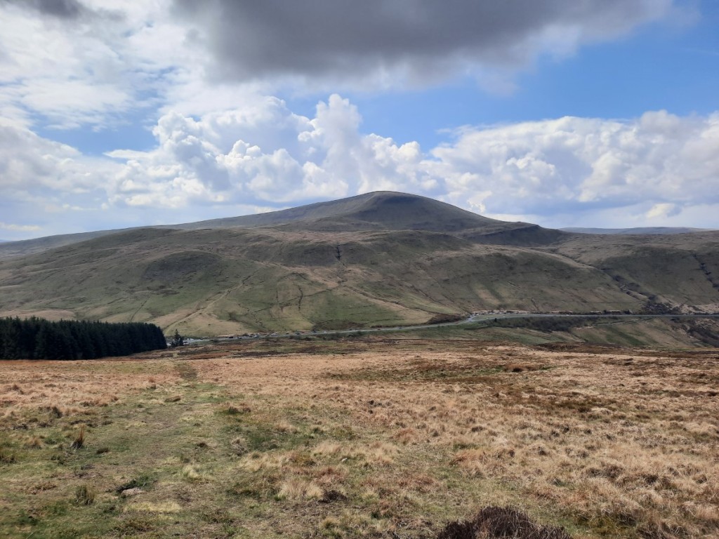
Once all the cleaning, tidying and packing was done after breakfast, I said my goodbyes and set off for Libanus, a drive of about 30 minutes. I started off by ascending the bridleway onto the ridge of Mynydd Illtud to pick up the Sarn Helen Roman Road again, and follow it southwest for a bit, with views of my route for the day. Pen y Fan was in-and-out of cloud, which continued all day, but everything else stayed clear. Once across the main road, I ascended the attractive northeast ridge of Fan Frynych, which has a good path all the way. The summit was a good viewpoint for the previous day’s three hills, with the Black Mountain beyond to the right.
Fan Frynych from Mynydd IlltudThe summit of Fan Frynych, with Fan Llia, Fan Nedd and Fan Gyhirych in the sunshine
From there, I headed south, skirting around the crest of the impressive Craig Cerrig-gleisiad before following the broad grassy ridge towards Fan Fawr. A steep final ascent of 100m brought me directly to the summit, with good views over the eastern crags into Cwm Tae with its reservoirs.
Looking along Craig Cerrig-gleisiad towards Pen y Fan (just in the cloud)Three reservoirs in Cwm Tae
Corn Du and Pen y Fan did not look far away, the other side of Storey Arms, and the grassy descent to the outdoor centre did not take long. Then it was an easy climb back up to the minor summit of Y Gyrn, following a grassy path to the left of the main path to Pen y Fan and thus avoiding all the descending crowds! I ate my lunch by the cairn in the sunshine, wondering whether I might add the higher hills to my route for the afternoon. Then I looked north and saw grey clouds and rain approaching and resolved to stick with my original plan of descending directly via Pen Milan!
Looking back to Fan Fawr
It did rain fairly heavily for 15 minutes as I made my way northeast from Y Gyrn to the main ridge, but then stayed mostly dry again for the remainder of the walk, with sunny spells returning to give some excellent views up Cwm Llwch to Pen y Fan. A short section on lanes brought me back to Libanus at around 2:30pm, and clear roads (except for lots of heavy showers) got me back home by 5:30 without delay or incident.
A shower over Pen y Fan and Corn DuPen y Fan from Pen MilanCwm Llwch
Another very enjoyable weekend away, not really marred by the lack of company on Day Two. I definitely felt like it had been the right choice to head back into the hills rather than joining in with the waterfall walk! Looking forward to the next meet, in mid-Wales in June.
The one downside of trips to the Highlands is that they make my local hills seem uninspiring for a while after I return! So despite a dry forecast and an empty diary, I wasn’t feeling very motivated to get out this morning. I procrastinated for a while before finally getting out of the house around 10:15, heading for some of the grassy hills between the Dove and Manifold valleys.
Once I’d parked up in Hartington village, I set off south along lanes and bridleways to reach Wolfscote Hill, duly climbed by its western slopes. Sadly this is the only way with public access – if there were a good traversing path I’m sure I would have visited more than once before today! After a dry start to the walk, some light drizzle blew in from the west and persisted for the next hour or so.
HartingtonLooking ahead to Gratton, Narrowdale and Wetton HillsLimestone and approaching drizzle on Wolfscote Hill
I dropped down into Wolfscote Dale then headed up the bridleway to Narrowdale farm. From there, it was a similar out-and-back ascent to Gratton Hill, also only my second visit. Next came a short, steep descent and re-ascent to neighbouring Narrowdale Hill, where I paused for lunch as the drizzle eased by the time I’d reached the western end of the ridge.
Wolfscote DaleWetton Hill
I continued west to Wetton Hill, then followed various muddy footpaths back to Hartington, via Back of Ecton and Upper Hurst. Not the most memorable outing thanks to the grey conditions and unexpected drizzle, but still good to get a few hours of fresh air.
A map of my route is available here, and more photos here.
With Ruth and Josh taking a trip to Madeira, my regular Easter break in the Highlands was a solo one this year. Nevertheless, I used her house as a convenient overnight stopping point on the Wednesday night. That left only a two hour drive to the foot of Thursday’s objective, Queensberry, the southernmost of the Lowther Hills.
I parked by the remote farm at Mitchellslack and soon set off up the track beside Capel Burn. Once I reached ‘The Law’, I followed smaller paths and trods up onto High Church and Wee Queensberry, surprisingly topped with a trig point while the main summit is not. A couple more kilometres of steady ascent brought me to Queesnberry itself, my first Graham of the trip. It was pretty windy but the huge cairn gave reasonable shelter as I had a snack break. You could see the Lakeland fells in the distance to the south.
High Church
I had decided to pick up a couple of extra Donalds by continuing around the Capel Burn horseshoe. The ridge to Penbreck gave easy grassy walking, followed by a steeper descent and re-ascent to Earncraig Hill. From there, there were decent paths all the way to Gana Hill, a very windy spot. A bigger track made the descent back to Capel Burn quick and easy, with a helpful footbridge to aid the crossing below The Law again.
The bealach between Penbreck and Earncraig HillKenriva Burn and CriffelCapel Burn
It was about half an hour’s drive to Moffat, where I had booked in for two nights at the campsite. Despite the wet spring, the grass was not at all waterlogged and was good even for driving and parking next to the tent. I strolled into town to pick up some provisions at the Co-op, then had a pleasant evening making tea, dinner, and more tea in the warm sunshine before sunset.
For Good Friday, I chose to climb the nearest Grahams to Moffat – three hills around the head of the Ettrick valley but more conveniently accessed from Moffat Dale. I parked at Sailfoot, where a convenient parking area has been made for walkers just over the bridge. Capel Fell was my first objective, easily reached by following the zigzagging forest tracks along Sailfoot Law then ATV tracks right up to the summit. There were lovely views north to the Corbetts of Hart Fell and White Coomb, looking good in the sunshine.
Hart Fell and White CoombCroft Head, from Capel Fell
I followed the easy undulating ridge over White Shank then dropped down the track to Potburn and passed by the bothy at Over Phawhope – apparently quite busy with a few visitors milling around and a couple of tents set up outside. From there, a good track led me up beside the Entertrona Burn, followed by a rougher climb up steep grass onto the next Graham, Ettrick Pen. Not the most remarkable summit but the views south over the forests to the distant Lake District hills were interesting.
The ridge to Croft Head took me over a selection of Donalds and Donald Tops, turning right at the trig point on Loch Fell to drop down to the Southern Upland Way and climb steeply back up the final hill of the day. Two ladies dressed festively in bunny ears were just leaving the summit of Croft Head as I arrived! I wished them a Happy Easter but they didn’t seem to want to chat – I guess they had just finished their own break. They were to be the only two other walkers I would see on the hill for the entire six day trip!
Capel Fell
It was an easy descent back to Selcoth and Sailfoot, marred only by squashing my fingertip quite painfully in a highly-sprung gate latch (badly bruised but not breaking the skin). After the short drive back to Moffat and refuelling stops at Gulf and Co-op, I enjoyed another evening cooking, eating and drinking at the picnic bench in the sunshine!
I got an early start on Saturday, up around 6am to have breakfast and break camp soon after 7am. My next destination was Dunoon, and I had decided to call in at Greenock parkrun on the way. I arrived in Greenock around 8:30, which gave plenty of time to pick up ferry tickets at the Co-op before heading to the esplanade for parkrun (a 9:30 start, as usual in Scotland). It was an attractive course, twice up and down the seafront, with good views over the Firth of Clyde. My improving form continued and my time of 19:22 was my fastest parkrun since January 2020. Still only good enough for 11th place out of 115 though, thanks to a strong contingent from the local running club. I didn’t hang around long after the finish, and managed to drive to Gourock in time to catch the 10:10 ferry with a few minutes to spare.
Greenock Esplanade
Making the most of the sunny day, I picked out a pair of Grahams to visit in the afternoon above Glen Lean. Starting at Corrachaive, I followed tracks up through the forest that, as described in the guidebooks, led further than shown on the map and brought me without difficulty to the top edge of the dense conifers. The ridge up to the summit of Cruach nan Capull was quite tussocky, but only a short climb, rewarded by views east over the Firth of Clyde and south over Bute to the Arran hills.
Arran, from Cruach nan CapullCruach nan Capull
I had a late lunch in the shelter of a small crag, then returned northwest along the ridge to pass over Mid Hill. Once across the very boggy bealach, I and ascended fairly easily beside Cruach Neuran Burn to the hill of that name, recently promoted to be a Graham following the drop in the qualifying height to 600m rather than 2000ft. I descended by the same route, except that I struggled to find the top part of the track through the forest (even though I was certain I had left the open ground at the correct point) and ended up blundering downhill in the right general direction to pick up the path a couple of zigzags lower! It had not seemed so indistinct in ascent!
Cruach Neuran, with Arran in the distance again
I drove back to Dunoon and checked into my Airbnb for the next three nights, a fairly luxurious second-floor one-bedroom flat with great views over the loch. I popped down to Morrisons for groceries then had a relaxing evening planning routes for the next few days and watching the ferries go back and forth.
Sunday was another bright day, although not as sunny as the previous three. I opted for the biggest available walk, visiting the Grahams of Beinn Mhor and Beinn Bheag, on the west side of Loch Eck. A few miles’ drive brought me to my starting point at Benmore Botanic Gardens. Good tracks and paths led most of the way from there steeply up onto the minor top of A’ Chruach. Then the gradient was easier for the continuation over the rocky tops of Cruachan Beag and Cruachan Mor, with increasingly impressive views of Clach Bheinn, an eastern spur of the main ridge. I followed the guidebook’s recommendation to include it in my itinerary and was rewarded with great views along the loch, particularly north towards Beinn Bheula (Corbett).
Creachan Beag, Clach Bheinn and Loch EckClach BheinnLooking along Loch Eck to Beinn Bheag and Beinn Bheula
Once I’d returned to the main ridge, it was a long and gentle climb, with a helpful tailwind, all the way to the summit of Beinn Mhor, only 741m but my highest of the trip! Very strong gusts around the summit prevented me from pausing there, but I found good shelter for lunch on the descent of the impressive northeast ridge, which has several large rocky buttresses on the right hand side.
Descending towards Beinn Bheag
Once across the bealach, it was a fairly steep, mostly pathless climb back up the other side to Beinn Bheag via a couple of minor tops. This was another great viewpoint, particularly over the loch towards Beinn Ruadh, which I had selected as my destination for the following day. I returned to the bealach by roughly the same route (contouring around the tops) then followed rough trods down Bernice Glen to reach the forestry tracks. Once down by the shore of Loch Eck, it was an easy flat walk of about 7km back to the car.
Beinn Ruadh and Beinn Mhor, from Beinn Bheag
Monday was greyer, with showers forecast, so I had chosen a shorter walk and had a more leisurely start. Still, it was quite sunny when I set off from my parking spot by the lane above Whistlefield, and I got up to the summit of Sligrachan Hill, via its East Top, in sunny spells. It’s clearly a more popular place than I expected, as there were lots of traces of path, and both these tops, and a few minor ones on the way down to the bealach, had cairns. I enjoyed the views ahead to Beinn Ruadh, and back across Loch Eck to the previous day’s hills.
Mixed forest below Sligrachan HillBeinn Ruadh, from Sligrachan Hill
As I made my way along the ridge, a light shower passed over, but the unexpected bonus was a rainbow over the loch. The ridge gave easy walking, mostly on obvious paths, past a small lochan then up to the windy summit. I paused in a sheltered spot on the way back down, and another passing shower created an even better rainbow to enjoy while I ate my lunch.
The first rainbowLooking over Loch Eck to Beinn BheagThe second rainbow!
By the time I was back in the forest, it had been dry for long enough that my waterproofs had dried so I took them off. Typically, another shower passed shortly afterwards, but I managed to wait it out under some dense tree foliage, and avoid getting back to the car with wet gear.
By the late afternoon it had become sunny, so I popped out again for a stroll along the Kirn seafront, past Hafton Castle and up to Lazaretto Point and back.
Holy Loch from Lazaretto Point
Tuesday was the last day of the trip. I packed up and checked out by around 8:30am, and headed back to Glen Lean for my morning walk, up another newly-promoted Graham, Sgorach Mor. Again, the guidebooks helped me find the best route up through the forests of the lower slopes onto the open ground of the ridge. Again, my ascent was in the dry, only for a couple of heavy showers to pass over on the descent. The summit itself was the most interesting feature, being a large knoll defended on three sides by crags.
Cruach Neuran and Loch TarsanCruach NeuranSgorach Mor
I was up and down in two and a half hours, and drove back to Dunoon to catch the ferry. The first was full though, so I had to wait an extra 20 minutes for the next. Thereafter, the drive back as far as Ruth’s was easy, with quiet roads and dry weather. After dinner, and a good chat about her trip to Madeira, I continued back to Derby, enduring strong winds and heavy rain most of the way but getting there without incident.
Overall, a productive trip, ticking off 10 Grahams, and one with mostly good weather. The Cowal peninsula proved to be a very scenic new area to explore, with good sea views from the hills despite their more modest height. I expect my next Scottish trip, at the end of May, will have more of a mix with larger hills, so it was good to get some efficient bagging done this time!
My full photo album can be viewed here, and maps of my routes at the following links:
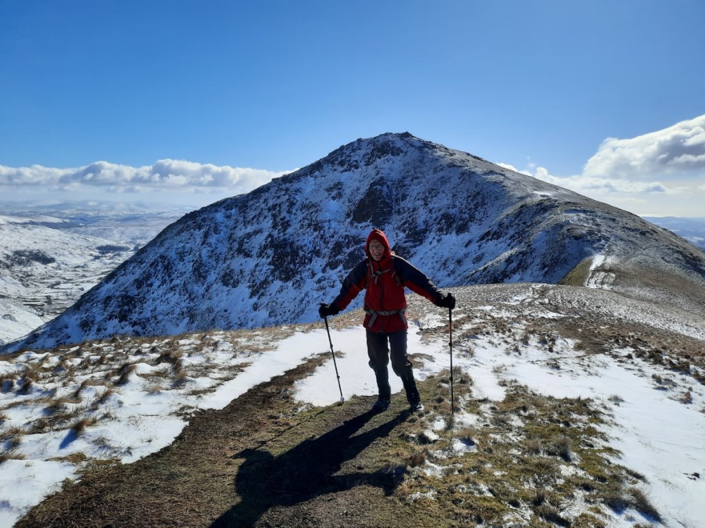
Only a week after my previous visit, I headed back to the Lake District for another weekend, this time with the Gentian Mountainering and Hill Walking Club. Coincidentally, all my previous weekend meets have been in Wales, so this was my first time with them in the Lakes. Using up another left over day of 2022 annual leave, I again took the Friday off work to enjoy an extra day in the hills. Thursday had been a snowy day in northern England, so I had been worried that the evening drive up to Ruth’s house could be difficult, but it turned out that the roads were totally clear, with nothing worse than sleet falling.
I had advertised my intention to walk on the Friday to the other trip participants, and was pleased that Mike had accepted the invitation. We had arranged to meet in Staveley, with a view to then popping up the valley to Kentmere village for a walk around the horseshoe. He texted me when he arrived at Wilf’s cafe, having got an early start and driven up from Coventry, and I headed across from Ruth’s, via Asda to refuel, while he had his breakfast. Heading up the valley, we found that the farmer had helpfully ploughed the lane all the way, so there was no difficulty reaching the small car parking area by the Kentmere Institute.
It was a perfect, blue-sky day with a good covering of snow at all levels. As we got our boots on, we decided that it was not worth carrying an ice axe or crampons as we would not be crossing any really steep ground and the snow would be fresh and soft. Soon we were heading up the Garburn Pass track, which provides an easy route to the ridge. Continuing gently up to Yoke, we found that in many places the wind had already scoured the path entirely of snow, and progress was consequently fairly easy, except through the occasional deep drift.
Kentmere valley
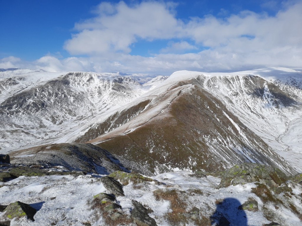
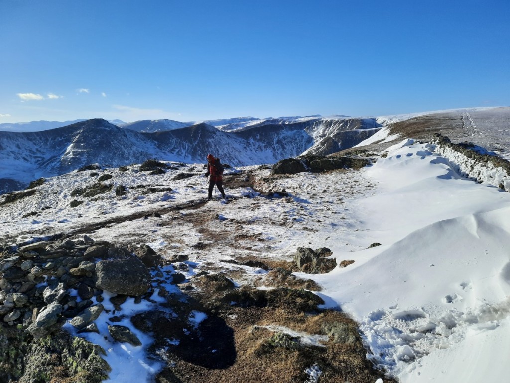
The ridge from Yoke to Thornthwaite Crag, via Ill Bell and Froswick, is one of my favourites in the Lake District, and did not disappoint. The light covering of snow nicely accentuated the crags, and with excellent visibility we could see clearly as far as the Coniston Fells, Langdale, Scafell Pike, Fairfield and Helvellyn to the west. We had first lunch in the disappointingly-ineffective shelter of Thornthwaite Beacon, not lingering on before getting moving again to warm up.
Looking north from Ill Bell to Froswick and Thornthwaite CragMike on Froswick
The next section of the walk, over the shoulder of High Street to Mardale Ill Bell, had the deepest snow covering of the day, with at least six inches most of the way and deeper drifts in places. As always, the views back to Ill Bell and its neighbours were magnificent. Crossing Nan Bield Pass to Harter Fell, we gained spectacular vistas north over Small Water and Haweswater, and paused in a relatively sheltered spot for second lunch.
Looking back to Yoke, Ill Bell and FroswickSmall Water and HaweswaterLooking over Small Water to High Street
I had expected more deep snow on the long, gentle ridge to Kentmere Pike and Shipman Knotts, but that proved not to be the case, with the stony path blown totally clear most of the way. Nevertheless, it felt like quite a long way down the ridge, particularly as we ended up taking a rougher line than intended down to the bridleway at Stile End. From there, it was just a couple of kilometres along the lanes back to Kentmere village. A perfect winter day in the sunshine!
Snowdrifts on Kentmere Pike, but little snow on the path
I dropped Mike back to his car in Staveley, then continued via Ambleside and Dunmail Raise to our accommodation for the weekend, the Blencathra Centre, above Threlkeld. Most of the others had already arrived. It was quite a luxurious bunkhouse, with small en-suite bedrooms and a comfortable lounge-dining area with panoramic views over the Vale of Keswick, Once I’d said my hellos and taken a few minutes to settle in and make my bed, a few of us set off down to Threlkeld for a hearty pub dinner at the Horse and Farrier. Once back at the bunkhouse, we had time for a glass of wine and some more chat before bed.
On Saturday, I offered to lead a walk around the horseshoe to Blencathra from Mungrisdale village. I was surprised that Mike was the only one to sign up, with many preferring to walk directly from the bunkhouse even though Howard’s route (also up Blencathra) was longer, and a few others heading to Skiddaw. Nevertheless, the two of us set out again, and I drove us the 15 minutes or so to our start point. We were not sure to what extent the partially-thawed snow at lower levels would have re-frozen into hard ice overnight, so opted to wear winter boots and carry crampons, although not ice axes. It turned out the snow remained soft at all levels and no winter gear was necessary.
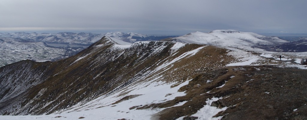
Our route started over Souther Fell, which always offers excellent views of Bannerdale Crags and Blencathra to the west – views in fact of our route for the rest of the day! I thought Souther Fell was a quiet hill but we found at least a couple of dozen others making their way along the ridge, so perhaps it has become a popular route. Deservedly so, in my opinion!
Bannerdale Crags
A gentle descent was followed by a long, gentle ascent over Scales Fell to the summit of Blencathra. This offered great views of Sharp Edge and Scales Tarn to the right, and improving views over the very snowy Dodds, less snowy Central Fells, and beyond, to the left. There was only the odd sunny spell, the weather being mostly overcast, but the air clarity was still excellent.
Looking over the Vale of KeswickScales TarnLooking towards Skiddaw
Turning north, we continued over Atkinson Pike then descended (with great views back to the snowy side of Sharp Edge) and reascended over easy ground to Bannerdale Crags, where we paused for lunch. The ridge onward to Bowscale Fell gave easy walking with a light covering of snow, before the final descent into Mosedale via the attractive Bowscale Tarn. That just left a couple of miles of easy track and road walking back to the car.
Looking back to Blencathra from Bannerdale CragsBowscale Tarn
We were the first back to the bunkhouse, so I was able to enjoy a couple of cups of tea and a shower before the others began to return. We enjoyed discussing our excellent, snowy days on the hill over the preparation and eating of dinner – spag bol for the carnivores. In common with the others, I got a fairly early night, but did not sleep well – not sure why!
On Sunday, I again offered to lead a walk, this time up the Ullock Pike ridge southwest of Skiddaw, but did not get any takers. So instead I joined Howard’s walk from Mosedale village over Carrock Fell and High Pike, in the northeastern corner of the Northern Fells, behind Blencathra. Mike, Marie, Simon and Jayne also came along, but unfortunately Jayne left her boots behind so she and Simon had to return to collect those and ended up doing a similar route separately, a little later.
Almost all the snow had melted with a rise in temperatures and some heavy rain overnight, so the ground around Bowscale Tarn (looking up the valley) had changed from white to brown. Howard led us up a small and attractive path that I didn’t know existed, directly up the end of Carrock Fell from the southeast. In the past I have always used the one marked on the map on the northeastern side. Winding through the heather and past a few sheepfolds, we soon reached the old fort at the summit.
Looking back down over Mosedale village
The winds were pretty ferocious in the immediate vicinity of the cairn, so we didn’t stop there, dropping down to the west and continuing along the flat ridge over Milton Hill. We had seen a couple of race marshals near the summit, and were soon being overtaken by the leaders in the Carrock Fell Race, and thereafter by progressively slower fellrunners further back in the sizeable field! I did not envy them racing in shorts and singlets in the strong, cold wind while I was comfortable in base layer, micro-fleece and two jackets!
When we reached the junction with the Cumbria Way, the others opted to skip the small detour to High Pike and head south directly. I thought I’d have a quick yomp up to the summit and back, and catch them back up on the descent. It proved a good decision as the mist lifted off the top as I ascended to leave good views in all directions, with even Blencathra and Skiddaw clearing for a bit.
Carrock Fell, from High Pike
I found the others having lunch in the ‘Lingy Hut’, a small MBA bothy on the side of Great Lingy Hill, offering welcome respite from the wind. Once we’d eaten, we continued down the Cumbria Way into Mosedale, past the old tungsten mines and down the lane to return to the cars. A little light rain fell in the final half hour, later than had been forecast, but wasn’t enough to make us significantly wet.
Lingy Hut, with Blencathra beyond
Having said my farewells, I drove an hour and a quarter or so to High Bentham to visit my parents for dinner and a chat. After that, the drive south was very wet but not delayed, and I was home by around 9:15pm.
To sum up, another fantastic weekend in the hills with some welcome late-winter snow conditions. I look forward to the next Gentian meet, in the Brecon Beacons next month.
Unusually, we both had empty diaries, so I took the opportunity to visit my sister for the weekend. As she wanted to avoid damaging a sore knee, Ruth didn’t want to do long walks, so there was plenty of time for me to fit in a tourist parkrun to start Saturday. The chosen location was Barrow, which was about 45 minutes’ drive from Ruth’s house. Walking into the park at around 8:45, it seemed surprisingly deserted and we began to wonder whether I had somehow missed a cancellation notice, but sure enough a few volunteers were lurking in the bandstand and other runners soon began to emerge. The park is near the town centre, so I suspect a lot of the runners come on foot and don’t feel the need to leave much slack time in their travel plans!
In the end, there were 131 participants. Buoyed by my first sub-20 run for months, two weeks ago on the flat tarmac of Alvaston, I was feeling optimistic for a good time, but doubted I’d be able to achieve that milestone again when I saw the significant hill from lake to war memorial, to be tackled three times. I pushed hard though, and was pleasantly surprised to keep my average pace below 4:00/km throughout and finish in 19:47, just 2 seconds slower than at Alvaston. Four speedy under-16s beat me, two of them in under 17 minutes! Ruth walked around and photographed me at a few locations around the compact course!
Lap 1 at Barrow parkrun, surprisingly already running alone!
Afterwards, we headed north to park at the summit of the Ulpha / Birker Fell road. I had only visited these quiet hills around Devoke Water once before, so it was good to renew my acquaintance. We made an anticlockwise loop around the lake, taking in the rocky summits of Rough Crag, Water Crag, White Pike and Yoadcastle, and enjoying the distant views of the Scafell massif to the northeast, as well as towards the coast.
Looking over Devoke Water into the Lake DistrictThe summit of White Pike, with Yoadcastle in the background
The continuation over Hesk Fell, down to the pass (with a pause for lunch), and back up the other side to Great Worm Crag, was grassier and less steep, From there, it got more interesting again, and it was good to revisit the Wainwright, Green Crag, with its impressive summit tor. Three other pairs of walkers there were the only others we passed all day. Then it was just a short walk back to Birkerthwaite and the car.
Looking past Harter Fell to the Scafell range, from Green CragSetting off down from Green Crag
Once we were back in Natland, Ruth had some marking to do, so I gave her some peace and quiet and popped into Kendal to call on Ian and Emma. Great to catch up over a cup of tea, initially with Ian, then joined by Emma and the girls once they returned from a 4th birthday party.
On Sunday we decided to head to the Yorkshire Dales: in particular, to Swaledale, where Ruth had a couple of unbagged Nuttalls. Looking back, I find that I’ve only made one previous visit to that valley myself, on a CUHWC weekend trip 12 years ago to the day! The drive up, via Kirkby Stephen, took around an hour. We parked in a layby just outside the small village of Muker. Once booted up, we headed north up Swaledale and then steeply up the rocky gorge of Swinner Gill – definitely the highlight of the day.
Swaledale, above MukerSwinner Gill
Once we’d gained the plateau, it was easy walking along tracks to Rogan’s Seat and then on a small path beside the fence to Water Crag, where we had lunch in the large and effective shelter cairn. The moorland views were extensive, north into the North Pennines and south over Swaledale. The terrain was pretty featureless and it didn’t look like the pathless valley from Wham Bottom would give easy walking, so we took a bearing SSE to the end of the bridleway at Blakethwaite, passing over fairly rough heather but surprisingly dry bogs.
Blakethwaite
The tracks down beside Gunnerside Gill gave more attractive walking, with natural limestone crags and various industrial remains from the once-extensive lead mining. There was a lot of lurid green grass and moss in the abandoned mining rakes, presumably affected by the minerals in the soil.
Industrial heritage by the old Blakethwaite SmelterFields and barns below Winterings Edge
The final stretch from Ivelet beside the river back to Muker gave an easy grassy finish to the day. We took the 500m detour north to the footbridge once we had confirmed that there was no easy crossing available on the direct path. I paused at Ruth’s for dinner before hitting the road for a quiet and undelayed drive back home. Great to revisit two quiet but pretty areas that I had only been to once before. And less than a week until my next trip to the Lake District!
Maps of our routes are available here (Birker Fell) and here (Rogan’s Seat), and more photographs here.
I took a trip to one of the furthest-away parts of the Peak District, aiming to tick off three of my four unbagged Ethels and explore the unfamiliar area east of Black Hill. It’s an off-putting 70 miles from home, but actually mostly on the A38 and M1 so only about 80 minutes’ drive. I parked near the sailing club at Winscar Reservoir, where the forecast of sunny spells first thing happily proved to be correct!
Winscar Reservoir
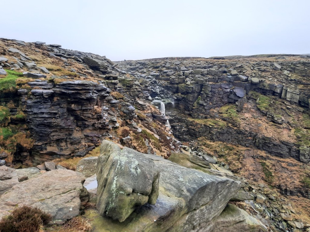
The moorland to the west is pretty much pathless on the OS map but I had used the Strava Global Heatmap to identify the most popular routes on the ground and this did give me paths most of the way, even if they were sometimes indistinct or boggy. I followed small trods beside the stream up Dearden Clough, then picked up the fence-line along Upper Dead Edge. There hadn’t been much of a view from the broad ridge, with Bleaklow in the cloud to the south, but on reaching the trig point (and Ethel summit) I was suddenly able to see down towards Woodhead and Crowden.
Looking down to Crowden from Dead Edge End
More interesting views over the steeper slopes of Withens Moor made the traverse to Britland Edge Hill (the next Ethel) more enjoyable. The wire fence was also unusually festooned with strands of wind-blown grass, fluttering in the strong westerly breeze.
Withens Moor and the wind-blown grass!
The next couple of kilometres to the road at Holme Moss were particularly boggy, so I was glad to reach the firmer ground beyond. I had only seen a pair of fellrunners up to this point, so I was surprised to find quite a few other walkers on the path up to Black Hill. Perhaps I should not have been surprised, as it’s the shortest and easiest route, even if not as well surfaced as the Pennine Way! Although the path was reasonably obvious, in the mist I was glad of the reassurance of a compass bearing after I’d passed the last real landmark at Heyden Head. With a cold breeze and no view at the summit, I didn’t hang around long before setting off north along the stone-pitched path beside Issue Clough. Once I’d descended a few metres, however, I was back in the clear, with sunlit views northeast towards Holmfirth, and my route down to the ‘Issues Road’ track became obvious.
Dropping back into the sunshine by Issue Clough
The track gave easy walking down to the hamlet of Holme, beyond which I picked up some popular footpaths beside Brownhill Reservoir – an attractive spot with steep, mixed woodlands all around. Once I’d crossed the dam of Ramsden Reservoir, I reascended towards Ramsden Edge and traversed above the woods into Ramsden Clough. There I paused for a late lunch on a very comfortable rock in the sunshine, with an excellent view over the reservoirs and up Ramsden Clough!
Brownhill ReservoirRiding Wood Reservoir, from my lunch spot
After lunch, I continued up Ramsden and Ruddle Cloughs to gain the moorland plateau again, then followed a line of grouse butts up onto Snailsden Pike. From the western top, marked as higher on the map, I felt sure that the trig point further east was in fact higher, but looking back from the trig it was not so clear! Best to visit both to be sure of bagging the Ethel properly. A good path led down to Harden Reservoir dam, from where it was an easy walk on large tracks around the east side of Winscar Reservoir and back to the car.
Ramsden CloughThe spillway from Harden Reservoir into Winscar Reservoir
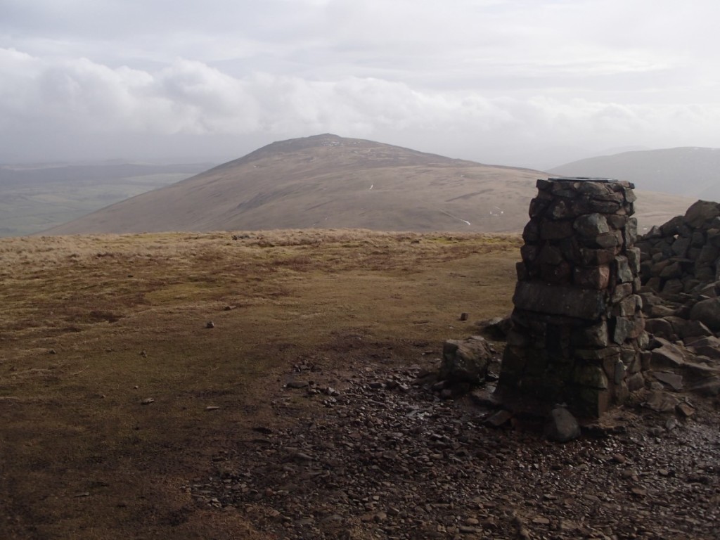
The Ethel summits themselves weren’t especially inspiring today, but my route back from Black Hill via Holme and Marsden Clough was very attractive, and this area would definitely be worth exploring more thoroughly. My remaining Ethel is Ashway Moss, near the Trinnacle, so that should give a good walk from Dovestone Reservoir later in the year.
More photos can be seen here, and a map of my route here.
I haven’t been for a walk with Amina since 2020, so I was pleasantly surprised when she said recently that she’d be up for a day out in the Peak District. No parkrun for me, in order to be fresh for a longer race the following morning, so it was the ideal Saturday for a walk and the forecast of dry, overcast weather was alright too.
We met at my house soon after 9 o’clock and I drove us up to Hayfield – Amina was keen to see my new car – to start walking soon after 10:30. I had wondered whether the cloud would be on the tops to start off. That proved not to be the case so we walked clockwise to get to the highest ground sooner, heading past Kinder Reservoir and then up William Clough. The visibility was pretty good with clear views around the skyline, and towards Manchester and Bleaklow once we reached the ridge.
Looking over Kinder Reservoir dam towards Mount FamineAmina in William Clough
We continued east along the edge of Sandy Heys, pausing for a brief first-lunch in the shelter of a gully and to take a few photos around Kinder Downfall.
Gritstone crags at Sandy HeysKinder Downfall
Another half hour or so brought us to the high point of the day, the trig point on Kinder Low. By this point, the cloud had started to drop a bit and Sandy Heys was in the mist although Kinder Low itself remained just about clear.
The summit of Kinder LowAmina by Edale Rocks
We dropped down to Edale Cross for lunch in the most sheltered spot we could find, then continued along the path – well-pitched at first, then boggy – over the shoulder of Brown Knoll and down the ridge to South Head and Mount Famine. A bit of drizzle blew through in the wind and made us a little damp for quarter of an hour or so but petered out before we’d got around to putting on our waterproof jackets. All that remained was the easy descent down the bridleway to Coldwell Clough and the car.
Looking back to Kinder Scout from Mount FamineLooking back up to South Head and Mount Famine from Coldwell Clough
A good day out on the hill and it was great to catch up with Amina as we walked and talked. Hopefully it won’t be another 2.5 years until the next time! You can find more photos here and a map of our route here.
Looks like I missed the best weather of the weekend, having seen photos of a cracking day of inversions and sunshine in the Peaks yesterday, but nevertheless I headed up to Hathersage today for my first local walk of the year. It was a cold start, with temperatures on the drive ranging from -7.5°C to -5°C, but with light winds didn’t actually feel too chilly at any point on the walk.
I started by ascending to Carhead Rocks, somewhere I had not been before, which gave good views down to the Derwent Valley and up to Stanage Edge.
Carhead Rocks, with Stanage Edge above
I then continued up to Stanage and followed the edge north all the way to Moscar Lodge. There were quite a few people around initially, but it got much quieter further north. There was a little snow wherever the sun had not shone, but nothing was very slippery, and progress was easy, particularly with the peat all well frozen.
Orange skies to the southA bit snowier near Stanage End
Once past Moscar, I headed northwest over Strines Edge – another new route for me – and across the heather moor to reach Derwent Edge near Dovestone Tor. Turning south, I followed the edge as far as Whinstone Lee Tor, enjoying the views over Ladybower and the various rock formations, then took the bridleway east to Cutthroat Bridge, where I paused for lunch in the warmth of the woods.
Ladybower, with Kinder beyond
A short climb back up via Jarvis Clough brought me onto Bamford Moor, and soon to the busy viewpoint of Bamford Edge. I escaped the crowds as I descended south, and returned to Hathersage via Gatehouse and Birley Farm.
The classic view from Bamford EdgeLooking down over Bamford
No real sunshine and fairly hazy views today, but it was good to get out in the Peaks in wintery conditions before the thaw comes later in the week.
There’s a map of my route here, and more photos here.
The Gentian Club’s first weekend trip of 2023 went to the Oread Club’s ‘Tan yr Wyddfa’ bunkhouse in Rhyd Ddu, west of Snowdon – a place I had stayed as an undergraduate with CUHWC. I have a few days of 2022 annual leave to use up by Easter, so I took the first of them on Friday to make it a three day weekend. I had advertised my intention to walk on Mynydd Mawr on the Friday, and Simon had decided to join me, and also offered me a lift from his home in Walsall. A pretty early start was required to get to his house around 7:45am for the three hour drive to west Wales. Google directed us around the traffic by recommending the scenic route via Bala and Trawsfynydd.
We parked in Nantlle village and were walking just before 11am, following the Slate Trail around the south side of Llyn Nantlle Uchaf and up the valley. We then zigzagged back left onto the ridge of Mynydd Mawr, enjoying dramatic views over the crags of Craig y Bera on the final section towards the summit. Sunny spells gave dramatic light conditions over all the surrounding peaks, although Snowdon was in cloud.
Snowdon and Yr AranCraig y BeraSunshine over the Nantlle Ridge
We descended northwest to cross the boggy bwlch and reach the minor summit of Moel Tryfan – a HuMP I had not previously visited. The hill is heavily scarred by disused and active slate quarries, but still gave good views. We then rejoined the Slate Trail for the return leg to Nantlle, finishing around 3:30pm.
The view from Moel TryfanSimon above Nantlle village
After a short drive east, we reached the bunkhouse slightly before the appointed arrival time of 4 o’clock to find a few others also just arriving. With a few attendees having dropped out in the preceding few days, the bunkrooms, lounge and dining area were fairly spacious for the ten of us, and the temperature gradually rose as the coal fire burned! I had fresh pasta for dinner before an evening of chat and a couple of glasses of wine.
On Saturday, I led a walk up Moel Hebog, for which I was joined by Simon, Petra, Sheena and Martin. The day had started fairly wet, but it was petering out by the time we set out from Rhyd Ddu, and a couple of light showers in the first half hour of walking were the sum total of rain during our walk. The skies gradually brightened as we followed the Slate Trail south through Beddgelert Forest towards Beddgelert. About 1km short of the village, we turned right to ascend the well-trodden path up onto Moel Hebog, with improving views towards Snowdon – which emerged from the cloud for an hour or so – Cnicht and the Moelwyns. We had lunch in the shelter of a small crag about two thirds of the way up, before the final steep climb between the crags to the ridge.
Yr AranLooking towards Cnicht and the Moelwyns
The summit gave great views both south to Porthmadog and north to the subsidiary tops of Moel yr Ogof and Moel Lefn, with the Nantlle Ridge. However, with a strong and cold wind, we didn’t linger long before starting the descent north. Once we were down at the bwlch, Martin opted to descend east from there back to the forest tracks, while the other four of us continued along the ridge. Short ascents with a little easy scrambling here and there led us up to each hill. The clouds generally got greyer and the wind strengthened noticeably, but there were still dramatic light conditions over the coast, seen best from Moel Lefn.
Descending from Moel HebogMoody skies over Moel LefnLooking out to the coast from Moel Lefn
A steep and fairly rough descent eventually brought us to the shelter of the forest, and easier walking on tracks and good paths back to Rhyd Ddu where we were glad of tea, cake and showers. In the evening, Simon cooked a tasty and filling beef casserole for the meat-eaters, followed by Petra’s bread and butter pudding.
Sunday started very wet, and with low cloud shrouding all the summits. Nevertheless, I trusted the forecast, which only predicted showers, and proposed a linear walk along the Nantlle Ridge, from west to east to have the wind behind us. Simon and Petra chose to join me, while the others mostly did a walk along the Slate Trail from Waunfawr back to Rhyd Ddu – part of which Simon and I had done on Friday.
Simon drove us to the start but, unfortunately, hit a large pothole hidden in a puddle near the top of the low pass, puncturing his front offside tyre. That meant a short stop to change the wheel in the cold rain before we could continue to our start point near Talysarn. The walk started on what turned out to be a very little-used footpath up through trees, undergrowth and a small quarry. It was good to reach the open land above, which gave easier walking with less careful navigation required!
Petra and Simon escaping the undergrowth above Talysarn
We passed the ruined cottage of Brynllidiard and continued up beside the crags of Cwm Silyn. Sadly the thick mist meant we couldn’t see the lakes in the combe below. A light shower blew through as we approached the summit of Craig Cwm Silyn, and I put my waterproofs on in the shelter of one of the large cairns. The descent to Bwlch Dros-bern proved to be the most awkward of the walk, thanks to the patchy covering of slushy snow on the boulders.
After the short but steep reascent to Mynydd Tal-y-mignedd, we paused for lunch at the summit, which was surprisingly sheltered – or perhaps the wind had just dropped – before continuing on the narrower sections of ridge to Trum y Ddysgl and Mynydd Drws-y-coed. Although we never dropped out of the mist, the terrain is interesting enough to be enjoyable even without a view. Soon we had reached the easier ground of Y Garn, which just left the descent of the eroded path back to Rhyd Ddu.
The summit of Mynydd Tal-y-migneddMynydd Drws-y-coed
We were the first back, at least an hour before the slower-moving group on the Slate Trail, so made a good start on the cleaning and tidying while we waited. Unfortunately, Petra had inadvertently left her car keys in Simon’s car, so we were unable to collect it from Talysarn until the other drivers arrived back from their walk to rescue us! In the end, Simon and I set off home around 6pm and had a smooth journey back to Walsall, and then (for me) on to Hilton.
Overall, three good days on the hill with great company. Weather-wise, we got away pretty lightly considering the forecast each day had been for strong winds and heavy showers. Most of the heaviest rain fell overnight, and we had had summit views on two days out of three. I look forward to the next weekend trip, to the North Lakes in March.
My full photo album is available on Google Photos here.
Usually, the weekend after New Year, a few of us from Rolls-Royce (Derby) Band take a trip to Butlins in Skegness for a social weekend at the annual Mineworkers Contest. However, there was no contest held this year, so I organised an alternative, “(not)Butlins” weekend away. The destination was Ironbridge, where we stayed in the spacious and well-equipped YHA hostel at Coalbrookdale.
As the lead booker, I felt I ought to arrive promptly on the Friday afternoon, so I got an early finish from work at around 2:30pm, picked up Becky from Littleover, and drove down to arrive in Ironbridge around 4pm – a surprisingly smooth journey for a Friday afternoon. Jeff and Helen had arrived a few minutes earlier and opened up. They had volunteered to lead the group catering, so we helped them unload the groceries into the large commercial kitchen before getting the kettle on and starting some advance food preparations for Saturday dinner. The others – 21 of us in total – arrived over the course of the evening and we had a sociable evening over dinner and a few drinks.
Saturday began with most of us heading to the nearby Telford parkrun. Fortunately, fairly heavy rain as we drove into town began to ease by around 8:45am and had fully stopped by the time the race briefing was underway, so we avoided a soaking! The course was comprised of two laps, one short and one long, mostly on tarmac, with a significant downhill to start and, of course, a significant uphill back up to the finish. I was first finisher from our group (as usual), but Tim’s run, around 90 seconds slower than mine, achieved by far the highest age grade, just over 70%. I strolled back down to the bottom of the hill to run back up with Heather D offering ‘encouragement’. She and several others ran good times. Afterwards, we got coffee and cakes at Costa before returning to the hostel.
Team photo after parkrun: Jane, Tim, Heather H, Hayley, Ashleigh, Jake, Meg, Heather D, Becky, Helen, Jeff, me, Will and Janine.
For the afternoon, I led some of the group on a walk up The Wrekin, while the others went for a sightseeing stroll by the bridge and river. We took the main path up from the east, enjoying clear views in all directions in the sunny spells. It was dramatic to see the flooded River Severn below, with the main Shropshire hills beyond. We continued along the ridge to descend to the lane to the west, then took lower-level tracks around the south side of the hill back to the cars.
Setting off from the summit of The WrekinDescending the steep west ridge
We were back at the hostel by teatime to shower and change before a big effort to prepare the group dinner under Helen’s leadership. After the meal, the evening continued with drinks and games in the lounge until late.
Sunday started with a full cooked breakfast together, after which we cleaned up and packed away all our stuff into the cars to check out by 10am. A few headed home or to other commitments, while most of us returned to the Ironbridge riverside for a stroll and/or coffee at a café. After that, we headed to the Exotic Zoo, close to where parkrun had been held in the Town Park, to potter around looking at the animals before another café stop for lunch before the drive home.
The Iron Bridge
In summary, a well-attended and very enjoyable social / team-building weekend away for the band before our main preparations begin for the Midlands Championships at the end of February. Perhaps, if the Butlins contest doesn’t resume, we’ll do something similar again next year.
There are a few photos here, and a map of our route up The Wrekin here. Telford parkrun results are here!
For this year’s New Year trip to the Highlands, we had booked an Airbnb cottage in Kinlochleven, which would give us good access to the Mamores and the Glen Coe hills. In order that he and Ruth could take their bikes, and to have plenty of room for luggage and provisions in general, Josh drove us up in his van this year. The drive went well, without major delay, pausing for a supermarket shop and lunch at Morrison’s in Dumbarton. The roadsides were pretty snowy through the Highlands, but the road itself was clear.
Lots of snow at the top of Glen Coe
The cottage was attractively located right at the top of the village, giving views down the loch with the Corbetts of Garbh Bheinn and Mam na Gualainn either side. Soon we had unpacked the shopping, settled into our rooms and prepared dinner for the night. We had read reviews saying the cottage was chilly in winter, but the electric heating actually proved more than capable of keeping the place cosy, with or without the assistance of the woodburning stove.
Wednesday seemed to have the best forecast of the first three days, so we elected to get out at dawn for a walk in the Mamores, fairly similar to one I’d done three years previously when Ruth and I were staying in Glencoe village, but in the opposite direction and following different ridges up and down. We started alongside the Grey Mare’s Tail waterfall before gaining the grassy south ridge of Na Gruagaichean, earning ever-improving views over Loch Leven and towards Am Bodach as we climbed.
Loch Leven
At about 900m, we decided the snow was hard enough for crampons to be worthwhile – the long-awaited first use for Josh’s pair that had been carried in vain on numerous previous outings! We were in and out of the mist on the final approach to the summit, but had views enough of the time to get a good impression of the dramatic surroundings.
The ridge to Na Gruagaichean
A fairly steep descent and reascent led us to the NW Top of Na Gruagaichean, perhaps a better viewpoint than the main summit. Then it was much easier walking along the broader, gentler ridge to Stob Coire a’ Chairn, with great views of An Gearanach close-by, and the Nevis range in the distance.
Na Gruagaichean NW Top, and Aonach Beag across the glenAm Bodach, Sgurr a’ Mhaim and Ben Nevis, from Na Gruagaichean NW TopBen Nevis and Carn Mor Dearg, from Stob Coire a’ Chairn
The traverse to Am Bodach was narrower and steeper again, and very enjoyable in the snow. The clouds dropped a bit as we made the final ascent to deprive us of a summit view though. We descended by the SE ridge towards Sgurr an Fhuarain, but dropped off southwest well before that minor top to follow a snowy gully down into the valley – much more pleasant than the rough heather either side. We ran out of snow at around 500m, so took our crampons off there before continuing down to meet the West Highland Way which led us back to Kinlochleven.
Am Bodach
The cloud was lower on Thursday, and a few showers were forecast, but it seemed better than Friday at least. We chose to head to a Graham, Druim na Sgriodain, on the far side of the Corran Ferry. Foot passengers go free, so we parked at the east side of the ferry, which drops you right where you need to be for this hill anyway.
The first couple of kilometres were north along the lochside road as far as the burial ground at Cille Mhaodain. From there, it was a steep ascent up fairly easy grassy terrain to gain the ridge of Sgurr na h-Eanchainne. This offered good views into Ardgour and back down to Loch Linnhe.
Looking into ArdgourLoch Linnhe
The peak had been clear as we ascended, but was in cloud by the time we got there, so we didn’t linger long before continuing west and southwest on compass bearings past various lochans to reach the Graham summit, 4 metres higher than the more shapely Sgurr.
Ruth and Josh by a frozen lochan on Druim na Sgriodain
Descending the ridge to Meall Breac, we soon dropped back into the clear. A slightly awkward descent down a steep grassy gully brought us safely between the crags into the bottom of Coire Dubh, from where a small path led more easily down beside the waterfall of Maclean’s Towel to a transmitter mast. The sun was coming out, giving attractive views over the loch and towards Beinn a’ Bheithir. Easy tracks led the rest of the way back to the ferry.
Sunset over Loch Linnhe, from beside Maclean’s Towel
On Friday, more persistent rain was forecast. Ruth and Josh were tired and opted for a cycle ride around Loch Leven, while I headed up the nearby Corbett, Garbh Bheinn. On my previous visit, I had taken the standard route up the west ridge, so this time the east ridge would give some variety. The rain was light but persistent as I set off up the hydro tracks into Coire Mhorair, so I soon paused to put on full waterproofs.
Coire Mhorair
Once I’d reached the small reservoir at 160m, I turned more steeply up the grassy slopes to the west, and made steady but tiring progress up through increasingly-deep snow to the East Top. The Mamores to the north were mostly in cloud, but the Aonach Eagach to the south stayed clear, providing dramatic views to my left. After a short pause for a snack and to put on an extra layer, I continued up the broad, snowy ridge to the Corbett summit, which gave closer views of the craggiest parts of the Aonach Eagach, and also down the loch to the Pap of Glencoe.
Pap of Glencoe and Mam na GualainnLooking towards the MamoresSnowy Aonach Eagach
I returned to Kinlochleven by the same route, the light rain never really stopping or getting heavy enough to give me a soaking, and my footprints (the only ones) making the navigation quick and straightforward! On reaching the cottage, I was surprised to find Ruth and Josh just setting out for a stroll up to a nearby waterfall, having abandoned their cycling plan due to the rain being too heavy. Clearly it had been worse in the valley than on the hill!
Saturday, New Year’s Eve, had the best weather forecast of the trip, with light winds and high cloud predicted. But we were pleasantly surprised when we got up to see that the skies were in fact cloudless! This confirmed our intention to have a go at a circuit of Bidean nam Bian, one of the more challenging peaks in Glen Coe. It was about half an hour’s drive to the start point at the Three Sisters viewpoint, where we set off a bit before sunrise but in good light. The path down to the river and up the other side into Coire Gabhail – the ‘Lost Valley’ – was mostly dry and unexpectedly ice-free, making for easy progress.
Ascending into Coire Gabhail, with views across Glen Coe
Once we’d escaped the narrow gorge, it didn’t take long to cross the flat, rocky bed of the hanging valley above and reach the snowline. After a short detour up the wrong side of the river to realise we were separated from the path by an uncrossable gully, we retraced our steps a short distance to get back on track and continue up through ever-deepening and steepening snow. The crust at lower levels was mostly firm enough to take my weight and Ruth’s, but not so often Josh’s!
Coire Gabhail, the ‘Lost Valley’
There were clearly no rocky obstacles on the route up the snow all the way to the bealach at the head of the corrie, but we could not really tell whether there was a significant cornice to cross there. I led the way, breaking the trail and kicking steps where needed! Ruth put crampons on part-way up, and Josh and I followed suit a bit later. The final section was as steep as I’m comfortable ascending without a rope, but the snow was pleasantly solid and it never felt like the foot or ice-axe placements might give way. The final metre or so turned out to be a softer cornice, but not quite vertical, and solid enough to climb over the top rather than having to cut a route through. It had been tiring work though, and I was relieved to reach the easy flat ground above, particularly when the views in all directions were such a magnificent reward! I took a few photographs and offered what advice I could as Josh and then Ruth followed me up.
Ruth and Josh, high in Coire GabhailJosh checking on Ruth’s progressRuth approaching the final cornice
Once we’d all gathered our breath and had some refreshments, we continued the walk up the easy (but very snowy) ridge to the first Munro, Stob Coire Sgreamhach. This was a super viewpoint over the two Buachailles to the east, and back over the bealach to Sgurr na h-Ulaidh and Bidean nam Bian itself.
Coire Gabhail, from Stob Coire SgreamhachThe view of Sgurr na h-Ulaidh and Bidean nam BianRuth and Josh on Stob Coire Sgreamhach, with the Buachailles in the background
We returned to the bealach then ascended easily the other side to reach the main summit of Bidean, revealing more incredible views over Stob Coire nam Beith to the west. We were amazed that nobody else had come up that day, our footprints being the only blemish in the deep, pristine snow.
Heading for Bidean, with views of Sgurr na h-UlaidhLooking back to Stob Coire SgreamhachApproaching Bidean nam Bian
The ridge onward to Stob Coire nan Lochan had the deepest snow yet, a little softer where it had accumulated on the north side of the hill, but didn’t provide any real obstacles to progress. Soon we were at that final Top, where we met a climber who had just come up by one of the easier gullies on the north side. It turned out there were quite a few climbers there, although none had made the continuation to Bidean.
Stob Coire nan LochanMe, Ruth and Josh on Stob Coire nan Lochan, looking back to Bidean
It did mean we had plenty of tracks to follow for a quick descent down into Coire nan Lochan to gain the path back down into Glen Coe. An enjoyable end to perhaps the best winter day I’ve had in the Highlands. In the evening, we enjoyed Toad in the Hole and Sticky Toffee Pudding for our Hogmanay dinner, but were tired from a bit day and decided not to stay up to see in the new year.
Stob Coire nam Beith, as we descended
On New Year’s Day, it looked like the best of the weather would be on the coast, so we picked the two Munros of Beinn a’ Bheithir as our objective. We started in Ballachulish and set off south up Gleann an Fhiodh. Light rain fell to start with, but soon petered out to nothing, and it stayed dry from then on. A well walked path leads up onto the ‘Schoolhouse Ridge’, the NE ridge of Sgorr Bhan.
Loch Leven below
We gained height steadily in just a thin covering of fairly grippy snow, and after a while reached the scrambly section. The crux step proved to be quite a major obstacle in winter conditions! Josh clambered up with some difficulty in his boots, and recommended that Ruth and I put our crampons on before attempting to follow. Ruth’s regular climbing experience helped her get up too, but I was less confident, chickened out and took an easier line by grassy ledges around the south side instead. From there on, the route was more straightforward, the rocky steps having a better covering of snow on the ledges which thus felt a lot more secure under the crampons!
Ruth on Schoolhouse Ridge
We had entered the cloud part way up, and didn’t get any unrestricted views as we continued along the ridge, slightly down and back up to the first Munro, Sgorr Dhearg, then more significantly down and back up to the second, Sgorr Dhonuill.
Approaching the summit of Sgorr Dhonuill
There we met two men whose footsteps we had been following since the summit of Sgorr Bhan, and chatted briefly before they continued. We had lunch on the summit, then returned to the bealach and descended easy snow slopes to the north into the corrie. Ruth found a small, well-built path that avoided the boggy ground and felled forestry on the book route. Then the final few kilometres were an easy march, gently downhill on forest tracks back to the village.
On Tuesday, we sadly had to head home. It was a sunny morning, so we had lots of awesome views to enjoy as we drove back up Glen Coe and over Rannoch Moor to Crianlarich and along Loch Lomond. Conditions got steadily less snowy as we continued south through the Southern Uplands, and there was barely any snow in sight in the English hills of the North Pennines and Lake District. The final drive home from Ruth’s house to Derby wasn’t a good one, with significant bank holiday traffic clogging the M6, but I made it eventually and without incident, with a few hours spare to get the laundry and unpacking sorted before bed and the return to work.
In summary, five excellent, contrasting days on the hill. I revisited seven Munros and a Corbett, and bagged one new Graham. Very atypically of recent New Year trips, the wind was never strong and the rain never heavy! The crampons and ice axe saw more use than they have for years, with quality winter days on the Mamores and Beinn a’ Bheithir, and of course the undoubted highlight of that perfect New Year’s Eve walk up Bidean.
With Mum and Dad having moved temporarily to rented accommodation in North Yorkshire, there was no need for Ruth and me to head south for a family Christmas. Instead, Ruth volunteered to host us in Natland, which would be a much more convenient starting point for our subsequent trip north for New Year! I had booked the Friday off work so drove up on the evening of Thursday 22nd. This was the first motorway cruise for my new car, which proved to be very smooth, quiet and comfortable. Having switched from diesel to petrol, I was relatively happy with the average of 54mpg.
Friday offered a dry, overcast morning with rain coming in from lunchtime. Ruth and I took a stroll in Kendal, along the river and up to the Castle, before Mum and Dad arrived for lunch. We didn’t venture out again in the afternoon, owing to the poor weather.
Ruth in Kendal
On Christmas Eve, we were up fairly early for another visit to Morecambe Prom parkrun. I drove the five of us down and we were able to park for free on the seafront this time. Ruth, Josh and Dad also joined in the run, while Mum sought out a newsagent then cheered us over the line. I found it disappointingly hard work in fairly favourable conditions, and was about 40 seconds slower than on our previous visit a couple of months before. We returned to Natland for a late second-breakfast, after which Ruth and Josh headed off for an afternoon and evening with Josh’s family. Mum, Dad and I took an afternoon stroll up onto the nearby hill, The Helm, and found many others also enjoying the bright day and views over Kendal and the surrounding countryside.
Dad and Mum ascending The Helm
Christmas Day was wetter, but I decided I would take a trip to Ford parkrun, in Ulverston, anyway. This was the first time I’ve found myself within sensible driving distance of a Christmas Day parkrun, so not to be missed! Dad and Mum came along to support and for another ride in the car, while Ruth and Josh stayed home to start the Christmas dinner preparations. We drove through a couple of heavy showers, but the rain was easing by the time we had parked up, and actually held off for the duration of the run, save a few spots after about 15 minutes. The course was quite a tough one, with three-and-a-half laps of the small park, on a mixture of tarmac, gravel, grass and wood chippings. Each lap featured two hills, adding up to a total of almost 80m ascent. Hoad Hill towered attractively above, with its monument. With a challenging course, tired legs and a sore knee, it took me over 22 minutes to complete the run – one of my slowest parkruns ever – but I was still glad to have turned out.
Christmas Day at Ford parkrun
We returned to Natland straight afterwards for brunch and a more conventional remainder of our family Christmas Day, with a delicious roast turkey dinner prepared by Josh (with Ruth’s assistance). More rain prevented us from venturing outside again.
Boxing Day brought fairer weather. We took a drive into the Lake District for an easy hill walk up Loughrigg Fell. Having parked by Rydal Hall, we started by heading alongside the river and Rydal Water, enjoying the views over the lake and up to Nab Scar.
Mum, Ruth, Josh and Dad by Rydal Water
Then we followed Loughrigg Terrace across the lower slopes of the fell, the higher ground giving excellent views over Grasmere towards Helm Crag, Dunmail Raise and Seat Sandal.
Looking over Grasmere from Loughrigg Terrace
A steep climb up a pitched path led us directly to the summit of Loughrigg Fell, where there were more good views, west to the Langdale Pikes and southwest towards Wetherlam. We followed some of the many small paths along the ridge and down beside a stream – rather boggy! – back to Rydal, then returned to Ruth’s for lunch and a leisurely afternoon. Route map: https://www.plotaroute.com/route/2114032
Looking over Elter Water to Wetherlam and Lingmoor FellDescending, with views of Low Pike and Red Screes
On the 27th, Ruth, Josh and I said our goodbyes to Mum and Dad, and set off north for our next adventure. More about that in the next post!
I haven’t got out walking at all in December, my weekends mainly being busy with brass band carolling and concerts, so I was looking forward to today’s Gentian meet in the Peak District. There have been lots of crisp, cold, sunny days recently, but sadly today was not such a day, with gloomy grey skies.
I set off from home around 7:45am, enjoying the drive up the Derwent Valley in my new car on its first major outing, and met the others at 9:15 at Fairholmes. Petra and Jane were new acquaintances for me, the others familiar from previous trips. The roads and paths around the visitor centre were pretty icy after the extended cold spell, so we hoped that it would be less compacted on the hill paths.
Soon we were under way, the seven of us heading up beside Locker Brook to the eponymous outdoor centre on the ridge above. The path through the woods wasn’t too bad, but the track along the ridge was mostly very icy. However, it was generally possible to get by on the softer snow on the verges, so I got away without putting my crampons on. At this point, Steve and Martin decided to head back down while the rest of us continued on the planned route.
Approaching Lockerbrook Farm
The open moorland of Rowlee Pasture made for easier walking, the icy slabs of the path easily avoided on the snowy grass beside, and the bogs well frozen. Although the light and visibility were not good, we enjoyed views over the Woodlands Valley and Alport Dale. Before long we were looking over the landslip, cliffs and boulders of Alport Castles, looking impressive with a dusting of snow.
Jane, Richard, Simon and Petra above Alport CastlesLooking over The Tower
From there, we dropped down into Alport Dale, where we paused for an early lunch as it was a lot less windy than on the ridge. Then we continued down the track – icy again – to Alport Bridge and took a short loop of bridleway the other side of the River Ashop before ascending back up to Lockerbrook via Rowlee Farm, a path I don’t think I had used before. As the afternoon was getting increasingly drizzly, we opted to descend directly to Fairholmes rather than take the planned detour to Crook Hill, which was just about in the mist by that point anyway.
Alport DaleThe icy track near Bellhag Barn
The road and car parks had thawed out quite a bit over the day, so the drive back to the gritted roads was less slippery than the approach had been in the morning. We paused for a drink in the Yorkshire Bridge Inn before heading to our respective homes.
Despite the murky weather, an enjoyable day out in good company, and I was happy to have got some snow under the boots before the big thaw comes tomorrow. Hopefully there will be more to enjoy in the Highlands in 10 days’ time! A map of our route can be seen here, and more of my photos here.