As ever, I spent Spring Bank Holiday week in the Highlands. Even after all these years, it doesn’t lose any of its appeal! With Graham-bagging not always seeming the most exciting option on good-weather days, I interspersed a few new ticks with return visits to some of my favourite Munros and Corbetts, and I expect that’s how the pattern will continue through my Graham project.
To help make the Friday-night drive more manageable, I worked from my parents’ new house in Kendal that day, and was able to get away around 3pm for the drive up to Aviemore. Ruth had departed earlier in the campervan with Josh, and had warned of long delays on the M6 and A6 south of Penrith, so I decided the least bad option was to take the scenic route via Windermere and the Kirkstone Pass – not fast roads but I reached Penrith without sitting in any queues, probably more quickly and certainly more pleasantly than the alternatives!
The rest of the drive was straightforward, stopping for dinner in Perth and arriving at Cairngorm Lodge SYHA by 9pm. Once I’d checked in and chosen my bunk, I sought out Ruth and Josh in their van on the adjacent campsite to make plans for the next day. I would have camped myself but the Loch Morlich campsite is so expensive that it was £10 per night cheaper to have a dormitory bed in the hostel!
Saturday dawned overcast and breezy. The three of us headed to Aviemore parkrun, which turned out to be a very enjoyable course along the Speyside Way, with views of the Cairngorms. Until the turn-around point at half way, I shared the lead with one other runner, but he pulled up soon after that – presumably injured – and by the end I had a lead of over 90 seconds to the next runner. It had been more than three years since the last time I was First Finisher at a parkrun! Ruth finished in 6th place overall, surprisingly only 3rd woman!

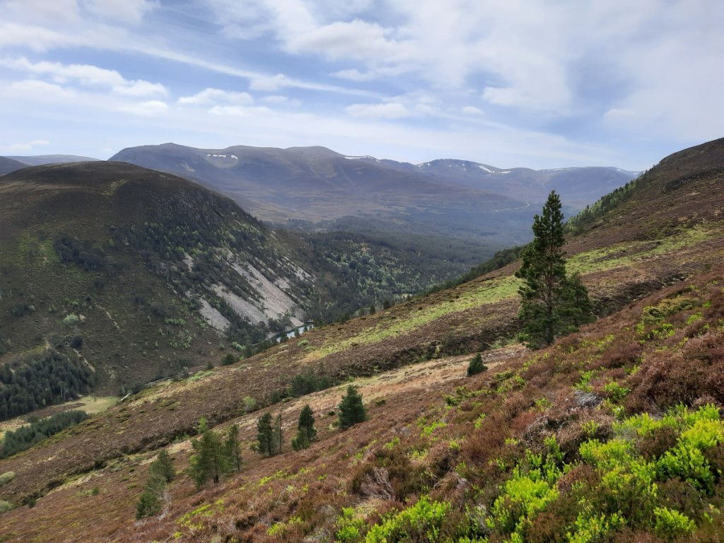
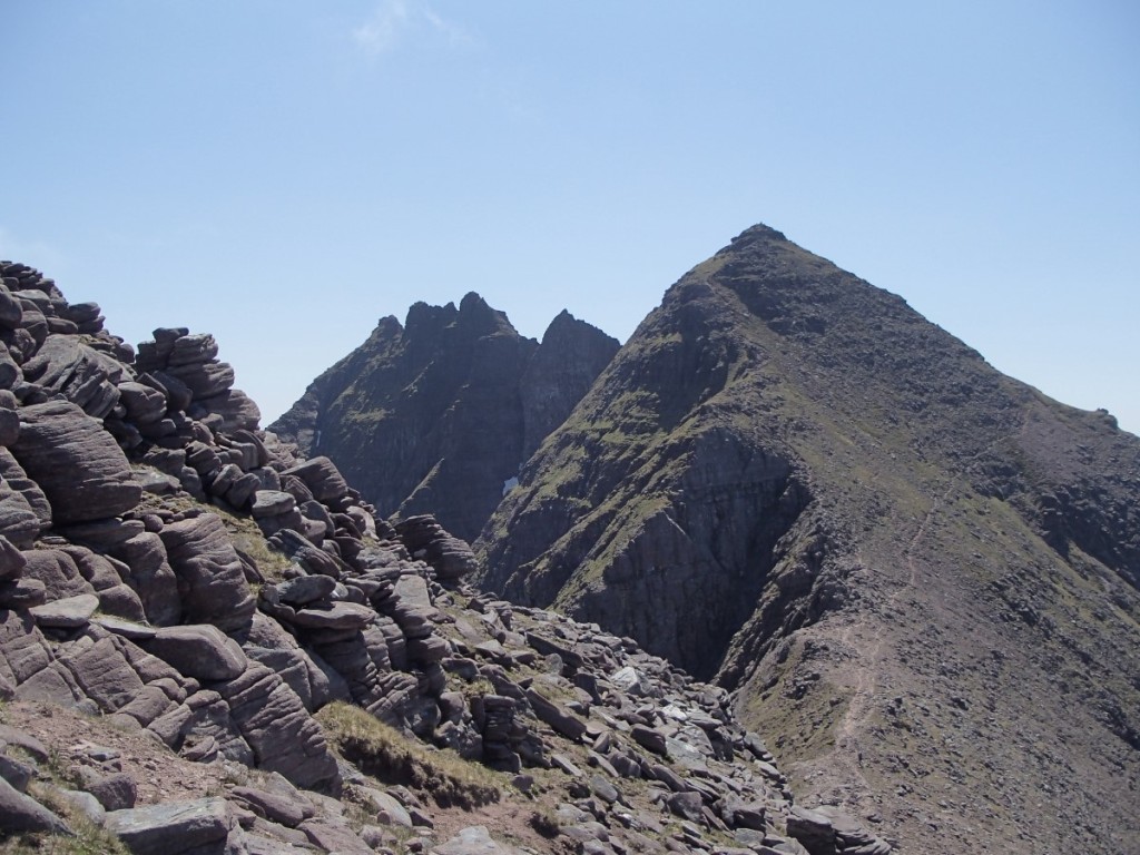
Afterwards, Ruth and Josh went for a bike ride, while I opted for a high walk in the Cairngorms. I parked by the ski centre at Coire Cas and, once I’d escaped the mess of ski infrastructure, enjoyed my walk up onto the plateau via the Fiacaill ridge. A short climb then led me to the windy summit of Cairn Gorm, which became clear of cloud as I approached.
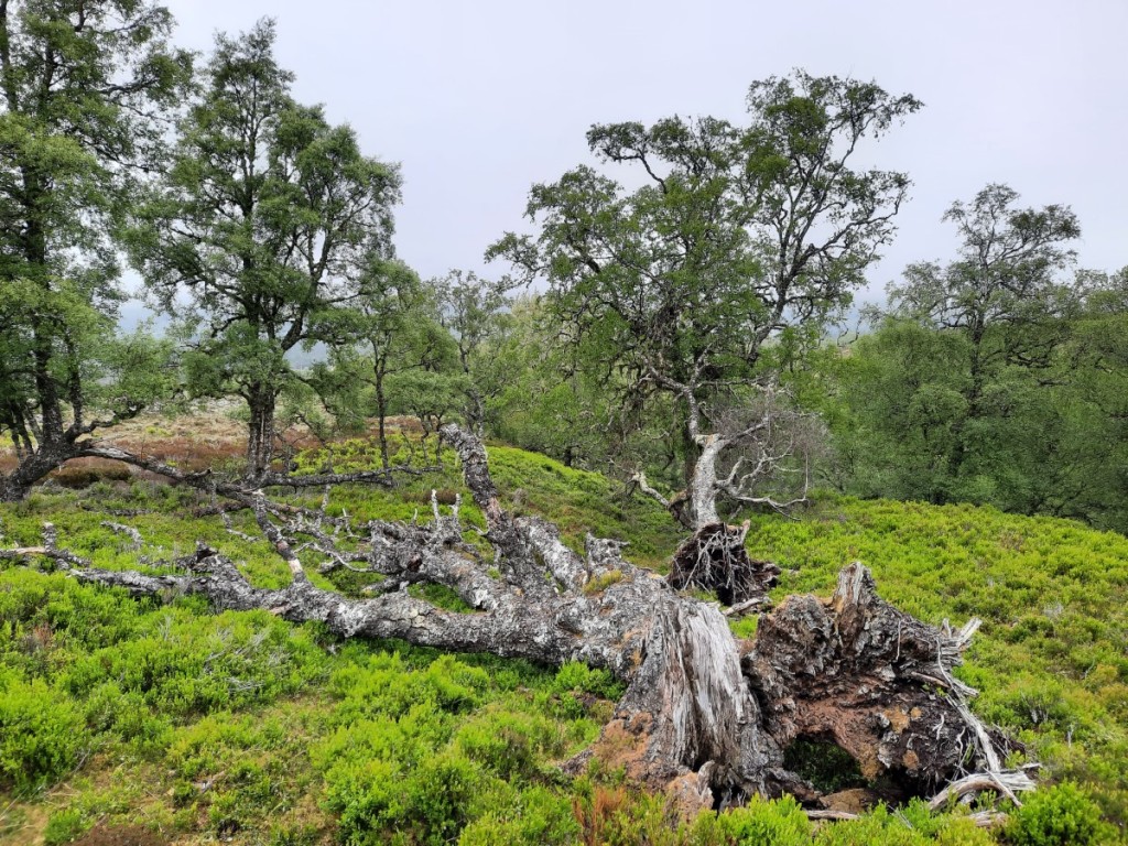
I then made the long but easy traverse to Ben Macdui, with good views over Coire an t-Sneachda and towards Beinn Mheadhoin, passing quite a few other walkers and crossing a few large snow patches. The summit was in mist, so I didn’t linger long before heading back north on the direct path back to Coire Cas. Breaks in the cloud gave intermittent views over the Lairig Ghru to Cairn Toul and Braeriach.
Route map: https://www.plotaroute.com/route/2266510


Back at the hostel, I showered and had a cup of tea before joining Ruth and Josh in the campervan for dinner. The Farrows and Hobbs-Ballses had also arrived and set up camp, so it was good to catch up with them too.
Sunday was the appointed day for Ruth’s Corbett completion on nearby Meall a’ Bhuachaille, which had been my own first Corbett, way back in January 2005, when a few of us from CUHWC did some winter skills training in the area! The group congregated at the Visitor Centre at 10am, including some from Ruth’s work plus a selection of Old Duffers and bagging friends, and quite a few of their young children. It was good that Amy + girls were able to join us, giving a chance to catch up with her too. My own choice of final Corbett last year, Streap, was a more typical example (i.e. largely pathless) and would not have been so family friendly!
The ascent route was straightforward, along the forest tracks to the Green Lochan and Ryvoan Bothy, then more steeply up the well-walked hill path to the summit. The day grew increasingly sunny, and we enjoyed good views of the main Cairngorm plateau. We had celebratory prosecco and lunch at the summit, very warm with barely a breeze! Then it was just a short walk down to the bealach and directly from there down paths to Glen More.
Route map: https://www.plotaroute.com/route/2269501

In the evening, some of the group reconvened on the beach by Loch Morlich for a relaxing barbecue in the sunshine.
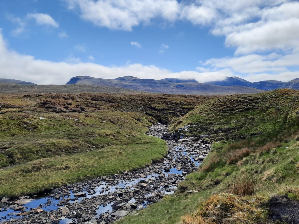
On Monday, I had arranged to meet Ruth and Josh by the east end of Loch Droma – a 90-minute drive further northwest – for a walk up Cona Mheall and Beinn Dearg. When they arrived, we did a quick car faff to drop my car at our finish point, at the other end of the loch and save a little road walking at the end of the day. Then we set off north across the rough hillside to pick up a small path past Loch a’ Gharbhrain and down to the Allt a’ Gharbhrain. We had read that this river can become uncrossable in spate, but after the very dry recent weather it was a trivial crossing with a wide range of flat stepping stones to choose from!
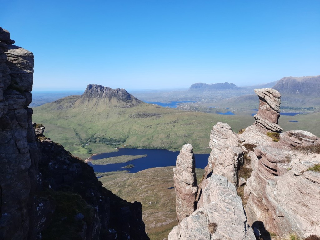
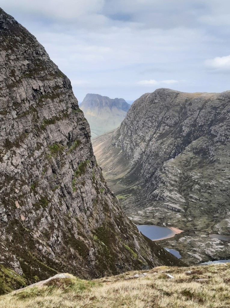
We continued over rougher ground beside Loch Coire Lair then diagonally up the slopes of Leac an Tuadh, crossing a few steep slabs higher up to reach the foot of Coire Granda. From there, the south ridge of Cona Mheall looked a very unlikely walkers’ route but, as the book had described, the steep climb up to its crest did not involve any significant scrambling, with plenty of easy lines between the crags and buttresses. The views over Loch a’ Choire Ghranda were suitably grand as we clambered up and then traversed the narrow arete to the summit of Cona Mheall!


After lunch in the lee of some rocks on the eastern side of the hill, we continued down to the bealach, then up the well-walked path to Beinn Dearg, passing three others as we climbed – the only others we would see that day. The descent via the SSE ridge to Loch nan Eilean gave more fine views over the corrie. After another short drop down to re-cross the Allt a’ Gharbhrain, we were just left with a short crossing of Meall Feith Dhiongaig, on easy ATV tracks, to reach the car at the dam. A great day out in these dramatic hills, by a far superior route to the standard approach up Gleann na Sguaib!
Route map: https://www.plotaroute.com/route/2268302


We then drove the final few miles to the campsite at Ardmair Point, pausing en route through Ullapool to pick up supplies for the next few days.
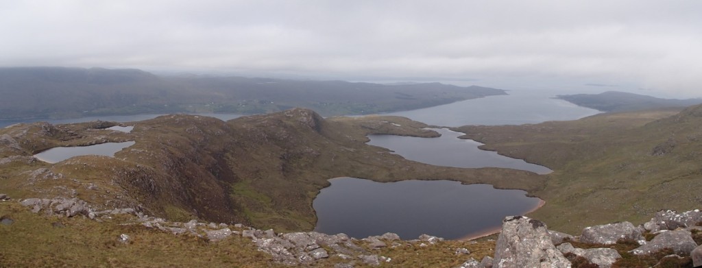
Ruth and Josh decided to go for another bike ride on Tuesday, so I made it a Graham-bagging day. First on my list was Beinn Ghobhlach, a dramatic-looking hill on the peninsula between Loch Broom and Little Loch Broom. It’s only 4 miles from the campsite as the crow flies, but the drive to its foot at Badrallach required a less convenient 50-minute drive via Braemore Junction! I parked near the end of the road then set off on a rising traverse to reach the small lochans on the west ridge of Cnoc a’ Bhaid-rallaich. These, and the larger Loch na h-Uidhe and Loch na Coireig beyond, gave a great foreground to the views of Beinn Ghobhlach.

First, though, I headed up the very attractive rocky ridge to the Cnoc, which is a sub-2000-foot Marilyn in its own right, and was excited to see a couple of golden eagles flying above the bealach.
After a snack at the summit, I descended easily to Loch a’ Bhealaich before zigzagging west then east up the slopes beyond to reach the summit of Beinn Ghobhlach. The summit itself was clear, and gave sunny views inland, but a low cloud was hanging to the northwest and obscuring views further down the peninsula. This gradually lifted and cleared as I walked around the rim of Coire Dearg, and I could see clearly over the Summer Isles as I began the descent. The pinnacles of An Teallach also put in an appearance, above a layer of cloud to the south! I dropped down all the way to the coast path, then followed that back to Badrallach.
Route map: https://www.plotaroute.com/route/2269492


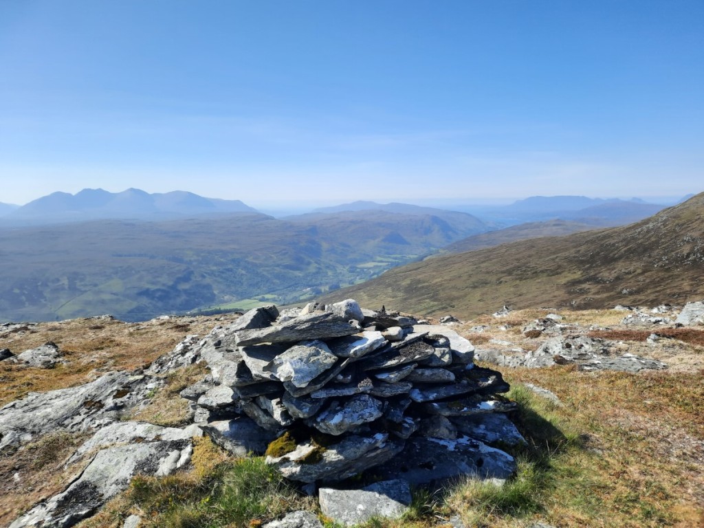
With plenty of the afternoon remaining, and plenty of energy in the legs, I broke the drive back to Ardmair with a shorter walk up another Graham, Meall Doire Faid, above Braemore Junction. My ascent route followed paths past Home Loch then up to the northern bealach before an easy scramble up the northwest ridge. The summit was unremarkable but a great viewpoint for the Fannaichs, Fisherfield, An Teallach, Beinn Dearg and Coigach. I descended more directly down the southwestern slopes to the car.
Route map: https://www.plotaroute.com/route/2269498
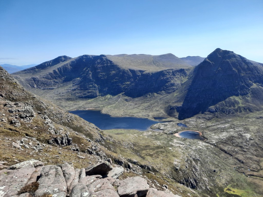
On Wednesday, Ruth and Josh fancied a scramble around the horseshoe of An Teallach. It’s my favourite of all Scottish mountains, so I was very happy to make my third ever visit! We drove back around via Braemore Juntion to park at Corriehallie, with cloud above but an expectation that it would soon burn off. Sure enough, by the time we had walked up the track and lower slopes of Sail Liath, it was breaking up to reveal patches of blue sky. Nearing the summit of that Munro Top, we were above what remained of the cloud layer, giving some dramatic views over the Fisherfield hills, particularly Beinn Dearg Mor.

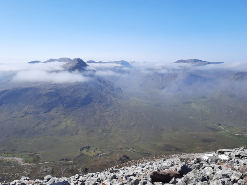
As we continued along the ridge towards Corrag Bhuidhe, the clouds dispersed altogether, exactly as forecast. The pinnacles, as usual, gave excellent exposed scrambling on grippy rock, and incredible airy views over the corrie up to the two Munro summits. We had the whole ridge to ourselves, only meeting a few others near the summit of Sgurr Fiona – they had all come up by the easier path from Dundonnell.


It didn’t take long to traverse to Bidein a’ Ghlas Thuill, enjoying the views back to the pinnacles as we went. Then we were just left with the quick descent on small paths down Glas Tholl back to the road.
Route map: https://www.plotaroute.com/route/2270892

Thursday was another cycling day for Ruth and Josh, and another Graham day for me. As the morning was rather grey, and expected to brighten from the south, I opted for the easier and less interesting of my two objectives first – Beinn Bhreac, above Inverlael. Good forest tracks then upland 4×4 tracks led me very easily up to 500m on the hillside, just leaving a couple of kilometres over short grass, with the help of an ATV track, to the flat 667m summit with a small lochan. The cloud was gradually rising to give glimpses of Seana Bhraigh and the Beinn Dearg hills, although their summits only came fully into view as I descended (by the same route). It was clearer over the more-distant Fannaichs though. By the time I reached the top of the forest, I could also see An Teallach to the west. Although 14km and nearly 700m ascent, the whole walk only took me 3 hours, thanks to the very easy tracks most of the way!
Route map: https://www.plotaroute.com/route/2272268
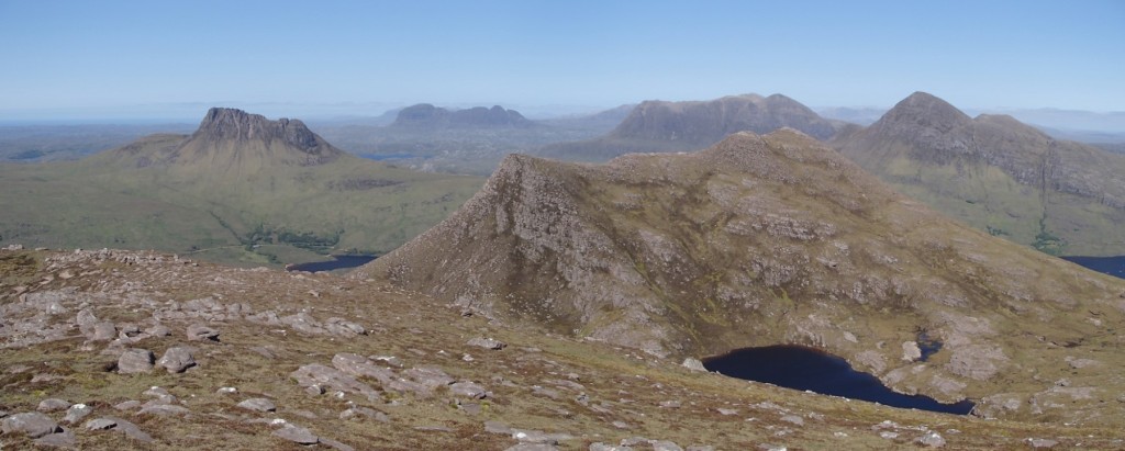
My second objective for the day was Beinn an Eoin, a craggy Graham just north of Ben More Coigach. My route started near the eastern end of Loch Lurgainn, where the one parking place was already taken so I had to begin 1km further up the road than planned. The map shows forest on the approach to Cioch Beinn an Eoin, but in reality it’s now just scattered trees. The ground remains very rough though, with various stump-holes evident! I was pleased to reach that eastern top of the ridge and have a late lunch break there in the sunshine.

The ridge up to the main summit of Beinn an Eoin gave superb views over Lochan Tuath to Ben More Coigach to the south, as well as north to all the other famous Assynt hills, most prominently Stac Pollaidh and Cul Beag. A steep descent and reascent led me to Sgorr Tuath, the north top, from where it was a relatively easy descending traverse south and east, around the end of the ascent ridge to reach the road and car.
Route map: https://www.plotaroute.com/route/2272270

For Friday’s walk, I was joined by Ruth and Josh on the twin Grahams of Ben More Coigach and Sgurr an Fhidhleir, the former dominating the view north from our campsite and thus an obvious objective for the trip! To enjoy the most logical horseshoe route, we drove all the way around three and a half sides of the hill to end up at the end of the road at Culnacraig, again not far from camp as the crow flies.
An unexpectedly good path led from there up into the corrie, and making easy work of the first 300m ascent. We then traversed across the ravine of Allt nan Coisiche to reach the end of the Garbh Choireachan ridge – another one that looked daunting but just required walking and optional easy scrambling in reality. As we continued along the ridge towards the summit of Ben More Coigach, we passed one of Ruth’s colleagues’ wife and son running the opposite way – small world (although we had seen their van in the car park so it wasn’t a total surprise!).


We took the scenic detour to the viewpoint of Speicein Coinnich before continuing northwest, down and back up to the pointy summit of Sgurr an Fhidhleir, surrounded on three sides by huge cliffs. This gave splendid views of Beinn an Eoin (that I had climbed the previous day) and the other Assynt hills beyond.


Ruth’s knee was getting sore, so she and Josh descended slowly by the direct path while I took the scenic route over Beinn nan Caorach and reached Culnacraig not long after them.
Route map: https://www.plotaroute.com/route/2274247
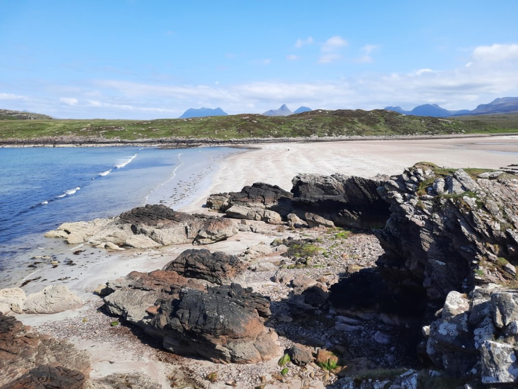
We broke the drive back to camp with a stroll on the white sandy beach and dunes at Achnahaird Bay. In the evening we popped into Ullapool for fish and chips, although we returned to camp to eat them as the seafront was a construction zone with nowhere to sit!
On Saturday, Ruth and Josh opted for a short walk up Stac Pollaidh and potter around Achmelvich, while I preferred a bigger hill-day and headed further north to the triple Corbett of Quinag. My previous visit had been in showers and poor visibility, so I hoped for better views this time but was disappointed that, even with a late-ish start, the morning mist was not showing much sign of breaking up as I set off from the car park. As I climbed, bright skies above gave the impression that the cloud was not thick, but it was only in the final few metres to the summit of Spidean Coinich that I broke free into the sunshine above an inversion! Banks of cloud drifting around meant there were only fleeting glimpses of the other two Corbetts.
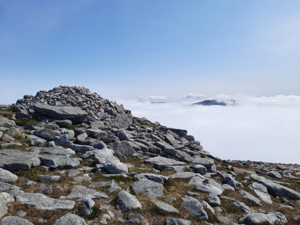
After enjoying the cloudscape and chattign with a few others on the summit for a while, I continued along the narrow ridge down to Bealach a’ Chornaidh, then up the broader ridge to the second Corbett, Sail Ghorm. This was similarly situated just above a sea of cloud, which enjoyed as I ate my lunch in the sunshine.


The cloud finally began to break up more significantly as I made the final traverse to the third and highest summit, Sail Gharbh, giving intermittent views of both the other tops, which continued to improve as I descended to the bealach and corrie. Returning to the car mid-afternoon, it was finally getting properly sunny. Still, I had had a much better experience on Quinag to last time, even without the hoped-for views of Canisp and Suilven.
Route map: https://www.plotaroute.com/route/2274248

Sunday was mostly spent on the 9 hour drive home. I got up quite early and was on the road by 7:45am and parked up just off the A9 at Lynebeg by 9am for a quick walk up the Graham, Carn na h-Easgainn. This must be one of the easiest Grahams as the ascent is only 3km and 300m climb, with a large track all the way. I was surprised to overtake two women near the summit, and not to have the place entirely to myself, particularly as the cloud was low and there were no views to be enjoyed that early in the day. They assured me that the views over Inverness were good! I think it cleared an hour or so later, as it was certainly clear everywhere by the time I was driving past the high Cairngorms. Sadly a later start was not really an option for me with the long drive to do.
Route map: https://www.plotaroute.com/route/2276711
The roads were flowing well and I made it home by about 7:30pm after a lunch stop in Perth and dinner stop at Sandbach services. This week will certainly live long in the memory as one of my best ever summer weeks in the Highlands – sunshine most days and never any significant wind or rain, but enough breeze in camp to keep the midges at bay! That capped with great walks on some of the finest hills in the country made it a brilliant holiday.
My full photo album is available on Google Photos here.
