May is prime hillwalking season in the Highlands, a sweet spot of few midges and (usually) good weather, so it’s always with excitement that I make the trip north at this time of year. As I have the last two years, I joined the Gentian Club for their week-long meet, which this year went to the comfortable Mar Lodge bunkhouse near Braemar in the Cairngorms. Sheena and Claire travelled with me once again, meeting at my house on Thursday evening to drive up as far as my sister’s house for the night.
After a fairly leisurely Friday breakfast and a little time playing with baby Chloe (now 11 months), we continued north, taking a short comfort break at Abington services and a longer grocery-shopping and lunch break at Tesco in Perth. That just left 90 minutes’ drive over the Cairnwell Pass, and we arrived at the bunkhouse a little before 3pm. Although check-in time was officially from 4pm, the cleaner emerged a few minutes after our arrival to say that everything was ready, so we were able to unload, choose beds, and put cold goods in the fridge.
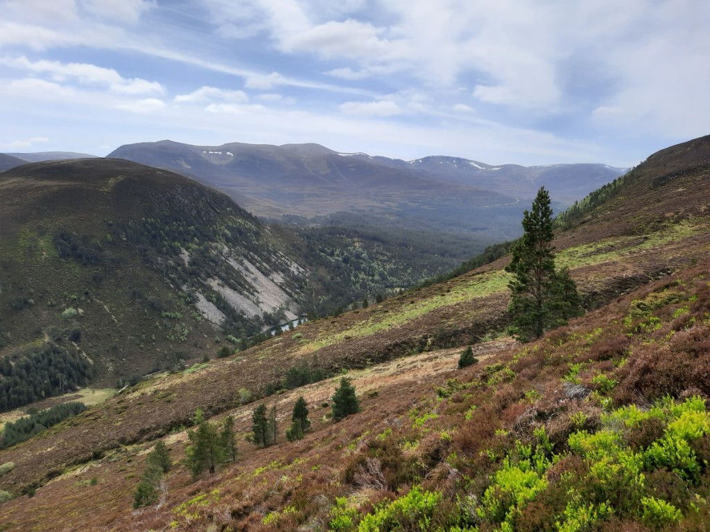
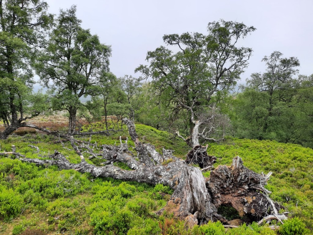
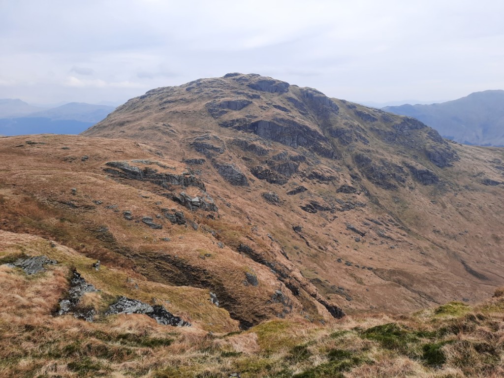
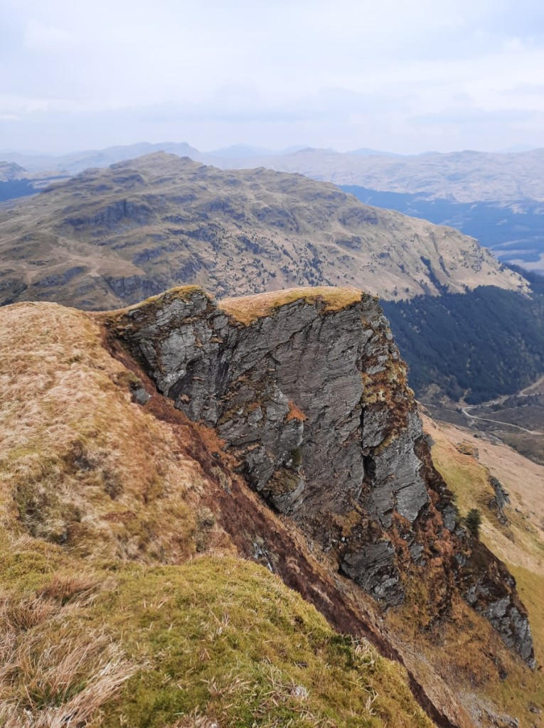
Ned and Vivienne arrived just as we were heading back out for an afternoon stroll up Creag Bhalg (the one nearby Graham still on my to-do list!), but couldn’t join us as they’d agreed to pick up Martin from the bus stop a little later. We ascended by good tracks up onto the broad ridge, then gradually up on short heather to the summit cairn. It was not a particularly remarkable hill, only 330m above valley level, but did offer great views of the high Cairngorms, with lots of enticing snow patches remaining after the very snowy spring. We made a round route of it by continuing over the east top to pick up another track traversing across the southern slopes to regain the upward route just above Mar Lodge.
Route map: https://www.plotaroute.com/route/3323261

Most of the others had arrived by the time we got back from the walk. Sheena kindly cooked me dinner and we all spent the rest of the evening chatting over a couple of drinks as usual.
The forecast for the week looked extremely promising, with settled dry weather, so I started as I meant to continue by offering a big walk up some Munros! Vivienne, Amanda, Claire and Sheena opted to join in for my proposed route over Carn a’ Mhaim, Ben Macdui and Derry Cairngorm. We drove the couple of miles to Linn of Dee then set off up the good tracks to Derry Lodge under mostly cloudy skies with the odd sunny spell. Continuing up Gleann Laoigh Bheag I crossed the Luibeg Burn easily, stepping from rock to rock, but the others declined to follow so I spent a few minutes watching them make their way 500m upstream to the bridge and back!

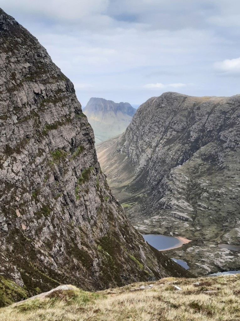
The path up Carn a’ Mhaim is not marked on the OS map but turned out to be heavily improved with stone pitching and drainage most of the way, making for easy progress. I hadn’t been that way before, as my one previous ascent was directly up from Corrour Bothy. The summit gave excellent views over the Lairig Ghru to Beinn Bhrotain and the Devil’s Point. After a short pause, we continued along the ridge – narrow by Cairngorm standards but not at all exposed – then made our way up the steep, bouldery, southwestern slopes of Ben Macdui. There were grand views of Cairn Toul and Braeriach, with lots of snow in the corries.


A short walk across the plateau brought us to the summit of Ben Macdui, the second highest in Britain but not a great viewpoint due to the flat ground all around. The wind was quite strong and we definitely needed our hats and gloves! We made our way east and enjoyed crossing several large snow patches in the shallow valley above Loch Etchachan. Further on, we gained grand views over Coire Sputan Dearg to our final objective, Derry Cairngorm.


After a break near the bouldery summit, we made our way down the long south ridge to Carn Crom. I took the short detour to the summit, which is listed in the new High Hills of Britain book, then caught up with the others on the descent back to Derry Lodge. That just left a fairly tedious 5km back along the tracks to the car to end a 30km day.
Route map: https://www.plotaroute.com/route/3323263
Sunday was similarly overcast and breezy. Howard proposed a linear walk taking in four Munros on the East Mounth, and I was happy to drive to help facilitate it. Six others joined too: Mike, Ned, Martin, Amanda, Claire and Sheena. We dropped my car at the end point near Baddoch, then drove over the pass to the Devil’s Elbow car park in Howard’s and Amanda’s. The ascent to Creag Leacach was quite scenic, beside a burn initially then up grassy slopes below Meal Gorm to reach the bouldery upper ridge. There were improving views up the pass to The Cairnwell and later south down Glen Shee.


Glas Maol had initially been in cloud but had cleared by the time we reached the summit of Creag Leacach. We continued up the widening ridge to cross that broad dome and pick up a Land Rover track across the plateau. I and a couple of others left the track for a detour to take in the views over the steep-sided Caenlochan Glen from Craigie Glasalt, and caught back up with the group having lunch near the summit of Cairn of Claise.


On the way to the day’s final peak, Carn an Tuirc, we took another short detour for a grand view over Loch Kander into Glen Callater. On the descent of the northwestern slopes we crossed a fairly steep snow field to reach a ruined hut and the small path down to the road. I ferried the other two drivers back over the pass to fetch their cars, and we were soon all back at Mar Lodge.
Route map: https://www.plotaroute.com/route/3323993


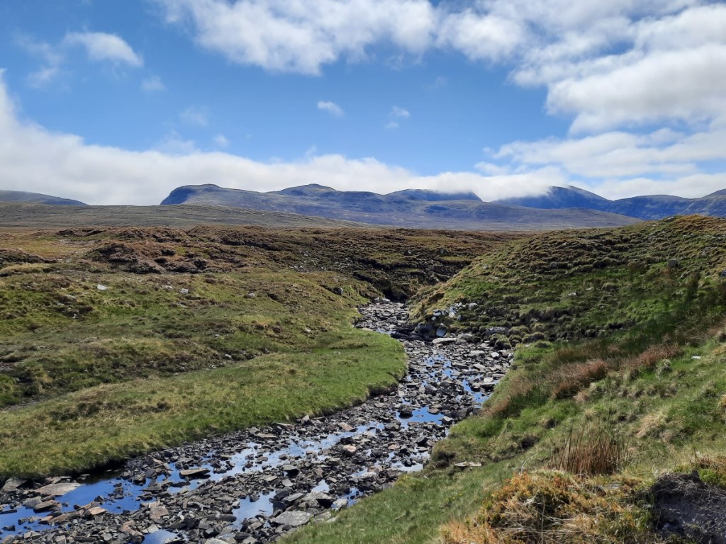
Monday was sunnier. I led another 30km walk, this time on the West Mounth, starting in Inverey, just a mile’s drive from the bunkhouse. Sheena and Amanda joined me. I’m sure Claire would have too, but sadly she had painfully damaged her toenails over the previous two days and was forced to take a few days off. The walk started with 8km on the valley track up Glen Ey to the ruins of Altanour Lodge. The distance passed quickly though, with pretty scattered trees, heather burning patterns in the heather above, and the meandering river in the valley bottom.


Intermittent ATV tracks and some off-piste sections led us to the foot of the northeast ridge of Beinn Iutharn Mhor, where we paused for a snack with views of An Socach, which John and Susie had climbed the previous day. A short, steep climb up a well-walked path led to the easy-angled upper ridge, where we gained views of Loch nan Eun, location of one of my wild camps many years ago. The view over the corrie above Lochan Uaine was greatly enhanced by the impressive remains of a large cornice. We visited the windy summit, with views of Carn an Righ and Beinn a’ Ghlo, before retreating a bit to a sheltered spot on the eastern slopes for lunch.


We returned to the east top then dropped down steeply across scree patches to gain the broad, heathery ridge to Carn Bhac – fairly hard going although not boggy as it might have been in more normal conditions. It was good to reach the rockier ground of the upper ridge, around the rim of Coire Bhearnaist to the summit. We dropped down east then contoured northeast to pick up the end of a well-used Land Rover track down the ridge of Carn nan Seileach to reach the Glen Ey track at Auchelie, about 3km above Inverey – not such a long and tedious walk out today!
Route map: https://www.plotaroute.com/route/3324808


Ned spent the evening planning and publicising a scramble up The Stuic for Wednesday. Several of the group wanted to save energy for that with an easy day on Tuesday, but given the continuing sunny weather I was still surprised that only Sheena joined me for my walk up Lochnagar, probably the grandest hill in the area! The drive via Ballater to to Spittal of Glenmuick took about 45 minutes, and we were soon on our way up the standard route via Clais Rathadan. Straight away, we passed a group of red deer, surprisingly the first we had seen on this visit to the Highlands. Further up, there was lots of colourful yellow broom beside the river. A helicopter passed overhead as we continued up the well-built path to the corrie rim.

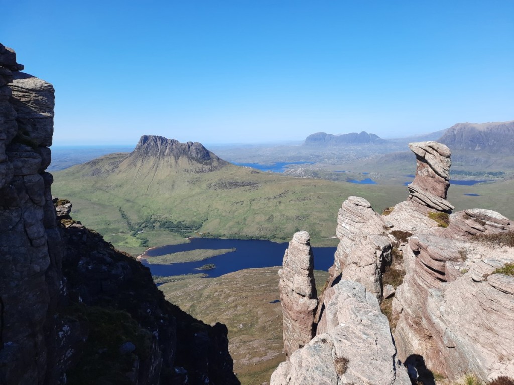
We paused for a short while to enjoy the views over the lochan to the celebrated cliffs, then made our way up the boulders to the plateau and followed the cliff-edge path all the way over Cac Carn Mor to the highest summit, Cac Carn Beag. Part-way along, a ptarmigan posed obligingly for photos overlooking Meikle Pap! From the summit, there was also a great view of the proposed scramble for the next day.


We had our lunch in a sheltered spot below the summit tor, then made our way southwest towards Eagles Rock. Part way, we disturbed a large group of deer which, unusually, divided into two smaller groups rather than all running away together. The eastern group ran dramatically along the skyline above us.

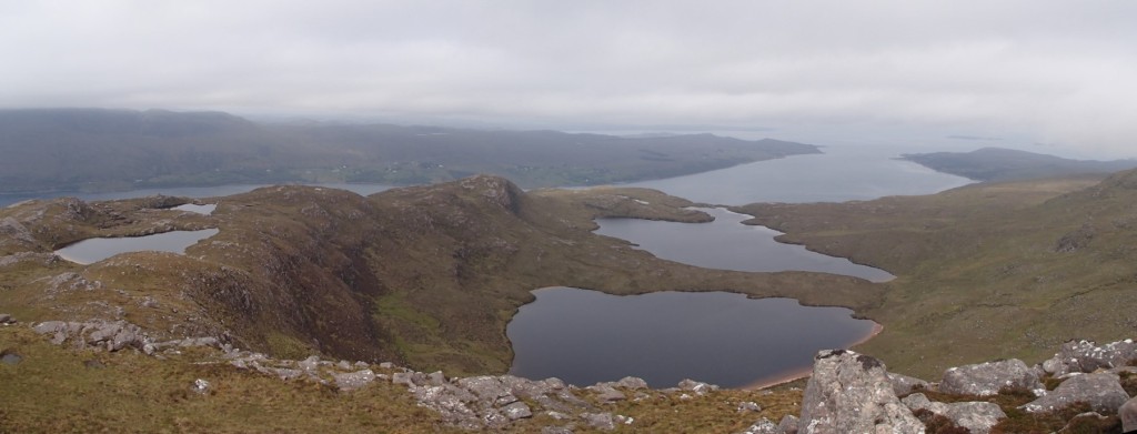
The descent southeast from the 1051m top was an unconventional and partly pathless route but did offer views of Creag an Dubh-loch, where we could see that Central Gully, another of Ned’s suggested scrambles, was partly filled with snow as I’d suspected. Further down, we gained views of Dubh Loch itself, then the smaller Loch Buidhe. We joined the stalkers’ path down the valley for the final couple of kilometres to the head of Loch Muick, where we paused for second lunch on the shore. That left 6km on a path then a larger track along the south shores of the loch back to the car: scenic walking but it felt a long way! We paused at the Co-op in Ballater on the way back to the bunkhouse to pick up extra breakfast supplies (I had been assigned breakfast duty for the week).
Route map: https://www.plotaroute.com/route/3325855


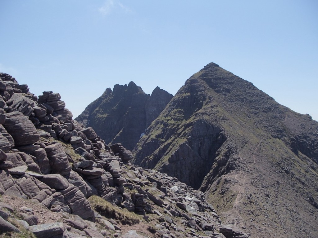
On Thursday I joined Ned’s walk and scramble, providing the second car to enable it to be a linear route from Invercauld Bridge to Auchallater. We dropped Mike’s car at the finish point then continued to the start in mine. Sheena and Howard also joined the group. The first few kilometres were gently uphill on tracks through the very pleasant natural woodland of Ballochbuie Forest. We were interested to pass a group harvesting sticks of heather for use in thatching. We left the forest on the track beside Feindallacher Burn and, soon afterwards, crossed it, all keeping dry feet except for Mike! We crossed some pathless ground over Druim Odhar to reach an ATV track that eased progress beside Allt Lochan nan Eun. Further up, it became just a small path up to the shore of Sandy Loch, where we gained views of The Stuic (our scramble) and up the corrie to Lochnagar.


Rather a rough climb through heather and some boulders led us to the shore of Loch nan Eun, right at the foot of the scramble. We took a lunch break in the lee of a large boulder, then set off steeply upwards. Keeping to the most interesting line on the lower section, the scrambling was more continuous than it had looked from below, on good rock with nice holds. Higher up, the crest of the ridge gave the easiest line and was a fairly well-worn route – deservedly so with the grand setting between two impressive corries. Apparently Lord Byron once ascended that way! Near the top, we saw a couple of ptarmigan on the rocks.


From the top of The Stuic, it was a short walk across the plateau to the (slightly higher) summit of the Munro, Carn a’ Choire Bhoidheach, where we had some more lunch. This was the first day without a strong breeze, so there was no need to seek a sheltered spot. Afterwards, we returned to The Stuic, where we bumped into John and Susie, who were doing a there-and-back walk from Auchallater. We had a short chat, then continued west across the undulating plateau, over Carn an t-Sagairt Beag to the day’s second Munro, Carn an t-Sagairt Mor.


Dropping down west a short distance, we passed scattered remains of a crashed RAF Canberra aircraft (from the 1950s), and gained views into Coire Loch Kander, which we had looked down on Howard’s walk a few days prior. Soon we were on a well-built stalkers’ path that led all the way down to Lochcallater Lodge. We spent a few minutes having a look around the MBA bothy in the old stable block, looked enviously at John and Susie’s bikes locked nearby, then walked the 6km down the track to the road.
Route map: https://www.plotaroute.com/route/3326886

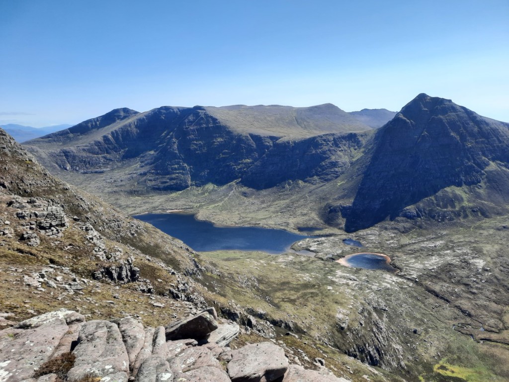
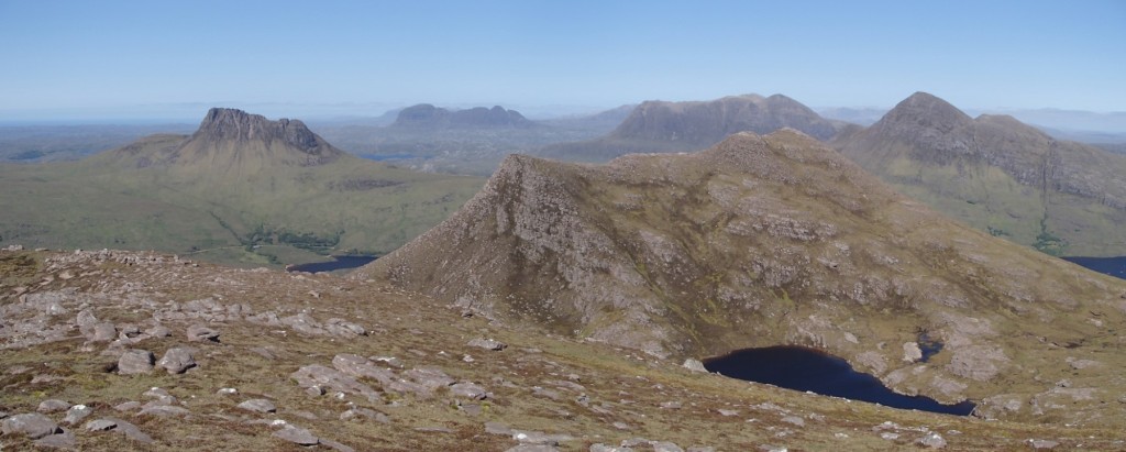
The good weather continued for the final day of the club trip, so I proposed another big day up onto the high Cairngorms, this time Beinn a’ Bhuird. Ned, Vivienne and Sheena opted to join me. We drove the short distance to Linn of Quoich and followed the high-level track across the slopes of Carn Elrig Mor to rejoin Quoich Water in the scattered, natural pine woods further up. We forded the river without difficulty and followed a helpful unmapped path east to gain the mapped one up to the ridge above Carn Fiaclach. From there, it was an enjoyable walk up large, grippy boulders to the rim of the impressive Coire na Ciche, then across the tundra to the South Top. We continued a few hundred metres north to the rim of Coire an Dubh-lochain rim for a lunch break with a grand view over the corrie and lochan and towards Ben Avon.


After lunch, it was easy walking around the corrie rim and then around Coire nan Clach to the Munro summit on the North Top – another flat summit that doesn’t do justice to this fine mountain! We retraced our steps for a couple of kilometres then took the path branching southwest to descend easily via An Diollaid back into Glen Quoich. Once we’d easily forded the shallow river, we were just left with a final stretch down the valley, the monotony of track walking this time broken up by a section of smaller, more attractive path beside the river.
Route map: https://www.plotaroute.com/route/3327822


In the evening, most of us went into Braemar for a tasty dinner at the Flying Stag bar at the Fife Arms Hotel. A great way to mark the conclusion of a wonderful week of Cairngorm hillwalking.
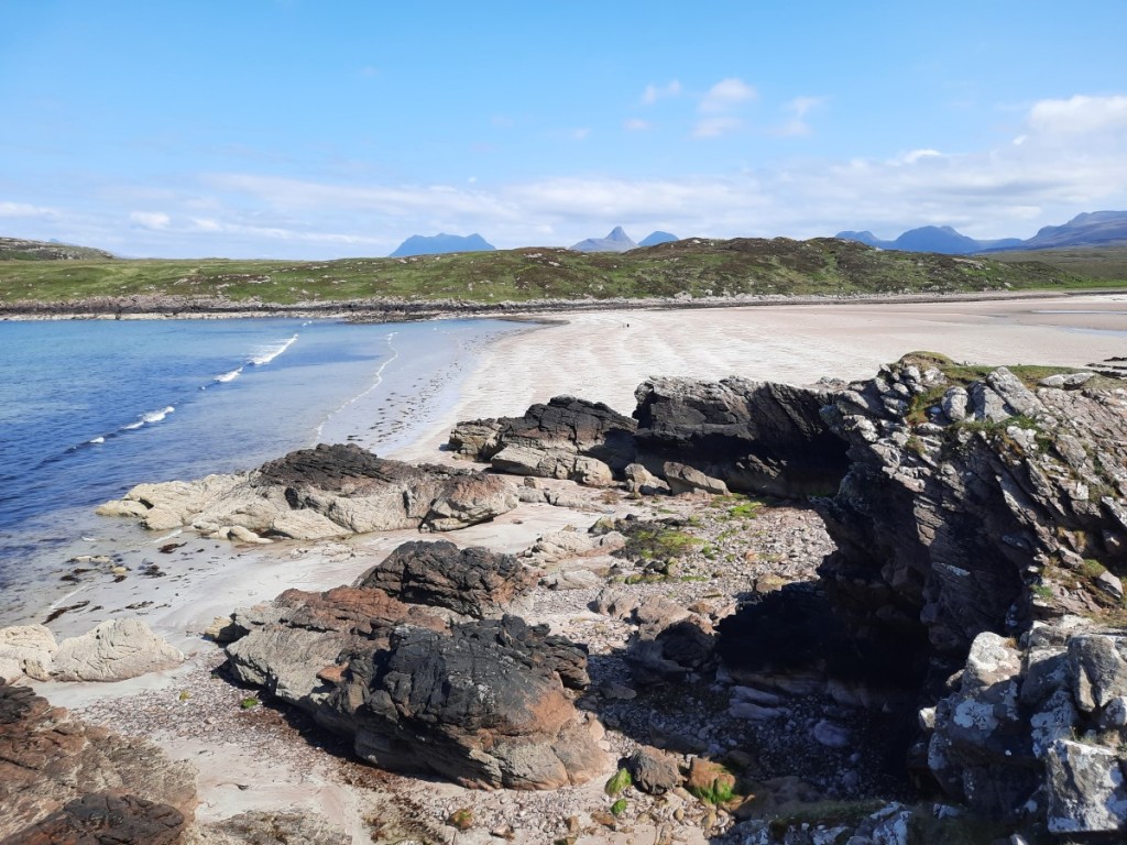
The next morning, we spent some time packing up our stuff and tidying the bunkhouse before saying our goodbyes and hitting the road. Claire, Sheena and I were heading to Pitlochry for an extra couple of days before returning home, to make best use of the weekend. We drove for about 75 minutes to reach the Ben Vrackie car park and followed the tourist route up via Lochan a’ Choire to the summit. Luckily, Claire toes had recovered enough for her to enjoy a bit of hillwalking again! Not so luckily, a shower blew through as we approached the summit and low cloud obscured the views for a while. We had lunch on a bench by the lochan then continued down to the car and drove into town.
Route map: https://www.plotaroute.com/route/3328949

The afternoon was a bit brighter and we enjoyed a few miles’ walk beside Loch Faskally, Loch Dunmore and the River Garry – pretty woodland although not as good in spring as in the autumn! We were surprised to find bungee jumping in progress under Garry Bridge, and watched that for a few minutes before heading back down the riverside path.
Route map: https://www.plotaroute.com/route/3328956


Back in Pitlochry, we checked into our accommodation at the Backpackers Hostel, got ice creams, then popped to the Co-op for provisions before an evening in the hostel.
Saturday started with a tourist parkrun at FeldyRoo Fitness Trail in Aberfeldy, a pleasant three-lapper beside the River Tay and through scattered trees on trail and grass paths. I was a little slower than of late, after a week of long walks and somewhat disturbed sleep, but did finish first out of 80 participants. Sheena annoyingly beat me by 0.01% on age grade!


After parkrun, we drove west along Loch Tay for a walk up Ben Lawers, starting at the high car park by the National Nature Reserve. The car park was quite full, with our late start on a Saturday morning, but the hill didn’t seem so busy. Perhaps lots of people had gone up Meall nan Tarmachan instead. Some afternoon rain was forecast but it stayed dry with sunny spells as we ascended towards Beinn Ghlas with extensive views over Loch Tay to Ben Vorlich and Ben More.


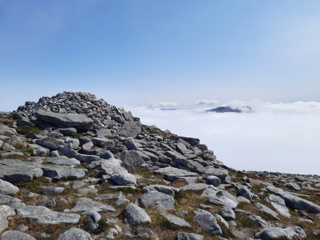
The summit was just in the cloud, but we dropped back out of it at the bealach before Ben Lawers, and we paused there for lunch. The summit of Ben Lawers was also in cloud, but it never dropped much below 1000m so we had views all the way back along the traverse path below Beinn Ghlas. A bit of light rain fell as we descended Coire Odhar back to the car, and our finish was well timed as a heavier shower arrived as we drove back along Loch Tay.
Route map: https://www.plotaroute.com/route/3329772


Back at the hostel, I was feeling lazy and got fish and chips for dinner, while Sheena and Claire cooked their own meals. Sheena made an impromptu visit to a local ceilidh for the evening while Claire and I watched the film ‘Prince Caspian’, which was being projected in the hostel lounge. Not a great film – at least an hour longer than it needed to be – but it filled the evening!
We started Sunday with a short walk from Pitlochry to the nearby Black Spout waterfall, circling back via Moulin with good views of Ben Vrackie.
Route map: https://www.plotaroute.com/route/3330721

That just left the six hour drive back to Derby, which was free flowing except for some queues on the M6 near Knutsford. Definitely a trip that will leave behind lots of fond memories. I revisited 15 Munros and 1 Corbett, as well as bagging a new Graham the first afternoon, and we only had a few minutes of rain over the entire 10 days. And great to spend time with good friends. Midge season is starting now though, so I’ll leave it until October for my next Highland jaunt!
You can view my full photo album on Google Photos here.