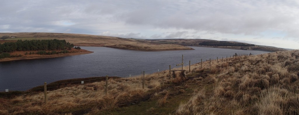
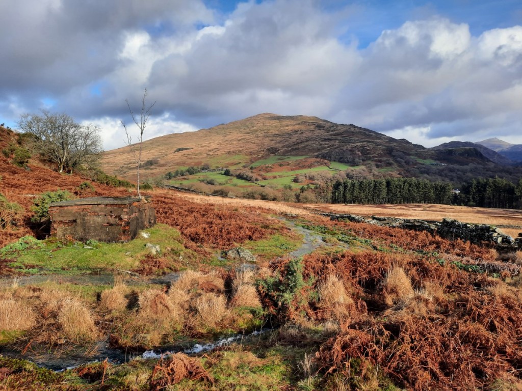
I took a trip to one of the furthest-away parts of the Peak District, aiming to tick off three of my four unbagged Ethels and explore the unfamiliar area east of Black Hill. It’s an off-putting 70 miles from home, but actually mostly on the A38 and M1 so only about 80 minutes’ drive. I parked near the sailing club at Winscar Reservoir, where the forecast of sunny spells first thing happily proved to be correct!
Winscar Reservoir
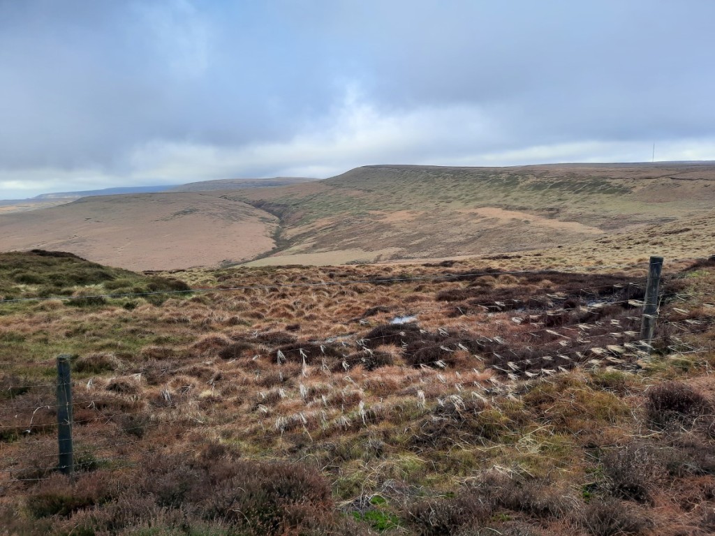
The moorland to the west is pretty much pathless on the OS map but I had used the Strava Global Heatmap to identify the most popular routes on the ground and this did give me paths most of the way, even if they were sometimes indistinct or boggy. I followed small trods beside the stream up Dearden Clough, then picked up the fence-line along Upper Dead Edge. There hadn’t been much of a view from the broad ridge, with Bleaklow in the cloud to the south, but on reaching the trig point (and Ethel summit) I was suddenly able to see down towards Woodhead and Crowden.
Looking down to Crowden from Dead Edge End
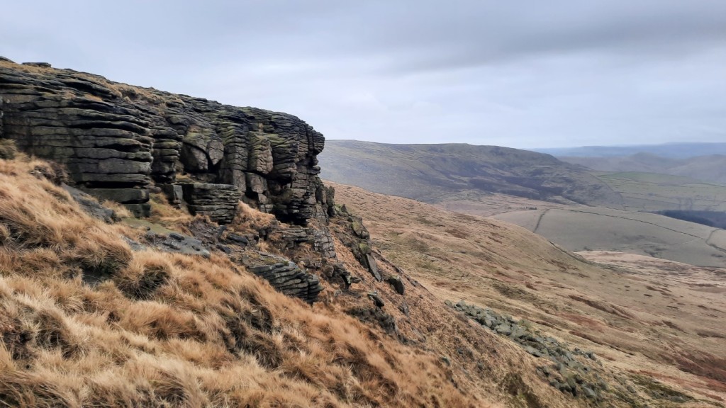
More interesting views over the steeper slopes of Withens Moor made the traverse to Britland Edge Hill (the next Ethel) more enjoyable. The wire fence was also unusually festooned with strands of wind-blown grass, fluttering in the strong westerly breeze.
Withens Moor and the wind-blown grass!
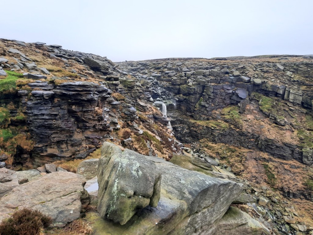
The next couple of kilometres to the road at Holme Moss were particularly boggy, so I was glad to reach the firmer ground beyond. I had only seen a pair of fellrunners up to this point, so I was surprised to find quite a few other walkers on the path up to Black Hill. Perhaps I should not have been surprised, as it’s the shortest and easiest route, even if not as well surfaced as the Pennine Way! Although the path was reasonably obvious, in the mist I was glad of the reassurance of a compass bearing after I’d passed the last real landmark at Heyden Head. With a cold breeze and no view at the summit, I didn’t hang around long before setting off north along the stone-pitched path beside Issue Clough. Once I’d descended a few metres, however, I was back in the clear, with sunlit views northeast towards Holmfirth, and my route down to the ‘Issues Road’ track became obvious.
Dropping back into the sunshine by Issue Clough
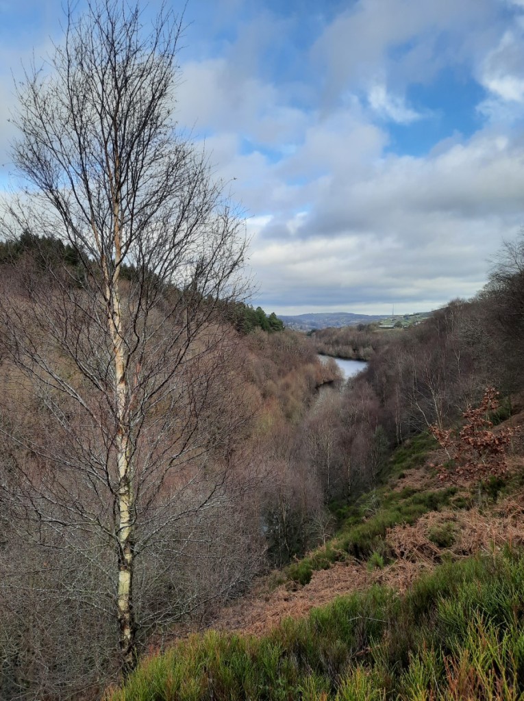
The track gave easy walking down to the hamlet of Holme, beyond which I picked up some popular footpaths beside Brownhill Reservoir – an attractive spot with steep, mixed woodlands all around. Once I’d crossed the dam of Ramsden Reservoir, I reascended towards Ramsden Edge and traversed above the woods into Ramsden Clough. There I paused for a late lunch on a very comfortable rock in the sunshine, with an excellent view over the reservoirs and up Ramsden Clough!
Brownhill ReservoirRiding Wood Reservoir, from my lunch spot
After lunch, I continued up Ramsden and Ruddle Cloughs to gain the moorland plateau again, then followed a line of grouse butts up onto Snailsden Pike. From the western top, marked as higher on the map, I felt sure that the trig point further east was in fact higher, but looking back from the trig it was not so clear! Best to visit both to be sure of bagging the Ethel properly. A good path led down to Harden Reservoir dam, from where it was an easy walk on large tracks around the east side of Winscar Reservoir and back to the car.
Ramsden CloughThe spillway from Harden Reservoir into Winscar Reservoir
The Ethel summits themselves weren’t especially inspiring today, but my route back from Black Hill via Holme and Marsden Clough was very attractive, and this area would definitely be worth exploring more thoroughly. My remaining Ethel is Ashway Moss, near the Trinnacle, so that should give a good walk from Dovestone Reservoir later in the year.
More photos can be seen here, and a map of my route here.
I haven’t been for a walk with Amina since 2020, so I was pleasantly surprised when she said recently that she’d be up for a day out in the Peak District. No parkrun for me, in order to be fresh for a longer race the following morning, so it was the ideal Saturday for a walk and the forecast of dry, overcast weather was alright too.
We met at my house soon after 9 o’clock and I drove us up to Hayfield – Amina was keen to see my new car – to start walking soon after 10:30. I had wondered whether the cloud would be on the tops to start off. That proved not to be the case so we walked clockwise to get to the highest ground sooner, heading past Kinder Reservoir and then up William Clough. The visibility was pretty good with clear views around the skyline, and towards Manchester and Bleaklow once we reached the ridge.
Looking over Kinder Reservoir dam towards Mount FamineAmina in William Clough
We continued east along the edge of Sandy Heys, pausing for a brief first-lunch in the shelter of a gully and to take a few photos around Kinder Downfall.
Gritstone crags at Sandy HeysKinder Downfall
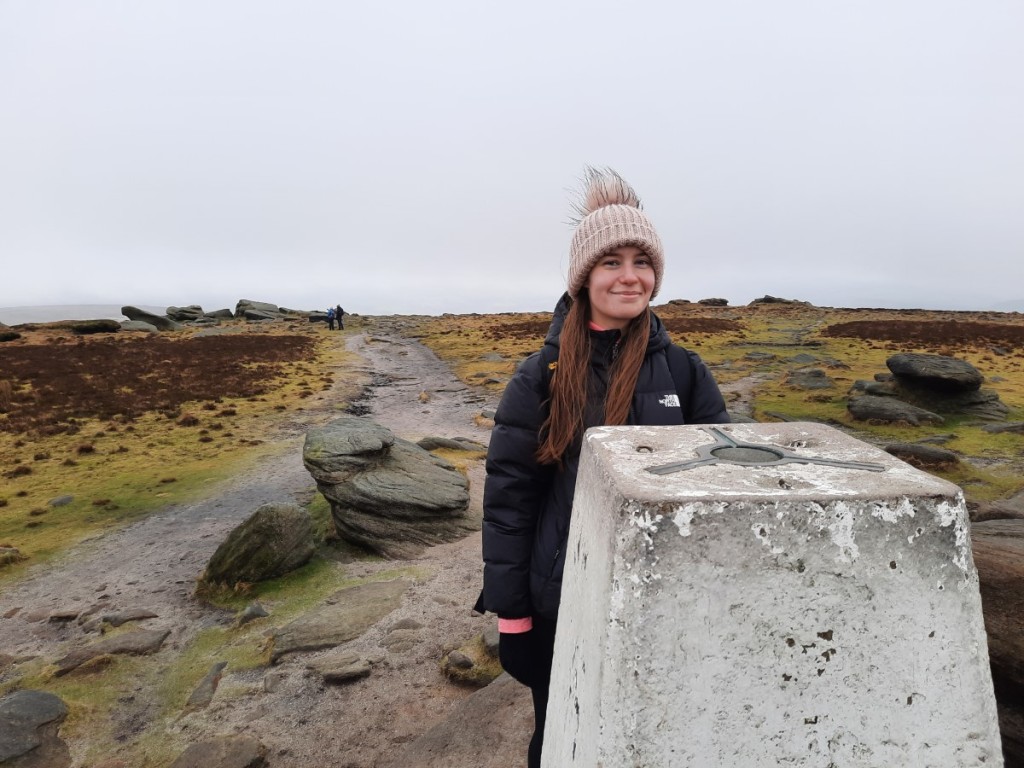
Another half hour or so brought us to the high point of the day, the trig point on Kinder Low. By this point, the cloud had started to drop a bit and Sandy Heys was in the mist although Kinder Low itself remained just about clear.
The summit of Kinder LowAmina by Edale Rocks
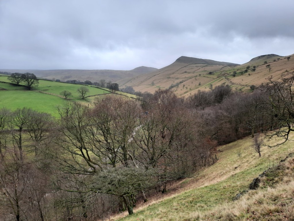
We dropped down to Edale Cross for lunch in the most sheltered spot we could find, then continued along the path – well-pitched at first, then boggy – over the shoulder of Brown Knoll and down the ridge to South Head and Mount Famine. A bit of drizzle blew through in the wind and made us a little damp for quarter of an hour or so but petered out before we’d got around to putting on our waterproof jackets. All that remained was the easy descent down the bridleway to Coldwell Clough and the car.
Looking back to Kinder Scout from Mount FamineLooking back up to South Head and Mount Famine from Coldwell Clough
A good day out on the hill and it was great to catch up with Amina as we walked and talked. Hopefully it won’t be another 2.5 years until the next time! You can find more photos here and a map of our route here.
Looks like I missed the best weather of the weekend, having seen photos of a cracking day of inversions and sunshine in the Peaks yesterday, but nevertheless I headed up to Hathersage today for my first local walk of the year. It was a cold start, with temperatures on the drive ranging from -7.5°C to -5°C, but with light winds didn’t actually feel too chilly at any point on the walk.
I started by ascending to Carhead Rocks, somewhere I had not been before, which gave good views down to the Derwent Valley and up to Stanage Edge.
Carhead Rocks, with Stanage Edge above
I then continued up to Stanage and followed the edge north all the way to Moscar Lodge. There were quite a few people around initially, but it got much quieter further north. There was a little snow wherever the sun had not shone, but nothing was very slippery, and progress was easy, particularly with the peat all well frozen.
Orange skies to the southA bit snowier near Stanage End
Once past Moscar, I headed northwest over Strines Edge – another new route for me – and across the heather moor to reach Derwent Edge near Dovestone Tor. Turning south, I followed the edge as far as Whinstone Lee Tor, enjoying the views over Ladybower and the various rock formations, then took the bridleway east to Cutthroat Bridge, where I paused for lunch in the warmth of the woods.
Ladybower, with Kinder beyond
A short climb back up via Jarvis Clough brought me onto Bamford Moor, and soon to the busy viewpoint of Bamford Edge. I escaped the crowds as I descended south, and returned to Hathersage via Gatehouse and Birley Farm.
The classic view from Bamford EdgeLooking down over Bamford
No real sunshine and fairly hazy views today, but it was good to get out in the Peaks in wintery conditions before the thaw comes later in the week.
There’s a map of my route here, and more photos here.
The Gentian Club’s first weekend trip of 2023 went to the Oread Club’s ‘Tan yr Wyddfa’ bunkhouse in Rhyd Ddu, west of Snowdon – a place I had stayed as an undergraduate with CUHWC. I have a few days of 2022 annual leave to use up by Easter, so I took the first of them on Friday to make it a three day weekend. I had advertised my intention to walk on Mynydd Mawr on the Friday, and Simon had decided to join me, and also offered me a lift from his home in Walsall. A pretty early start was required to get to his house around 7:45am for the three hour drive to west Wales. Google directed us around the traffic by recommending the scenic route via Bala and Trawsfynydd.
We parked in Nantlle village and were walking just before 11am, following the Slate Trail around the south side of Llyn Nantlle Uchaf and up the valley. We then zigzagged back left onto the ridge of Mynydd Mawr, enjoying dramatic views over the crags of Craig y Bera on the final section towards the summit. Sunny spells gave dramatic light conditions over all the surrounding peaks, although Snowdon was in cloud.
Snowdon and Yr AranCraig y BeraSunshine over the Nantlle Ridge
We descended northwest to cross the boggy bwlch and reach the minor summit of Moel Tryfan – a HuMP I had not previously visited. The hill is heavily scarred by disused and active slate quarries, but still gave good views. We then rejoined the Slate Trail for the return leg to Nantlle, finishing around 3:30pm.
The view from Moel TryfanSimon above Nantlle village
After a short drive east, we reached the bunkhouse slightly before the appointed arrival time of 4 o’clock to find a few others also just arriving. With a few attendees having dropped out in the preceding few days, the bunkrooms, lounge and dining area were fairly spacious for the ten of us, and the temperature gradually rose as the coal fire burned! I had fresh pasta for dinner before an evening of chat and a couple of glasses of wine.
On Saturday, I led a walk up Moel Hebog, for which I was joined by Simon, Petra, Sheena and Martin. The day had started fairly wet, but it was petering out by the time we set out from Rhyd Ddu, and a couple of light showers in the first half hour of walking were the sum total of rain during our walk. The skies gradually brightened as we followed the Slate Trail south through Beddgelert Forest towards Beddgelert. About 1km short of the village, we turned right to ascend the well-trodden path up onto Moel Hebog, with improving views towards Snowdon – which emerged from the cloud for an hour or so – Cnicht and the Moelwyns. We had lunch in the shelter of a small crag about two thirds of the way up, before the final steep climb between the crags to the ridge.
Yr AranLooking towards Cnicht and the Moelwyns
The summit gave great views both south to Porthmadog and north to the subsidiary tops of Moel yr Ogof and Moel Lefn, with the Nantlle Ridge. However, with a strong and cold wind, we didn’t linger long before starting the descent north. Once we were down at the bwlch, Martin opted to descend east from there back to the forest tracks, while the other four of us continued along the ridge. Short ascents with a little easy scrambling here and there led us up to each hill. The clouds generally got greyer and the wind strengthened noticeably, but there were still dramatic light conditions over the coast, seen best from Moel Lefn.
Descending from Moel HebogMoody skies over Moel LefnLooking out to the coast from Moel Lefn
A steep and fairly rough descent eventually brought us to the shelter of the forest, and easier walking on tracks and good paths back to Rhyd Ddu where we were glad of tea, cake and showers. In the evening, Simon cooked a tasty and filling beef casserole for the meat-eaters, followed by Petra’s bread and butter pudding.
Sunday started very wet, and with low cloud shrouding all the summits. Nevertheless, I trusted the forecast, which only predicted showers, and proposed a linear walk along the Nantlle Ridge, from west to east to have the wind behind us. Simon and Petra chose to join me, while the others mostly did a walk along the Slate Trail from Waunfawr back to Rhyd Ddu – part of which Simon and I had done on Friday.
Simon drove us to the start but, unfortunately, hit a large pothole hidden in a puddle near the top of the low pass, puncturing his front offside tyre. That meant a short stop to change the wheel in the cold rain before we could continue to our start point near Talysarn. The walk started on what turned out to be a very little-used footpath up through trees, undergrowth and a small quarry. It was good to reach the open land above, which gave easier walking with less careful navigation required!
Petra and Simon escaping the undergrowth above Talysarn
We passed the ruined cottage of Brynllidiard and continued up beside the crags of Cwm Silyn. Sadly the thick mist meant we couldn’t see the lakes in the combe below. A light shower blew through as we approached the summit of Craig Cwm Silyn, and I put my waterproofs on in the shelter of one of the large cairns. The descent to Bwlch Dros-bern proved to be the most awkward of the walk, thanks to the patchy covering of slushy snow on the boulders.
After the short but steep reascent to Mynydd Tal-y-mignedd, we paused for lunch at the summit, which was surprisingly sheltered – or perhaps the wind had just dropped – before continuing on the narrower sections of ridge to Trum y Ddysgl and Mynydd Drws-y-coed. Although we never dropped out of the mist, the terrain is interesting enough to be enjoyable even without a view. Soon we had reached the easier ground of Y Garn, which just left the descent of the eroded path back to Rhyd Ddu.
The summit of Mynydd Tal-y-migneddMynydd Drws-y-coed
We were the first back, at least an hour before the slower-moving group on the Slate Trail, so made a good start on the cleaning and tidying while we waited. Unfortunately, Petra had inadvertently left her car keys in Simon’s car, so we were unable to collect it from Talysarn until the other drivers arrived back from their walk to rescue us! In the end, Simon and I set off home around 6pm and had a smooth journey back to Walsall, and then (for me) on to Hilton.
Overall, three good days on the hill with great company. Weather-wise, we got away pretty lightly considering the forecast each day had been for strong winds and heavy showers. Most of the heaviest rain fell overnight, and we had had summit views on two days out of three. I look forward to the next weekend trip, to the North Lakes in March.
My full photo album is available on Google Photos here.
Usually, the weekend after New Year, a few of us from Rolls-Royce (Derby) Band take a trip to Butlins in Skegness for a social weekend at the annual Mineworkers Contest. However, there was no contest held this year, so I organised an alternative, “(not)Butlins” weekend away. The destination was Ironbridge, where we stayed in the spacious and well-equipped YHA hostel at Coalbrookdale.
As the lead booker, I felt I ought to arrive promptly on the Friday afternoon, so I got an early finish from work at around 2:30pm, picked up Becky from Littleover, and drove down to arrive in Ironbridge around 4pm – a surprisingly smooth journey for a Friday afternoon. Jeff and Helen had arrived a few minutes earlier and opened up. They had volunteered to lead the group catering, so we helped them unload the groceries into the large commercial kitchen before getting the kettle on and starting some advance food preparations for Saturday dinner. The others – 21 of us in total – arrived over the course of the evening and we had a sociable evening over dinner and a few drinks.
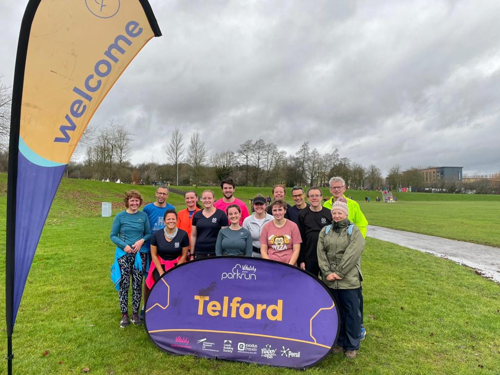
Saturday began with most of us heading to the nearby Telford parkrun. Fortunately, fairly heavy rain as we drove into town began to ease by around 8:45am and had fully stopped by the time the race briefing was underway, so we avoided a soaking! The course was comprised of two laps, one short and one long, mostly on tarmac, with a significant downhill to start and, of course, a significant uphill back up to the finish. I was first finisher from our group (as usual), but Tim’s run, around 90 seconds slower than mine, achieved by far the highest age grade, just over 70%. I strolled back down to the bottom of the hill to run back up with Heather D offering ‘encouragement’. She and several others ran good times. Afterwards, we got coffee and cakes at Costa before returning to the hostel.
Team photo after parkrun: Jane, Tim, Heather H, Hayley, Ashleigh, Jake, Meg, Heather D, Becky, Helen, Jeff, me, Will and Janine.
For the afternoon, I led some of the group on a walk up The Wrekin, while the others went for a sightseeing stroll by the bridge and river. We took the main path up from the east, enjoying clear views in all directions in the sunny spells. It was dramatic to see the flooded River Severn below, with the main Shropshire hills beyond. We continued along the ridge to descend to the lane to the west, then took lower-level tracks around the south side of the hill back to the cars.
Setting off from the summit of The WrekinDescending the steep west ridge
We were back at the hostel by teatime to shower and change before a big effort to prepare the group dinner under Helen’s leadership. After the meal, the evening continued with drinks and games in the lounge until late.
Sunday started with a full cooked breakfast together, after which we cleaned up and packed away all our stuff into the cars to check out by 10am. A few headed home or to other commitments, while most of us returned to the Ironbridge riverside for a stroll and/or coffee at a café. After that, we headed to the Exotic Zoo, close to where parkrun had been held in the Town Park, to potter around looking at the animals before another café stop for lunch before the drive home.
The Iron Bridge
In summary, a well-attended and very enjoyable social / team-building weekend away for the band before our main preparations begin for the Midlands Championships at the end of February. Perhaps, if the Butlins contest doesn’t resume, we’ll do something similar again next year.
There are a few photos here, and a map of our route up The Wrekin here. Telford parkrun results are here!
For this year’s New Year trip to the Highlands, we had booked an Airbnb cottage in Kinlochleven, which would give us good access to the Mamores and the Glen Coe hills. In order that he and Ruth could take their bikes, and to have plenty of room for luggage and provisions in general, Josh drove us up in his van this year. The drive went well, without major delay, pausing for a supermarket shop and lunch at Morrison’s in Dumbarton. The roadsides were pretty snowy through the Highlands, but the road itself was clear.
Lots of snow at the top of Glen Coe
The cottage was attractively located right at the top of the village, giving views down the loch with the Corbetts of Garbh Bheinn and Mam na Gualainn either side. Soon we had unpacked the shopping, settled into our rooms and prepared dinner for the night. We had read reviews saying the cottage was chilly in winter, but the electric heating actually proved more than capable of keeping the place cosy, with or without the assistance of the woodburning stove.
Wednesday seemed to have the best forecast of the first three days, so we elected to get out at dawn for a walk in the Mamores, fairly similar to one I’d done three years previously when Ruth and I were staying in Glencoe village, but in the opposite direction and following different ridges up and down. We started alongside the Grey Mare’s Tail waterfall before gaining the grassy south ridge of Na Gruagaichean, earning ever-improving views over Loch Leven and towards Am Bodach as we climbed.
Loch Leven
At about 900m, we decided the snow was hard enough for crampons to be worthwhile – the long-awaited first use for Josh’s pair that had been carried in vain on numerous previous outings! We were in and out of the mist on the final approach to the summit, but had views enough of the time to get a good impression of the dramatic surroundings.
The ridge to Na Gruagaichean
A fairly steep descent and reascent led us to the NW Top of Na Gruagaichean, perhaps a better viewpoint than the main summit. Then it was much easier walking along the broader, gentler ridge to Stob Coire a’ Chairn, with great views of An Gearanach close-by, and the Nevis range in the distance.
Na Gruagaichean NW Top, and Aonach Beag across the glenAm Bodach, Sgurr a’ Mhaim and Ben Nevis, from Na Gruagaichean NW TopBen Nevis and Carn Mor Dearg, from Stob Coire a’ Chairn
The traverse to Am Bodach was narrower and steeper again, and very enjoyable in the snow. The clouds dropped a bit as we made the final ascent to deprive us of a summit view though. We descended by the SE ridge towards Sgurr an Fhuarain, but dropped off southwest well before that minor top to follow a snowy gully down into the valley – much more pleasant than the rough heather either side. We ran out of snow at around 500m, so took our crampons off there before continuing down to meet the West Highland Way which led us back to Kinlochleven.
Am Bodach
The cloud was lower on Thursday, and a few showers were forecast, but it seemed better than Friday at least. We chose to head to a Graham, Druim na Sgriodain, on the far side of the Corran Ferry. Foot passengers go free, so we parked at the east side of the ferry, which drops you right where you need to be for this hill anyway.
The first couple of kilometres were north along the lochside road as far as the burial ground at Cille Mhaodain. From there, it was a steep ascent up fairly easy grassy terrain to gain the ridge of Sgurr na h-Eanchainne. This offered good views into Ardgour and back down to Loch Linnhe.
Looking into ArdgourLoch Linnhe
The peak had been clear as we ascended, but was in cloud by the time we got there, so we didn’t linger long before continuing west and southwest on compass bearings past various lochans to reach the Graham summit, 4 metres higher than the more shapely Sgurr.
Ruth and Josh by a frozen lochan on Druim na Sgriodain
Descending the ridge to Meall Breac, we soon dropped back into the clear. A slightly awkward descent down a steep grassy gully brought us safely between the crags into the bottom of Coire Dubh, from where a small path led more easily down beside the waterfall of Maclean’s Towel to a transmitter mast. The sun was coming out, giving attractive views over the loch and towards Beinn a’ Bheithir. Easy tracks led the rest of the way back to the ferry.
Sunset over Loch Linnhe, from beside Maclean’s Towel
On Friday, more persistent rain was forecast. Ruth and Josh were tired and opted for a cycle ride around Loch Leven, while I headed up the nearby Corbett, Garbh Bheinn. On my previous visit, I had taken the standard route up the west ridge, so this time the east ridge would give some variety. The rain was light but persistent as I set off up the hydro tracks into Coire Mhorair, so I soon paused to put on full waterproofs.
Coire Mhorair
Once I’d reached the small reservoir at 160m, I turned more steeply up the grassy slopes to the west, and made steady but tiring progress up through increasingly-deep snow to the East Top. The Mamores to the north were mostly in cloud, but the Aonach Eagach to the south stayed clear, providing dramatic views to my left. After a short pause for a snack and to put on an extra layer, I continued up the broad, snowy ridge to the Corbett summit, which gave closer views of the craggiest parts of the Aonach Eagach, and also down the loch to the Pap of Glencoe.
Pap of Glencoe and Mam na GualainnLooking towards the MamoresSnowy Aonach Eagach
I returned to Kinlochleven by the same route, the light rain never really stopping or getting heavy enough to give me a soaking, and my footprints (the only ones) making the navigation quick and straightforward! On reaching the cottage, I was surprised to find Ruth and Josh just setting out for a stroll up to a nearby waterfall, having abandoned their cycling plan due to the rain being too heavy. Clearly it had been worse in the valley than on the hill!
Saturday, New Year’s Eve, had the best weather forecast of the trip, with light winds and high cloud predicted. But we were pleasantly surprised when we got up to see that the skies were in fact cloudless! This confirmed our intention to have a go at a circuit of Bidean nam Bian, one of the more challenging peaks in Glen Coe. It was about half an hour’s drive to the start point at the Three Sisters viewpoint, where we set off a bit before sunrise but in good light. The path down to the river and up the other side into Coire Gabhail – the ‘Lost Valley’ – was mostly dry and unexpectedly ice-free, making for easy progress.
Ascending into Coire Gabhail, with views across Glen Coe
Once we’d escaped the narrow gorge, it didn’t take long to cross the flat, rocky bed of the hanging valley above and reach the snowline. After a short detour up the wrong side of the river to realise we were separated from the path by an uncrossable gully, we retraced our steps a short distance to get back on track and continue up through ever-deepening and steepening snow. The crust at lower levels was mostly firm enough to take my weight and Ruth’s, but not so often Josh’s!
Coire Gabhail, the ‘Lost Valley’
There were clearly no rocky obstacles on the route up the snow all the way to the bealach at the head of the corrie, but we could not really tell whether there was a significant cornice to cross there. I led the way, breaking the trail and kicking steps where needed! Ruth put crampons on part-way up, and Josh and I followed suit a bit later. The final section was as steep as I’m comfortable ascending without a rope, but the snow was pleasantly solid and it never felt like the foot or ice-axe placements might give way. The final metre or so turned out to be a softer cornice, but not quite vertical, and solid enough to climb over the top rather than having to cut a route through. It had been tiring work though, and I was relieved to reach the easy flat ground above, particularly when the views in all directions were such a magnificent reward! I took a few photographs and offered what advice I could as Josh and then Ruth followed me up.
Ruth and Josh, high in Coire GabhailJosh checking on Ruth’s progressRuth approaching the final cornice
Once we’d all gathered our breath and had some refreshments, we continued the walk up the easy (but very snowy) ridge to the first Munro, Stob Coire Sgreamhach. This was a super viewpoint over the two Buachailles to the east, and back over the bealach to Sgurr na h-Ulaidh and Bidean nam Bian itself.
Coire Gabhail, from Stob Coire SgreamhachThe view of Sgurr na h-Ulaidh and Bidean nam BianRuth and Josh on Stob Coire Sgreamhach, with the Buachailles in the background
We returned to the bealach then ascended easily the other side to reach the main summit of Bidean, revealing more incredible views over Stob Coire nam Beith to the west. We were amazed that nobody else had come up that day, our footprints being the only blemish in the deep, pristine snow.
Heading for Bidean, with views of Sgurr na h-UlaidhLooking back to Stob Coire SgreamhachApproaching Bidean nam Bian
The ridge onward to Stob Coire nan Lochan had the deepest snow yet, a little softer where it had accumulated on the north side of the hill, but didn’t provide any real obstacles to progress. Soon we were at that final Top, where we met a climber who had just come up by one of the easier gullies on the north side. It turned out there were quite a few climbers there, although none had made the continuation to Bidean.
Stob Coire nan LochanMe, Ruth and Josh on Stob Coire nan Lochan, looking back to Bidean
It did mean we had plenty of tracks to follow for a quick descent down into Coire nan Lochan to gain the path back down into Glen Coe. An enjoyable end to perhaps the best winter day I’ve had in the Highlands. In the evening, we enjoyed Toad in the Hole and Sticky Toffee Pudding for our Hogmanay dinner, but were tired from a bit day and decided not to stay up to see in the new year.
Stob Coire nam Beith, as we descended
On New Year’s Day, it looked like the best of the weather would be on the coast, so we picked the two Munros of Beinn a’ Bheithir as our objective. We started in Ballachulish and set off south up Gleann an Fhiodh. Light rain fell to start with, but soon petered out to nothing, and it stayed dry from then on. A well walked path leads up onto the ‘Schoolhouse Ridge’, the NE ridge of Sgorr Bhan.
Loch Leven below
We gained height steadily in just a thin covering of fairly grippy snow, and after a while reached the scrambly section. The crux step proved to be quite a major obstacle in winter conditions! Josh clambered up with some difficulty in his boots, and recommended that Ruth and I put our crampons on before attempting to follow. Ruth’s regular climbing experience helped her get up too, but I was less confident, chickened out and took an easier line by grassy ledges around the south side instead. From there on, the route was more straightforward, the rocky steps having a better covering of snow on the ledges which thus felt a lot more secure under the crampons!
Ruth on Schoolhouse Ridge
We had entered the cloud part way up, and didn’t get any unrestricted views as we continued along the ridge, slightly down and back up to the first Munro, Sgorr Dhearg, then more significantly down and back up to the second, Sgorr Dhonuill.
Approaching the summit of Sgorr Dhonuill
There we met two men whose footsteps we had been following since the summit of Sgorr Bhan, and chatted briefly before they continued. We had lunch on the summit, then returned to the bealach and descended easy snow slopes to the north into the corrie. Ruth found a small, well-built path that avoided the boggy ground and felled forestry on the book route. Then the final few kilometres were an easy march, gently downhill on forest tracks back to the village.
On Tuesday, we sadly had to head home. It was a sunny morning, so we had lots of awesome views to enjoy as we drove back up Glen Coe and over Rannoch Moor to Crianlarich and along Loch Lomond. Conditions got steadily less snowy as we continued south through the Southern Uplands, and there was barely any snow in sight in the English hills of the North Pennines and Lake District. The final drive home from Ruth’s house to Derby wasn’t a good one, with significant bank holiday traffic clogging the M6, but I made it eventually and without incident, with a few hours spare to get the laundry and unpacking sorted before bed and the return to work.
In summary, five excellent, contrasting days on the hill. I revisited seven Munros and a Corbett, and bagged one new Graham. Very atypically of recent New Year trips, the wind was never strong and the rain never heavy! The crampons and ice axe saw more use than they have for years, with quality winter days on the Mamores and Beinn a’ Bheithir, and of course the undoubted highlight of that perfect New Year’s Eve walk up Bidean.
With Mum and Dad having moved temporarily to rented accommodation in North Yorkshire, there was no need for Ruth and me to head south for a family Christmas. Instead, Ruth volunteered to host us in Natland, which would be a much more convenient starting point for our subsequent trip north for New Year! I had booked the Friday off work so drove up on the evening of Thursday 22nd. This was the first motorway cruise for my new car, which proved to be very smooth, quiet and comfortable. Having switched from diesel to petrol, I was relatively happy with the average of 54mpg.
Friday offered a dry, overcast morning with rain coming in from lunchtime. Ruth and I took a stroll in Kendal, along the river and up to the Castle, before Mum and Dad arrived for lunch. We didn’t venture out again in the afternoon, owing to the poor weather.
Ruth in Kendal
On Christmas Eve, we were up fairly early for another visit to Morecambe Prom parkrun. I drove the five of us down and we were able to park for free on the seafront this time. Ruth, Josh and Dad also joined in the run, while Mum sought out a newsagent then cheered us over the line. I found it disappointingly hard work in fairly favourable conditions, and was about 40 seconds slower than on our previous visit a couple of months before. We returned to Natland for a late second-breakfast, after which Ruth and Josh headed off for an afternoon and evening with Josh’s family. Mum, Dad and I took an afternoon stroll up onto the nearby hill, The Helm, and found many others also enjoying the bright day and views over Kendal and the surrounding countryside.
Dad and Mum ascending The Helm
Christmas Day was wetter, but I decided I would take a trip to Ford parkrun, in Ulverston, anyway. This was the first time I’ve found myself within sensible driving distance of a Christmas Day parkrun, so not to be missed! Dad and Mum came along to support and for another ride in the car, while Ruth and Josh stayed home to start the Christmas dinner preparations. We drove through a couple of heavy showers, but the rain was easing by the time we had parked up, and actually held off for the duration of the run, save a few spots after about 15 minutes. The course was quite a tough one, with three-and-a-half laps of the small park, on a mixture of tarmac, gravel, grass and wood chippings. Each lap featured two hills, adding up to a total of almost 80m ascent. Hoad Hill towered attractively above, with its monument. With a challenging course, tired legs and a sore knee, it took me over 22 minutes to complete the run – one of my slowest parkruns ever – but I was still glad to have turned out.
Christmas Day at Ford parkrun
We returned to Natland straight afterwards for brunch and a more conventional remainder of our family Christmas Day, with a delicious roast turkey dinner prepared by Josh (with Ruth’s assistance). More rain prevented us from venturing outside again.
Boxing Day brought fairer weather. We took a drive into the Lake District for an easy hill walk up Loughrigg Fell. Having parked by Rydal Hall, we started by heading alongside the river and Rydal Water, enjoying the views over the lake and up to Nab Scar.
Mum, Ruth, Josh and Dad by Rydal Water
Then we followed Loughrigg Terrace across the lower slopes of the fell, the higher ground giving excellent views over Grasmere towards Helm Crag, Dunmail Raise and Seat Sandal.
Looking over Grasmere from Loughrigg Terrace
A steep climb up a pitched path led us directly to the summit of Loughrigg Fell, where there were more good views, west to the Langdale Pikes and southwest towards Wetherlam. We followed some of the many small paths along the ridge and down beside a stream – rather boggy! – back to Rydal, then returned to Ruth’s for lunch and a leisurely afternoon. Route map: https://www.plotaroute.com/route/2114032
Looking over Elter Water to Wetherlam and Lingmoor FellDescending, with views of Low Pike and Red Screes
On the 27th, Ruth, Josh and I said our goodbyes to Mum and Dad, and set off north for our next adventure. More about that in the next post!
I haven’t got out walking at all in December, my weekends mainly being busy with brass band carolling and concerts, so I was looking forward to today’s Gentian meet in the Peak District. There have been lots of crisp, cold, sunny days recently, but sadly today was not such a day, with gloomy grey skies.
I set off from home around 7:45am, enjoying the drive up the Derwent Valley in my new car on its first major outing, and met the others at 9:15 at Fairholmes. Petra and Jane were new acquaintances for me, the others familiar from previous trips. The roads and paths around the visitor centre were pretty icy after the extended cold spell, so we hoped that it would be less compacted on the hill paths.
Soon we were under way, the seven of us heading up beside Locker Brook to the eponymous outdoor centre on the ridge above. The path through the woods wasn’t too bad, but the track along the ridge was mostly very icy. However, it was generally possible to get by on the softer snow on the verges, so I got away without putting my crampons on. At this point, Steve and Martin decided to head back down while the rest of us continued on the planned route.
Approaching Lockerbrook Farm
The open moorland of Rowlee Pasture made for easier walking, the icy slabs of the path easily avoided on the snowy grass beside, and the bogs well frozen. Although the light and visibility were not good, we enjoyed views over the Woodlands Valley and Alport Dale. Before long we were looking over the landslip, cliffs and boulders of Alport Castles, looking impressive with a dusting of snow.
Jane, Richard, Simon and Petra above Alport CastlesLooking over The Tower
From there, we dropped down into Alport Dale, where we paused for an early lunch as it was a lot less windy than on the ridge. Then we continued down the track – icy again – to Alport Bridge and took a short loop of bridleway the other side of the River Ashop before ascending back up to Lockerbrook via Rowlee Farm, a path I don’t think I had used before. As the afternoon was getting increasingly drizzly, we opted to descend directly to Fairholmes rather than take the planned detour to Crook Hill, which was just about in the mist by that point anyway.
Alport DaleThe icy track near Bellhag Barn
The road and car parks had thawed out quite a bit over the day, so the drive back to the gritted roads was less slippery than the approach had been in the morning. We paused for a drink in the Yorkshire Bridge Inn before heading to our respective homes.
Despite the murky weather, an enjoyable day out in good company, and I was happy to have got some snow under the boots before the big thaw comes tomorrow. Hopefully there will be more to enjoy in the Highlands in 10 days’ time! A map of our route can be seen here, and more of my photos here.
I have lots of Christmas carolling with the brass band over the coming weekends, so was keen to take advantage of an empty diary today and get out in the Peaks, despite the rather grey and murky conditions. Inspired by some Instagram photos I’d seen quite recently of Combs Edge, a place I’d only visited once, I got an early start and headed back to Buxton to start my walk around 8:30am. My first destination was Corbar Hill, which lies just north of the town, which is an Ethel I hadn’t visited before. A short ascent through the woods brought me to the summit crags, trig point and Alpine-style cross!
Burbage Edge, from Corbar Hill
Well-trodden but fairly boggy paths led from there up onto Combs Moss – I had chosen poorly by wearing my lightest boots and soon had wet feet. I continued north along the zigzagging Edge, pausing to photograph the rocks here and there and to enjoy the views of Burbage Edge to the south and Combs Reservoir below.
Combs EdgeLooking down from Combs EdgeCombs Edge, and Combs Reservoir below
After I’d reached the lane at the northern end of the moor, I followed fairly muddy footpaths via Sittinglow and Barmoor Farms to Sparrowpit – nothing very remarkable although there were some hazy views of Chinley Churn and South Head to enjoy. Next, the path traversing south of Gautries Hill gave more interest, following a wooded rake with lots of pits and gullies, evidence of mining.
Chinley Churn, Mount Famine and South Head in the distanceMining gullies near Gautries Hill
Once I’d crossed Perry Dale, I was pleased to spot a brand new concession path signposted as a route onto Eldon Hill from the west. Just what I needed, as I had thought I would have to follow the lane all the way around the north side of the quarry to double back from the northeast. Soon I was on the top, with a glimpse of Mam Tor in the view. Eldon Hill was another new Ethel for me, and also re-completed my Derbyshire Tumps (it had been identified as a Tump since I last completed that still-evolving list).
The new signposts had also noted the 55-metre-deep pothole of Eldon Hole, a few hundred metres to the south, so I took a look at that on my way down to Peak Forest. It was difficult to photograph but definitely an impressive sight, reminiscent of the Yorkshire Dales! It doesn’t seem like many people pass that way.
Looking over Eldon Hole to Peak Forest
Looking into Eldon Hole
My route then headed down Dam Dale, where I paused for a late lunch, and Hay Dale, then climbed back up very muddy footpaths to Hargatewall and Tunstead. That just left the final approach to Buxton, a fairly straight footpath on the map but apparently crossing the huge Tunstead Quarry so I was dubious! However, sure enough the path was well marked and fairly well used, using a long footbridge to get over the quarry access railway and roads, then skirting the northern edge of the pit to reach the undisturbed ground on the far side.
Almost sunny in Dam DaleTunstead Works, from the footbridge
I got back to the car around 3:30pm, seven hours after I’d started and comfortably before dark. A good long day out including gritstone moorland, muddy farmland, and classic limestone hills and dales. I now only have four Ethels left to bag, all in the far north of the National Park, so quite far from home. An easy goal for next year though!
A map of my route can be seen here, and more photos here.
A local weekend this week, but a well-filled one! Saturday morning started with a volunteering session at Rosliston parkrun. This was my 25th time volunteering, earning me a T-shirt, so I marked the occasion by picking my favourite role, timekeeping. I arrived quite early so had time for a peaceful stroll around the forest before the run started.
Morning reflections before parkrun
After parkrun, I headed up to the White Peak for an afternoon stroll, taking advantage of the fair weather after lots of rain recently. I parked by the church in Elton. My first objective was one of the eight hills on the ‘Ethel’ list that I hadn’t bagged prior to that list’s creation, Harthill Moor. I would dispute whether the designated location is really the summit of a hill at all, as it has minimal prominence and there are several higher points further up the broad ridge, but it does have the distinction of a trig point. The “summit” offered decent views to the north and west.
The disused quarry on Anthony Hill
From there, I descended northwest into the head of Bradford Dale, and followed the valley downstream as far as Youlgreave, pausing for a late lunch on one of the benches.
Bradford Dale
I then followed the Limestone Way up to Robin Hood’s Stride, always a worthwhile objective with its distinctive rocky tor. That just left a short walk down past Dudwood Farm and back up to Elton.
Autumn colours near Harthill Moor FarmRobin Hood’s Stride
On Sunday was the third of this year’s series of four Peak Raid 3 events (I had missed the second for the last Gentian trip, but can still quality for a series result as they take the best three results). The venue this time was the Goyt Valley, to the west of Buxton, with registration at Errwood Sailing Club. Ruth had decided to come down from Kendal to take part too, so we met in the large car park on the west side of the reservoir dam, and walked over to the start together. Although they had been forecasting rain or showers all week, it actually turned out to be a fairly sunny morning, the heavy rain having fully passed overnight.
Pre-race sunshine over Errwood Reservoir
The race went fairly well. I opted for a clockwise route, taking in 15 of the 19 controls and earning 500 out of a maximum 600 points. With hindsight, I did not visit the controls in the middle part of my route in the most efficient order, and could have saved nearly 1km and 90m ascent, perhaps saving enough time to visit an extra control within the three hours. I was happy with the start and end of my route though, and enjoyed the strenuous running through varied terrain and scenery. I finished with just 6 seconds to spare – judged to perfection! By chance, I had also passed over the summit of another of my missing Ethels, Foxlow Edge.
My chosen route
Ruth had also had a good run – a slower pace than mine but she had partly compensated for that by spotting that more efficient route. After we’d recovered and enjoyed the usual post-race coffee and flapjack in the clubroom, we returned to the cars, got changed, and then headed into Buxton for a café lunch and more discussion of our routes before we set off back to our respective homes.
This weekend was the Annual Dinner meet of the Gentian Mountaineering and Hill Walking Club, the first such occasion since I joined the club, held this year in the Brecon Beacons. Our accommodation was the well-equipped and comfortable Star Bunkhouse in Bwlch. I got a prompt finish from work, paused briefly at home to pack the car, and had a surprisingly good journey down the M42 and M5, with no more than half an hour of delays despite travelling in the height of the Friday rush hour. After stopping for dinner at Strensham services, it was only another hour or so to go, and I arrived at around 7:30pm. A few had gone to the pub across the road but most of us spent the evening chatting over drinks in the bunkhouse. It was good to meet a few more of the regular members whose paths I hadn’t crossed on other trips this year.
Saturday began with the standard group breakfast of porridge, toast and cereal. The forecast was for quite a wet and windy day. I offered to lead a walk starting a few miles down the road in Crickhowell, up onto the hills to the north, and six of the group elected to join me. We ascended via the Beacons Way up the unexpectedly pretty Cwm Cumbeth, with lovely autumn colours and an attractive stream cascading down. Once above the intake wall at around 400m, we traversed around to the hill fort at Table Mountain, known in Welsh as Crug Hywel – presumably the town below was named after the fort. The defensive earthworks are still clearly visible, and the hill gave good views both ways along the Usk valley as well as towards the Sugar Loaf and Crug Mawr.
Looking back over CrickhowellCwm CumbethLooking towards the Sugar Loaf, from Crug Hywel fort
We continued north up the ridge to Pen Cerrig-calch, which I had previously climbed from the east, and entered the cloud at around 500m. The paths were clear though, so navigation was straightforward up to the trig point, and onward along the ridge to Pen Allt-mawr, where the trig point is lying on its side. Some showers blew through, but the rain was never very intense and the wind was not severe either. We had lunch in the shelter of the cairn before heading back south along the ridge, but this time keeping to the paths on the west side. After a few hundred metres, we passed Mick’s group going the other way. Soon we were on the rocky outcrops of Pen Gloch-y-pibwr, from where we had fleeting views down into the valley as the clouds parted.
We descended by the southwest ridge, mostly pathless, and initially over very slippery limestone, but later on short grass and heather. On the crags at Bryniog, we dropped back out of the mist and had views into the valley again. The rest of the descent to the Beacons Way was rougher, but we found a relatively painless route through the bracken. The path then traversed across Cwm-gu and over the next spur to drop back into Crickhowell. It had been a surprisingly pleasant day, considering the poor forecast, and a good scenic walk. Route map: https://www.plotaroute.com/route/2080105
The linestone crags of BryniogBack on the Beacons Way
We were back at the bunkhouse soon after 3pm, leaving plenty of time to shower, rehydrate with a few cups of tea, and then get changed into smarter clothes for dinner. We gathered in the hut dining room for prosecco from 5pm, and were then picked up by our coach at 6pm to head back into Crickhowell, where our dinner venue was the Bear Hotel, an attractive 18th century coaching inn. The hotel served a tasty meal, which we enjoyed over good conversation. Afterwards, our special guest Alan Bowring, a geologist at the Brecon Beacons National Park and Geopark, gave us a very interesting and engaging presentation on the geological history of the region – a complex mixture of different sedimentary rocks laid down as what is now the Beacons drifted from 60 degrees south of the equator to where it now lies, 52 degrees north! The coach came to return us to Bwlch at 11pm and, like most others, I didn’t hang around long before getting to bed.
The Bear Hotel, Crickhowell
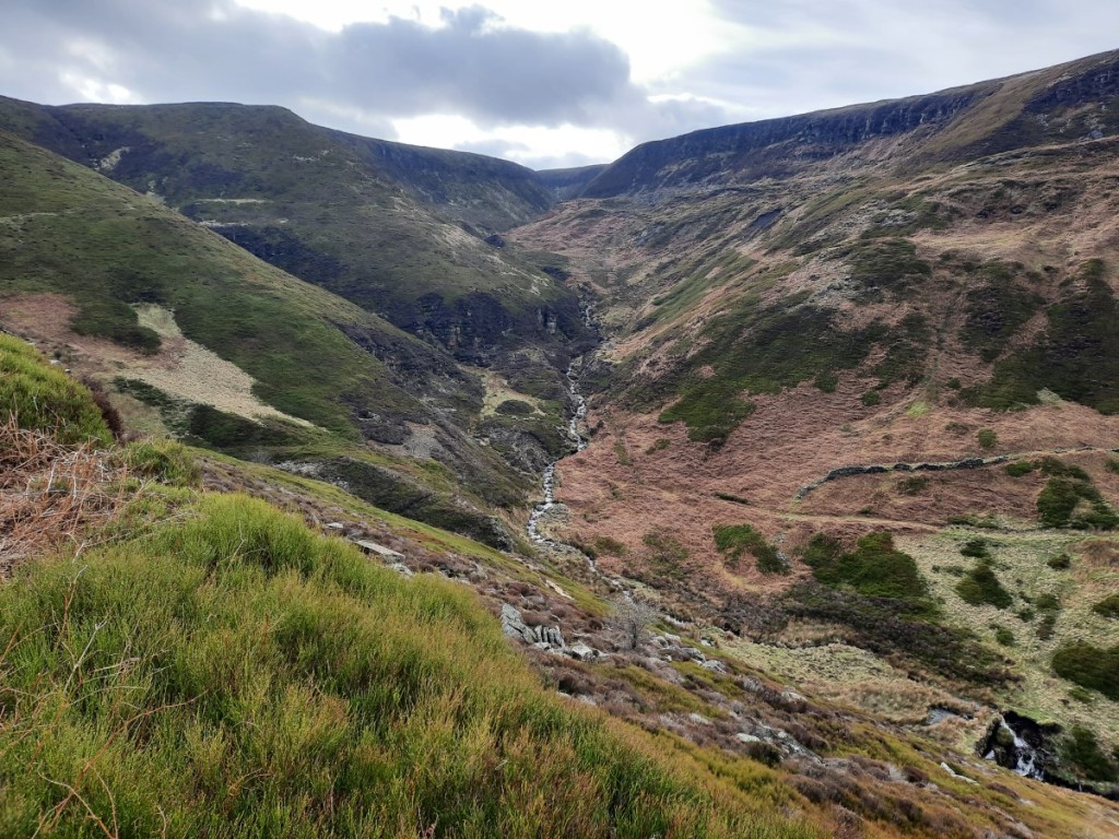
Sunday started dry, and the forecast showed heavy showers. Feeling optimistic, I planned a longer walk from Talybont Reservoir up onto Allt Lwyd then around the horseshoe via Pant y Creigiau. Simon and Sheena opted to join me again. The first rain arrived just as were finishing putting our boots on, but we set off undaunted. A reasonable, grassy path led us up to the southwest onto the ridge of Allt Lwyd – a route I had not taken before – with good views initially back down to the lake and Tor y Foel. I was surprised to find that, higher up, the path was in the process of being surfaced with shale and sandstone. As the rain intensified, we soon entered the mist, but the many bags of helicopter-dropped materials marked the way!
Looking back over Talybont Reservoir to Tor y FoelSheena and Simon in the rain
Beyond the summit, we continued along the well-defined ridge northwest, wishing that the views either side were visible to us. By the time we’d reached the large cairn at the eastern end of Waun Rydd, we were pretty damp and, 90 minutes in, the rain was showing no sign of abating, so we made the decision to take the shorter, direct route down via Twyn Du. Typically, half an hour later it was brightening up a lot, and the cloud had cleared the tops, and we wished we had pushed on a little longer into the rain! Anyway, we got some good views over the Usk valley towards the Black Mountains, and again across the reservoir to Tor y Foel, and the autumn colours were beautiful. Route map: https://www.plotaroute.com/route/2080784
Views towards the Black Mountains on the descentAutumn leaves and berries
We had our lunch in the dry on a picnic table near the reservoir shore, then changed out of our damp waterproofs and headed home. My drive went smoothly, taking 2h40 without needing a break. Overall, despite the persistently damp and grey weather, a very enjoyable weekend, sharing good company both on the hill and at the dinner. A fitting end to my first year in the Gentian club. There was talk of perhaps making the 50th Anniversary Dinner (in 2024) a black tie event, which would be more akin to the CUHWC Annual Dinners of student days! Let’s see what the future brings.
My parents are in the process of moving from Somerset to South Cumbria, and are currently renting in Bentham, near the border of North Yorkshire and Lancashire, while they house hunt! I visited them for the weekend to catch up and see their rented house. With major delays due to accidents on both the M6 and M1 on Friday afternoon, I knew it was going to be a slow drive north after work. I left at 3pm and plumped for the M1 option. It may or may not have been the best choice, but it was certainly slow, taking around 4 hours to reach my destination. It was good to be there in time for a late dinner and evening chat though.
With rain forecast for most of Saturday, it wasn’t going to be a proper walking day, so we decided we might as well start the day with a parkrun. The nearest one I hadn’t done before was Morecambe Prom. Dad and I ran – there and back along the promenade – while mum spectated. I was glad that my knee, which has been sore lately, didn’t twinge significantly or hamper my running, and was therefore fairly happy with my time of 20:06.
We returned to Bentham for morning coffee and a leisurely lunch. By mid afternoon, it was brightening up, so we headed out for a short walk from home, up the lane and a short distance across the moor to a local landmark, the ‘Big Stone’, or more formally the Great Stone of Fourstones. This is a glacial erratic, and certainly seems out of place on the edge of the moors of the Forest of Bowland. It is not known what became of the other three stones! We had salmon for dinner and a standard evening in front of the television.
The view from atop the Bentham ‘Big Stone’Dad and Mum by the Big Stone
Sunday’s forecast was a bit more promising – still grey, but dry for the morning at least. We therefore chose to use our extra hour (with the clocks going back) not for a lie-in but to give more dry walking hours, and were underway in nearby Clapham before 9am. We started by followed the bridleway above the forest to Clapdale Farm, then dropped down into the valley near Ingleborough Cave. From there, it was only a short distance up to the impressive gorge of Trow Gill – very different from my one previous visit in snow!
Heading up Trow Gill
Once we’d clambered up to the top, it was easier walking across the moor to Gaping Gill, where the river plunges underground (to later emerge at Ingleborough Cave). A dramatic spot, although the river was not flowing as strongly as I’d expected.
Gaping GillDad and Mum above Gaping Gill
We returned by the paths over Clapham Bottoms and then track down the east side of Clapdale. A few spots of rain fell as we neared the village, but weren’t sufficient to merit waterproofs, and the proper rain held off just long enough for us to have lunch outdoors on a picnic bench before the return to Bentham.
On the track below Thwaite
We had a leisurely afternoon at home. Ruth and Josh came around to join us for roast dinner, after which I returned to Derby, thankfully not meeting any delays on the M6 route and getting home in a much more civilised 2h15!
There are a more photos here, and maps of our walking routes here (to the Big Stone) and here (to Gaping Gill).
The plan for today had been to precede the Gentian day walk in the central Peak District with a visit to Monsal Trail parkrun. However, with a sore knee that seems to be exacerbated by even slow running, I surprisingly took the sensible option and skipped the parkrun, heading directly to Sir William Hill to meet the nine others at 9:45am. Steve had planned a ten-mile route via Bretton Clough, Abney Moor and Abney Clough.
We had clear blue skies overhead, and excellent visibility, as we began by ascending the short distance to the summit of Sir William Hill, and then descending north into Bretton Clough. The autumn colours in the bracken and trees were particularly fine in the sunshine.
Descending towards Bretton CloughAutumn colours in Bretton Clough
We continued up the valley a short way then climbed back up to Bretton, where we paused for a snack near the Barrel Inn pub, apparently the highest in Derbyshire. Turns out the Cat & Fiddle Inn is a few metres into Cheshire! We continued west along the lane – currently closed to vehicle traffic due to subsidence – towards Great Hucklow, enjoying the views over the dry-stone-walled White Peak pastures to the south.
Classic White Peak scenery
From Hucklow Edge, footpaths led us north across the fields and then over Abney Moor to Robin Hood’s Cross, where we paused for our main lunch break. Then we continued down to Abney village and down Abney Clough to reach Stoke Ford and, for a kilometre or so, retrace our morning route back up towards Sir William Hill. This time, however, we bypassed the summit and took the traversing path over the moor directly back to the cars.
Abney MoorLooking back towards Abney Clough
Some of the group headed to the pub in Eyam. I was in two minds but set off following the directions given. However, after a couple of passes through the village I hadn’t seen anywhere matching the description, and just headed straight home instead. That allowed me to get the lawn mown before dark anyway, ahead of tomorrow’s rain!
There are a few more photos on Google Photos here, and a map of our route here.
As has become my routine, I spent a solo autumn week in the Highlands. As I was coming from Snowdonia at the end of Gentian meet, I didn’t really fancy driving too far north, and settled for an extended stay at SYHA Crianlarich. This gave plenty of options for bagging new Grahams or returning to interesting Munros, according to weather and preference.
Having stayed at Ruth’s house on the Sunday night, it was only about a three-hour drive up on Monday morning. I parked in Glen Douglas to tackle the pair of Grahams on the north side, Tullich Hill and Beinn Bhreac. I had driven through a heavy shower minutes earlier on the shore of Loch Lomond, but started the walk in bright sunshine! Very long and tussocky grass made for hard going on the first ascent, so I was glad when the gradient finally eased near the summit. It was interesting to look back over the glen and see the 56 grass-rooved magazines of the ‘Defence Munitions’ facility, not shown on the OS Map! The reward at the summit was a good view over Loch Long to the Arrochar Alps.
Doune Hill and Loch Long, and the munitions magazines in the valleyThe Arrochar Alps, from Tullich Hill
Thankfully the grass on the descent to An t-Sreang and reascent to Ben Reoch was shorter. A few drops of rain fell as I ascended, but the worst of the shower missed me and blew down Glen Douglas. I had lunch in the shelter of the summit rocks, with a view over Loch Lomond, then continued along the gentle ridge to Beinn Bhreac, which had some interesting crags – probably a landslip – near the top. That just left an easy descent on an ATV track down the grass to Invergroin. Then it was only a short drive to Crianlarich, where I checked into the hostel before picking up provisions at the village shop. Route map: https://www.plotaroute.com/route/2059159
Ben Lomond and Loch Lomond
Tuesday was forecast to be a more showery day with persistent cloud at around 700m, so I opted for Graham-bagging again, hoping to stay mostly low enough to have a view. I drove up to Tyndrum then west down Glen Lochy to Corryghoil, where I found plenty of parking space at the start of the track into Succoth Lodge, as well as signs for hydro and electrical works up the valley. I hoped that these would not disrupt my plans.
Although my walk started in the dry, I had had to don my full waterproofs within a few minutes as a heavy shower passed – a repeat pattern for the day. The mixed woodlands around the Eas a’ Ghaill were attractive with the early autumn colours, with easy walking on the tracks to Succoth Lodge, then very boggy walking on the traversing track south. Eventually it became indistinct and I lost it entirely, and was glad shortly afterwards to pop out onto the firebreak that would lead up towards my first objective, Meall nan Gabhar. It turned out that a large new track had recently been built up this firebreak, for maintenance of the electricity pylons that run up it and over the moors above. This made for much quicker and dryer progress than expected! Many of the pylons had men working up them on ropes – clearly a major project given the number of personnel involved and the size of the access track.
Mixed woodland around Eas a’ Ghaill
Once I was past the main northern buttresses of Meall nan Gabhar, I struck up to the right to make my way steeply up to the ridge, a climb that was, as the guidebook had remarked, easier than it looked! A bit below the ridge, I was into the cloud, so I didn’t hang around for long as I passed over both tops and then Meall nan Tighean. Another shower passed over as I descended west towards the forest. This section unexpectedly gave the best views of the day, with Meall nan Gabhar looking quite impressive from among the trees, and also intermittent views towards Beinn na Sroine to the north, and Beinn Bhuidhe to the south.
Looking back to Meall nan Gabhar
It was helpful that I had checked the layout of the forest tracks in advance on plotaroute, as there were quite a few changes since my Landranger map was printed! Once out of the forest, the climb up to Beinn Bhalgairean was straightforward but pretty unmemorable, back in the mist, as was the easy walk out to the road along the forest tracks. Route map: https://www.plotaroute.com/route/2059797
Wednesday was forecast to start wet but clear to give a bright and calm afternoon, so I got a late start, around 10am, for my biggest walk of the week. My first objective was the Graham, Fiarach, above Dalrigh, where I parked. The walk up was damp but easy, along forest tracks beside the attractive rivers (in spate!) then ATV tracks up the hillside and various trods along the ridge. I was in and out of the mist, so didn’t get many distant views, but the summit itself featured an unusual protruding rock dyke, running several hundred metres across the moor.
The River Fillan, at Dalrigh
The going got increasingly boggy and tussocky as I continued south then northwest to the bealach with Beinn Dubhchraig, so it was actually a relief to reach the short grass of the steep 500m climb back up. A clearer spell had given me decent views as I ascended, but a heavy shower arrived just as I reached the Munro summit and obscured the views ahead. At this point, of course, I met the well-walked Munro-baggers’ path, which at least meant I didn’t have to think too hard about the navigation towards Ben Oss. By the time I was down at the bealach, the shower had passed and it was getting sunny. Beinn Dubhchraig, Loch Oss and Ben Oss looked particularly good, glistening after the rain! A couple passed me going the other way, returning from Ben Oss having bagged it and Beinn Dubhchraig, and we chatted briefly.
Loch OssBeinn Dubhchraig
Another brief shower brought a drop in the cloud-base as I started to descend from Ben Oss, and I needed to use the compass for a few minutes, but cleared out again a few minutes later. I enjoyed the views down Coire Laoigh, and towards the previous day’s first hill, Meall nan Gabhar, the other side. Ben Cruachan also came into view from the summit of Ben Lui, as did the Crianlarich Munros beyond Ben Oss.
Coire LaoighBeinn Bhuidhe and Meall nan Gabhar
I lingered for a while on the summit taking photos and enjoying the scene, then descended by the well-walked path down the northeast ridge and into Coire Gaothach, then down beside the burn to pick up the track all the way back through Cononish to Dalrigh, finishing around half an hour before dark. It had been a great decision to start late and persevere through the morning mist and heavy showers! Route map: https://www.plotaroute.com/route/2060686
Looking towards Ben Cruachan from the summit of Ben LuiLooking over Ben Oss to the Crianlarich Munros
The next day had the opposite forecast, with a dry morning then rain pushing in, so I started promptly for a walk up the nearby Munro, Beinn Challuim. I found a route on walkhighlands that seemed more attractive than the guidebook route, going up via Gleann a’ Chlachain and the northwest ridge. Starting at Auchtertyre, the first few kilometres were easy walking up the track through the glen, with some low cloud patches enhancing the view back into the valley and towards Fiariach (the previous day’s Graham). A very boggy crossing of the glen followed, up to the nearly-600m Bealach Ghlas-Leathaid, right at the head of Glen Lochay.
Fiarach, from Gleann a’ Chlachain
Soon after that, I entered the mist, which was broken here and there but never cleared the summit properly. Nevertheless, the ridge was an enjoyable one, with a few dramatic slabs to climb up/around and some sections of easy scrambling on the crest. With glimpses of blue sky above, but no horizontal view, I didn’t linger long on the summit, setting off down the standard route towards Kirkton and bearing right further down, away from the path, to return instead to Auchtertyre. By the time I’d driven back to Crianlarich, the rain had arrived – well timed! Route map: https://www.plotaroute.com/route/2061559
Cam Chreag from the slabs on the way up Beinn Challuim
Showery, windy weather was the theme of the rest of the trip! Friday seemed like it offered two relatively good weather windows, early and late, with a front passing over in the middle of the day. I bagged a Graham in each! The morning choice was Beinn Damhain, above Inveranan. The hydro track into Lairig Arnan made for an easy ascent to 350m or so, with the occasional shaft of sunshine breaking through in the east, but fairly persistent light rain falling. Then the burn up to Lochan Beinn Damhain, followed by the surprisingly rocky northeast ridge, made a pleasant onward route to the summit, just about clear of mist despite the rain. Ben Vorlich was intermittently clear in the view to the south. I returned to the car the same way. Route map: https://www.plotaroute.com/route/2062408
The rocky ridge to Beinn DamhainLooking over Lochan Beinn Damhain to Ben Vorlich
I kept an eye on the rainfall radar through the early afternoon and then set out around 3pm for my second walk, up Meall Odhar, west of Tyndrum. This time the lower slopes were climbed with the help of a zigzagging track through the old lead mines on Sron nan Colan. The views in all directions gradually improved as it got sunnier, and once on the ridge I could see Ben Oss and Ben Lui up the Cononish glen. The ridge to the summit gave pretty easy walking, with a path forming in a few sections – clearly this is one Graham that does get visited fairly regularly thanks to its convenient location. A little light rain unexpectedly returned as I descended the same way back to Tyndrum. Route map: https://www.plotaroute.com/route/2062410
Ben Oss and Ben LuiThe Crianlarich Munros
The dryest part of Saturday was the middle of the day. With conditions looking less bad further east, I chose to walk up another Graham, Creag Gharbh, south of Loch Tay. Starting just outside Killin, most of the ascent is very easy, on a tarmac hydro road up to Lochan Breaclaich, then a good gravel track to within half a kilometre and a 100m ascent of the summit.
Lochan Breaclaich
The views over the expansive, flat moors to the south and east were fairly unremarkable, so the highlight of the day was definitely the summit view along Loch Tay, even though Meall nan Tarmachan and Ben Lawers the other side were not clear at that point. I continued to the eastern top of Meall Odhar, then dropped back down to the track and followed it back to the car. Above the forest, I did briefly get views of the Munros, and could see that there was a little snow above about 1100m! Then rain returned as I made the final descent through the forest. Route map: https://www.plotaroute.com/route/2062998
Looking over Loch TayA little snow on Ben Lawers
Sunday would actually have offered a nice, sunny afternoon, but the necessity of driving home meant that I only had the morning available for walking. Still, I did get some sunny spells and only intermittent spots of rain on my short walk from the Glen Ogle pass up to Meall Buidhe. I followed a track up through the forest to a transmitter, then headed across the moor southeast to the summit, which gave good views south over Loch Earn to Ben Vorlich.
Looking over Loch Earn to Ben Vorlich and Stuc a’ Chroin
Continuing north to Beinn Leabhainn, I was rewarded with views Meall nan Tarmachan and Ben Lawers, with the snow-line now down having dropped to around 800m. Once I’d sat admiring it for a few minutes, sheltering behind the summit cairn from the very strong wind, I made the short descent back to the car. Route map: https://www.plotaroute.com/route/2063903
A rainbow over Loch TaySnow on Meall nan Tarmachan and Ben Lawers, seen from Beinn Leabhainn
The drive home went pretty well, pausing for lunch at Abington and only delayed a few minutes by the roadworks south of Lancaster. Not a great week weather-wise, with no entirely dry days, but I feel I made good use of the less wet and windy periods. Nine new Grahams and four revisited Munros seems a reasonable haul, all things considered!
October’s Gentian trip was my third with the club and, by quirk of my availability, also my third in northern Snowdonia! Still, it’s always a good area to visit with a wealth of choice of walks. This time we were staying in Plas y Brenin’s ‘Moelwyn’ bunkhouse, in Capel Curig.
I got a reasonably prompt finish from work and was on the road by around 4:30pm. Surprisingly, I didn’t hit any significant traffic and, with a short break in Llangollen for fish and chips, completed the journey by 8pm. I found most of the others in the bar. Ted popped down to give me my key and a quick tour of the bunkhouse facilities. Once I’d chosen a bed and brought my luggage in from the car, I went back up to the bar for a couple of drinks and a chat with various members, some familiar from previous trips and others I had not met before.
On the Saturday morning, we convened in the kitchen at 7:30am for the customary group breakfast of porridge, cereal and toast. Afterwards the walk leaders presented their plans for the day – I offered to lead a walk from the bunkhouse over the Glyderau and back along the Ogwen valley and got six takers (Ned, Vivienne, Mike, Sheena, Simon and Martin).
After tidying away the breakfast things and packing our bags, we were on our way by around 8:45am and set off in sunny spells up the bridleway to reach the eastern end of the ridge. A reasonable path climbs gradually up onto Cefn y Capel then on, boggy at times, to Y Foel Goch, with ever improving views northeast across the Ogwen valley into the Carneddau and south into the Moelwynion. The cloud gradually cleared off all the peaks except Snowdon, which remained well shrouded all day.
Sunshine over Moel SiabodThe eastern Carneddau: Pen yr Helgi Du, Pen Llithrig y Wrach, and Creigiau Gleision
Beyond Y Foel Goch, the view was dominated by the dramatic outlines of Bristly Ridge and Tryfan to the right. We continued up to Glyder Fach, where the ground becomes much rockier. In the dry conditions, it was nice and grippy and we made the customary visit to the Cantilever Rock for photographs before scrambling up onto the summit boulders. We then continued along the ridge to the pointy tor of Castell y Gwynt, of which a few of us also scrambled to the top.
The group on Y Foel GochTryfanLooking ahead from Glyder Fach to Castell y Gwynt and Glyder Fawr. Snowdon in the cloud.
We had lunch in the lee of the rocks and then took the path around the south side to continue down and back up to Glyder Fawr, with more interesting rock formations, and steeply down the scree paths to Llyn y Cŵn. From there, a good path leads very steeply down through the Devil’s Kitchen, with the wet black cliffs towering above on the left and Llyn Idwal below. Before long, we were down by the lake shore and, a little later, at Idwal Cottage where some of the group paused briefly for refreshments.
Fingers of rock on Glyder FawrThe Devil’s Kitchen
That just left the fairly long but flat walk all the way back down the valley. The first couple of kilometres are around the back of Llyn Ogwen, a path I don’t think I’ve taken before, with good views over the water to Tryfan. The rest of the way follows an old tramway along the south side of the valley, which made for quick progress over the final hour or so back to Plas y Brenin. A map of our route is available here.
John prepared a tasty Spaghetti Bolognese for dinner for the meat-eaters, with a couple of drinks from the Gentian bar to wash it down. Afterwards, John and Sue entertained us with some ceilidh-style music. It turns out they were among the musicians who had performed at the Kong Mountain Marathon in August – small world!
Much higher winds were forecast for Sunday but I decided to offer another hill-walk anyway. Six people (the same ones as the previous day, except that Marie replaced Mike) chose to join me for my proposed round of some of the quiet Nuttalls in the east of the Moelwyn range. After breakfast, we packed up all our stuff into the cars and had a quick clean-up of the bunkhouse before setting off. We drove a few miles via Betws-y-Coed and Dolwyddelan to park in a layby at the summit of the Crimea Pass.
The first objective of the day was Allt-fawr. A ridge with a small but obvious path leads all the way up from the pass. In one exposed section, we were barely able to stand up or make progress forward against the wind! After that, we fortunately found that the worst of it could be avoided by keeping to the more sheltered right-hand side. All the way, we enjoyed views north towards Moel Siabod and, intermittently, we could also see down to the quarry wastelands surrounding Blaenau Ffestiniog. Although the skies were overcast, the air clarity was very good, and in the distance we could see the Rhinogs and, beyond that, Cadair Idris.
Looking back from Allt-fawr, with Moel Siabod in the distance
The summit of Allt-fawr was not as windy as I’d expected. We continued without difficulty down the other side, with interesting views over the various small tarns scattered over the plateau. We passed beside Llyn Conglog as we made our way towards Moel Druman, pausing for a snack before the final ascent.
Llyn Conglog, and Cadair Idris in the distance
The final peaks of the day were the three tops of Ysgafell Wen, each with a few interesting rocky outcrops. Cnicht dominated the view ahead, with Moel Hebog and the Nantlle Ridge further away to the west. From there, it was a short but very steep descent on grass into the head of the Lledr valley, where we had lunch in a large sheepfold.
Looking towards Cnicht and the Nantlle RidgeDescending steeply from Ysgafell Wen
The walk down the valley was rather awkward, with lots of tussocks to negotiate beside the river. Consequently, we were glad when we finally reached the easy ground of the tramway back to Crimea Pass for the last couple of miles. Back at the cars, we said our farewells and departed, in my case heading north to Ruth’s house for the night en route to Scotland. To be continued… A map of our route is available here.
Another really enjoyable weekend in the hills with like-minded people. I look forward to the next trip, to the Brecon Beacons in around a month’s time.
My full photo album is available on Google photos here.
Jeff and Helen joined me for a walk in the Peak District, starting in Grindleford. We met at my house and I drove us up to the car park at the railway station to start the walk around 10am. Having driven through drizzle between Ashbourne and Monyash, I was glad it was dry and fairly bright further northeast.
We set off steeply uphill through oak and then silver birch woodlands into the old Bolehill Quarry – always one of my favourite spots – and continued from there below Millstone Edge and up onto Over Owler Tor, giving excellent views both ways over the Derwent Valley.
Helen and Jeff in the old Bolehill QuarryLooking up the Derwent Valley from Over Owler Tor
From there, it was easier walking along the ridge to Higger Tor and Upper Burbage Bridge, where we paused for a snack in the shelter of some boulders. We continued up to the southern trig point of Stanage Edge, and along the Edge for a few kilometres, watching a few rock climbers below and a few pairs of trail runners taking part in a relay race circumnavigating Sheffield. The clouds gradually broke up to give more sunny spells, and lifted off the top of Kinder Scout in the distance.
Helen, and the view towards Mam Tor and Kinder ScoutJeff on Stanage Edge
We descended by the ‘Long Causeway’ byway to have lunch by Dennis Knoll, looking back up to the Edge, then continued down to Hathersage for cream tea / coffee and cake in the attractive outdoor dining area at Cintra’s Tearoom. That just left an easy final few kilometres beside the River Derwent to return to Grindleford Station, where we had a quick look around the restored chapel of Padley Hall, and the ruins of the Hall behind (little more than foundations), before returning to the car.
Helen and Jeff beside the River Derwent
There are more photos on Google here, and a map of our route is available here.
My parents will soon be moving north, close to Ruth, but as they’re moving in to rented accommodation initially, won’t have much space. They asked if I could look after some indoor and outdoor pot plants for a few weeks/months. To save either of us driving all the way between Derby and Minehead, we decided to meet in the middle and make a day of it with a stroll in the southern end of the Cotswolds, about two hours’ drive.
I took the opportunity for a tourist parkrun, calling in at Worcester parkrun on my way down. This is a varied two-lap course, roughly evenly split between tarmac paths around County Hall, dirt trails through Nunnery Wood, and grass in Newtown Green park. Given my poor recent form, I was reasonably happy with my time of 20:12 on an undulating course with around 45m of height gain. After catching my breath and a short Strava faff, I continued on my way to the car park on the top of Stinchcombe Hill, near Dursley, arriving bang on the appointed time of 10:30 and just a few seconds after Dad and Mum!
Our route headed south along the Cotswold Way to North Nibley and from there steeply up onto Nibley Knoll to visit the Tyndale Monument. The tower was built in 1866 in honour of William Tyndale, who translated the New Testament into English.
Mum and Dad by the Tyndale Monument
Mum and I climbed the narrow spiral staircase to the top of the tower which gave slightly better views, north back to Stinchcombe Hill, west to the Bristol Channel, and south towards Wotton-under-Edge.
Looking back to Stinchcombe Hill
To make a round route back to the car, we followed various other footpaths and lanes via Hunt’s Court to Drakestone Point, and were surprised that most of them were poorly marked, little used and overgrown. Apparently the Cotswold Way is the only popular footpath in this area! A heavy shower passed as we ascended towards Drakestone Point, so we took the opportunity for a lunch break under the shelter of a large tree. After a short pause by the viewfinder on Drakestone Point, wondering whether you could see the hills at Minehead but concluding it was probably the Mendips near Weston-super-Mare, we were soon back at the cars.
Looking over the Bristol Channel
We transferred the plants to my car and set off to our respective homes. I found that driving gently to protect fragile plants results in exceptional fuel economy – an average of 79.5mpg! My patio and spare-bedroom windowsills will be more colourful for a while!
There are a few more photos here, and a route map of our route here.
Ruth and I had said many times over the years that it would be really interesting to enter a mountain marathon together and see whether we’d be a competitive pair. 2022 was the year it became a reality, and we picked the inaugural Kong Mountain Marathon, to be held on the Isle of Arran. I’ve enjoyed several of Kong’s ‘Mini Mountain Marathons’ in the Lake District over the last few years – four-hour score events – so was keen to support the organisers in their attempt to re-establish a Scottish mountain marathon following the demise of the LAMM and Highlander.
For the uninitiated: a mountain marathon is not a marathon held on mountainous terrain. It’s an endurance race held over two days (generally), with pairs of runners backpacking through the mountains via a series of checkpoints, only made known at the start of the race. The course is unmarked and you’re responsible for your own route choice and navigation, and have to carry all the kit and food required for the two days and overnight ‘mid-camp’. Generally there’s a choice of linear courses (a set of checkpoints to be visited in order) and score courses (score as many points as possible by visiting checkpoints in a time limit). For this event, we chose the middle of the three linear courses (‘B’), which we hoped would present a achievable challenge. (Even if we’d wanted, we weren’t eligible for the ‘A’ course, neither of us having previously completed a similar event.)
I took the Friday off work to make the journey up to the Highlands easy. We shopped for race provisions in Kendal in the morning, then made our way north to Ardrossan, where we enjoyed fish and chips for lunch. We then headed to the port to catch our 3:20pm ferry to Brodick, a fairly quiet and very smooth crossing, with lots of other race competitors also travelling as foot passengers.
Once on the island, it was only a 15 minute walk along the sea front to Arran Sports Association, which was the location of the event centre and base camp. We pitched our big tent (on the rugby pitch!), went to registration to collect our SI cards and commemorative T-shirts, and then enjoyed the pasta dinner offered at camp. A folk band provided ceilidh-style accompaniment inside, and the local pipe band unexpectedly (at least by us!) turned up for a rehearsal outside. We got a fairly early night to be as well rested as possible before the race.
Base camp in Brodick at sunset
On Saturday morning, we had a fairly early start to have our breakfast (bacon rolls again laid on by the race organisers) and pack up our race bags. Paring down our kit a bit compared with our regular Highland backpacking list, we easily fitted everything into 32 litre rucksacks that didn’t feel too heavy on the back. With hindsight, and with a bit of refinement, we might just about have managed with 25 litre bags (not that I own a suitable one!).
It was a couple of kilometres’ walk to the start, the other side of Brodick Bay at the Castle, and a very scenic walk along the beach in the sunshine at that. Our allocated start window was 8:30-8:45am, and we were underway promptly at the start of that period. We picked up up our maps and control cards and spent a few minutes marking on the map which 10 of the 70 controls we needed to visit that day. It turned out, as we’d guessed, that the mid-camp was in Lochranza at the north end of the island.
Our strategy was that, as the stronger runner, I would take the lead on the navigation, to allow Ruth to concentrate on just covering the ground as quickly as possible. The day started with a few fairly flat kilometres on paths into Glen Rosa, which we could mostly jog. Then the going got steeper, with a long climb up Beinn Nuis, taking a couple of diversions off the path to visit controls 2 and 3. Control 4 was by a rocky outcrop, just off the summit.
On the way up Beinn Nuis
That was pretty much the end of the path-work for the day! A descending traverse north took us over quite rough ground to control 5 at a stream junction in Garbh-choire Dubh. Then we turned west for a long, hard trudge through Glen Iorsa – exceptionally tussocky! – and past the south end of Loch Tanna to reach control 6 by the higher-level Dubh Loch. Next, heading northeast, we ascended onto Beinn Tarsuinn’s west top and control 7 (the 556m Beinn Tarsuinn, that is, not the Corbett).
Looking back across Glen IorsaClimbing above Loch Tanna
From there, we contoured around Beinn Tarsuinn’s east top and the slopes of Beinn Bhreac (more awkward ground) to reach the minor summit of Beinn Bhiorach (control 8). Some boggy but welcome trods eased progress from there down to control 9 by the Abhainn Bheag (river), before the trickiest navigation of the day led us down to control 10 on the coast path. That just left a flattish run-in to the finish by the castle on Loch Ranza. We were glad to reach the end of the day, but not totally exhausted, probably because the terrain had necessitated a high proportion of walking, and we’re well practiced at long, hilly walks!
We called in at download in the village hall before heading to mid-camp, a little further up the road at an outdoor centre. Soon we’d pitched our tent and done some useful refuelling and rehydration. It had stayed pretty sunny all day, but we could see that it was clouding over quite quickly, so decided to cook our dinner (flavoured couscous, as usual when backpacking) quite early, around 5pm. This proved a good decision as by 6 there were a few drops of rain falling and the midges had started to come out for dinner too! We escaped both by heading back to the village hall, where we could look at the results for the day, and see maps of all the courses. We were pleased to find that we’d finished in 6th place for Day 1, out of 43 pairs on our course. The organisers had put on a ceilidh for the evening. Like most of the race participants, we saved our energy by enjoying the music but not dancing!
Light rain continued on-and-off through the night, but had just about stopped by the time we were thinking about getting up, around 6:15am. It didn’t take very long to have our breakfast and pack up, and we were on the start line for Day 2 by around 7:15. We had thought the course would be significantly easier than Day 1, but it turned out only to be slightly shorter in distance, and with similar ascent. Lucky we hadn’t used up all our energy!
The start was up Gleann Easan Biorach for a short distance, then very steeply uphill onto the crags of Torr Nead an Eoin (control 1). We’d have located it more quickly if we’d read the control description, telling us it was above the crag, not below in the gully as I’d incorrectly inferred from the map! We then had a boggy jog on various trods along the Clachan ridge and down to the main road. It was back to walking pace as we climbed straight up the other side (via control 2 at a fence corner) to the ridge of Fionn Bhealach and very steeply back down (through heather and bracken – not much fun) to the coast near Millstone Point (control 3).
Then came the easiest running of the event, several kilometres of flat coast path to North Sannox, where control 4 was near the far side of the stepping stones across the river. Then came the main climb of the day, initially on paths to control 5 by the stream below Coire na Ciche, then much more steeply and roughly south onto Am Binnein (control 6). We were glad to reach the flatter, rockier ground of the ridge, which had traces of a path, and very good views of Goat Fell and the coast.
Ruth on Am Binnein
The hard work was now mostly done. We followed the ridge up to the summit of Goatfell (control 7 was hanging on the trig point), and then jogged down the tourist path to control 8 by Cnocan Burn. Forest paths then led us down via the final control to the finish, back at Brodick Castle. A classic finish to a great mountain expedition! We had covered a total of around 57km and 2800m ascent over the two days.
Cir Mhor and Caisteal Abhail
We were randomly selected for a kit check, so had to show the finish marshal that we did indeed have everything on the mandatory list. Then we ambled back along the beach and coast path to Brodick village to download our results. We got changed into clean clothes, then enjoyed the vegetable chilli and cakes provided for lunch, although we felt the portions were a bit disappointing!
Having taken down the base camp tent and packed our bags, we returned to the download room to check out the results, and were pleased to find that we’d gone one better to come 5th for Day 2, and that that had been enough to move us up to 5th place overall! 14 of the 43 pairs had failed to complete the full two-day course, as had 9 of the 18 on the ‘A’ course! So we were quite proud of our result on our first mountain marathon!
We caught the 4:40pm ferry back to Ardrossan and drove back to Ruth’s house for the night, and I continued to Derby on Monday morning for an afternoon of washing, drying and sorting gear.
In summary, a really enjoyable weekend in the mountains, and definitely the type of event I’ll do again. I gather that the event didn’t quite break even, so I hope that the organisers do find a way to make it profitable and organise more editions in future years. It was very well organised, with well-designed courses to provide physical and technical challenge, and deserves to be a success.
For this year’s main summer holiday, I headed back to the Swiss Alps for a fortnight based in Kandersteg in the west of the Bernese Oberland. The village is best known for its international scout centre but, never having been a scout, I had not visited before (except once passing through in the car having taken the vehicle train from the Valais).
Breaking with the tradition from past years of heading as far northern France after work on Friday evening, I stayed in Derby, ran a parkrun on Saturday morning and and played in a brass band concert at Horsley on the Saturday afternoon. Then I drove down to Folkestone in the evening and stayed the night in a cheap hotel in town. Meanwhile, Ruth had been out in the French Alps for 10 days with Josh, and drove back north with him as far as the Ardennes region, setting up camp in Charleville-Mézières.
An early-ish start on Sunday got me onto a Eurotunnel train by 7:30am, half an hour earlier than booked, and into France soon after 9 o’clock local time. A morning drive brought me to Ruth and Josh’s campsite by lunchtime. They arrived a few minutes later having been for a bike ride beside the River Meuse. A little later, we walked into town for a lunch of galettes and crepes at a restaurant in the Place Ducale. Ruth and I then took a longer stroll around the town centre, castle and riverside, while Josh got on with a bit of work preparation back in camp. In the evening, we had a barbecue together for dinner.
Place Ducale, in Charleville-Mézières
On Monday morning, Ruth and I headed back south towards Switzerland, while Josh headed north to the tunnel and home. Our journey through Belgium, Luxembourg and France went smoothly, except for one unnecessarily long diversion around a road closure near Molsheim – a small town which I only subsequently realised is the home of Bugatti! We dutifully purchased our vignette (motorway toll sticker) at the Swiss border in Basel, and from there it was only 90 minutes or so to Kandersteg. We went straight to our campsite – ‘Camping Rendez-vous’, despite this being a German-speaking area – and were soon set up on our attractive pitch, near the top of the terraced, grassy site, with excellent views over the valley (but quite a long and steep walk down to the toilet and shower block!).
Once we’d settled in, we took a walk down to town to get our bearings and stock up on provisions for the evening meal and the following day. A convenience of arriving on Monday rather than our usual Sunday was that the village shops were actually open! We spent the evening perusing the map to formulate plans for the next few days – the forecast looked excellent for the first week and then distinctly damp!
The view from our pitch towards Allmenalp
For Tuesday’s walk, we started directly from the campsite and headed to the mountain that dominated the view from the tent, First. From a distance, it was difficult to work out how the path marked on the map would make its way through the crags on the lower flanks, but sure enough it zigzagged up various wooded gullies to reach the open alp above. More strenuous climbing led us up to the ridge at Golitschepass, from where we followed the ridge over Stand and around the back of Howang to reach the summit of First, at 2548m. This was an excellent viewpoint over Kandertal as well as west over the Adelboden valley.
Ruth at GolitschepassLooking along the ridgeRuth at the summit of First
Our descent route led steeply down grassy slopes to Allmenalp. From there, we traversed south on tracks to reach another steep footpath down through the woods to Kandersteg, and called in at the Coop for a few more provisions our way back to the campsite. Route map: https://www.plotaroute.com/route/2011272
The Balmhorn and Rindenhorn, from Allmenalp
Having got hold of the ‘Guest Card’ in exchange for our tourist tax as part of the campsite fee, on Wednesday we decided to make use of the free local public transport it provided by doing a linear walk over to the head of Kiental, the next valley to the east. The first part of the walk was up to Oeschinensee, the most popular tourist sight of the area, which is a high lake surrounded by huge cliffs. We opted to walk up from Kandersteg rather than fork out the 20 Francs or so for the gondola, and took less than an hour to reach the top lift station.
Looking back down over Kandersteg
From there, we chose to take the higher of the two paths leading up the valley, as we thought it would give the most dramatic views over Oeschinensee. It seemed a good choice, with spectacular vistas down to the lake and up to the Doldenhorn towering above.
OeschinenseeLooking over Oeschinensee to the Doldenhorn
Beyond the lake, the path led past the chalets at Oberbärgli and up the moraine almost to the pass at Hohtürli. There we branched left to take the blue-signed (slightly trickier) path up the Schwarzhorn (at 2785m, our highest point of the trip), which had a short section of fixed cables for security on some exposed ledges. The summit gave awesome views south to the glaciers of Blüemlisalp with the Wyssi Frau and Blüemlisalphorn at the top.
Heading up the moraine towards HohtürliRuth on the Schwarzhorn, and the view of Blüemlisalp
We continued along the easier ridge to the Bundstock – a very flat-topped mountain in comparison – where we paused for lunch before starting the big descent via Bundalp to the village of Griesalp. It was about half an hour’s wait for the next bus which, disappointingly, proved not to be free in this upper section of Kiental, but only below Kiental village. Anyway, having paid handsomely for the first stage, we enjoyed our free ride the rest of the way down the valley to Reichenbach where the bus being a few minutes early and a 50m jog onto the railway platform meant we just caught an earlier train than planned back up Kandertal to Kandersteg! Route map: https://www.plotaroute.com/route/2011282
Descending from the Bundstock into Kiental
For Thursday’s walk, we took the local bus from Kandersteg a couple of miles up to the head of the valley at Eggeschwand, the bottom of another gondola. Again, we chose to walk up rather than taking the lazy option. A long set of zigzags through the forest led up to Sunnbüel and a sunny traverse from there below large cliffs onto the ridge of the Gällihorn. A few sport climbers were tackling some routes on the east face. Before long, we reached the summit, at 2282m, which gave impressive views down Kandertal and of the high peaks of Altels and the Rindenhorn to the east.
Ruth below the GällihornLooking into Gasteretal
After a snack break, we dropped back down to the traverse path along the Üschenegrat ridge, descending a bit below the crest before climbing back up to the summit of the Wyssi Flue (2470m), from where we enjoyed hazy views over the Daubensee lake and Gemmipass to some of the Valais peaks, most prominently the Matterhorn and Dent Blanche.
Looking towards the DoldenhornThe cliffs of the Felshorn, and the Daubensee and distant Valais peaks on the far left
We dropped back down to the appropriately named Schwarzgrätli (little black ridge) and from there followed an exposed ledge path below the cliffs of the Felshorn to reach Tälli. There, the ground became easier, over lots of moraine in a big zigzag up to the higher ridge at Chindbettipass, where we stopped for a lunch break with views over Adelboden and the Gemmipass.
The continuation, north along the ridge, was fairly flat to our high point for the day (2659m) a short distance south of the towering pinnacles of the Tschingellochtighorn, which definitely didn’t look like it offered an easy walkers’ route! We followed the footpath around the base of the cliffs to regain the ridge beyond, and then descended fairly steeply to the farms at Inner Üschene, and the track down the valley from there to Usser Üschene. That just left a final steep descent back down to Eggeschwand and the short bus ride back to Kandersteg. Route map: https://www.plotaroute.com/route/2011292
Ruth below the TschingellochtighornLooking back up to the Tshingellochtighorn
On Friday, we fancied a change of scenery, so got up early and caught the bus around to Adelboden (a direct service, down Kandertal to Frutigen and back up Entschligetal). A smaller, connecting service took us up the side valley to the village of Schermtanne, right at the foot of our objective for the day, the Albristhorn. As usual, the route started by zigzagging up through forest to reach higher alpine pastures, but this time with new views over the head of the valley and up to Hahnenmoospass. We paused by the chalet at Furggi for a snack, then continued up to reach the ridge at Furggeli and gain views into the Lenk valley (Obersimmental).
Looking over Furggeli to the Gsür
The next few miles were along a well-defined, rocky ridge, uphill initially with some easy and enjoyable scrambling to the summit of the Albristhorn (2762m), with dramatic views behind us to the adjacent peak of Gsür. We continued south, with a couple of exposed sections of ledge path, over a few subsidiary peaks and down to Laveygrat. Ahead, we could see the high, flat Glacier de la Plaine Morte and, to the left of that, the peaks of the Wildstrubel massif.
The ridge of the Albristhorn, with the Gsür on the rightLooking towards the Wildstrubel massif
The descent was on much busier paths, down the ridge to Sillerebüel, the top station of a popular gondola, then more steeply down to the valley and Adelboden. We caught the bus back around to Kandersteg and, as usual, shopped at Coop before returning to camp. Route map: https://www.plotaroute.com/route/2011299
The fine weather continued on Saturday, so we tackled another of our bigger objectives for the week, walking up hidden Gasteretal to Lötschepass. This was a more repetitive there-and-back route, but seemed a worthwhile destination and, despite being very nearby, at the head of Kandertal, would give largely new scenery mostly out of sight of the surrounding ridges we’d already explored.
As we had a few days earlier, we caught the local bus up to the head of the main valley at Eggeschwand. The first part of the walk was up an impressive gorge, deep in shadow at that time of day, with little clue of what lay ahead. After half an hour or so, we broke out into the flat, open meadows of Gasteretal, 150m above the main Kandertal valley. Looking around, it appeared that the pastures were fully enclosed by steep mountains and cliffs, with no obvious route out for the river. The next few kilometres were on fast and easy footpaths, crossing the river a couple of times and heading up through protected woodland to Brandhubel. There the going got much steeper as we turned towards the side valley of Schönbüel. Part-way up, we passed a private hut owned by the scout centre; later would would catch up with some British scouts who had stayed the night there before continuing their expedition up to the pass.
Gasteretal
The path continued to wind its way up, taking to the west side of the valley to get past some crags, down which an impressive waterfall flowed. We could also look up to the head of Gasteretal, where the Kanderfirn glacier ends and, above that, a glimpse of the Jungfrau. Above the crags, we reached the foot of the Lötschegletscher, or what remains of it! The great majority of its surface is now covered in moraine, presumably left behind on top as the ice carrying it has gradually melted. The route ahead was well marked with painted stakes, crossing over the stone-clad glacier to reach the lateral moraine on the far side.
The Doldenhorn, Gasteretal and, in the distance, the JungfrauHeading up the moraine beside the remains of the Lötschegletscher
It was then not much further, up a small cliff band with the help of a couple of fixed cables, to the head of the valley at Lötschepass (2689m), giving views into the Valais Alps. The Weissmies, Dom and Weisshorn dominated the scene, with the large snowy plateau of Monte Rosa also visible (but looking lower due to being a little further away). We had lunch near the Lötschenpasshütte and chatted to the scout group mentioned earlier, before returning by the same route all the way back to Eggeschwand. The main difference going down was that the extra meltwater in the heat of the afternoon made the river and waterfalls more impressive, particularly in the final gorge section. Route map: https://www.plotaroute.com/route/2011300
Looking towards the Weissmies, Dom and Weisshorn from LötschepassThe River Kander, with lots of glacial meltwater in the afternoon
Sunday looked like it could be the last day of sunny weather. After five big walks, we fancied something a little easier, so decided to take a circular walk from the campsite up to the Doldenhornhütte. After initially struggling to find a way across the river where it appears the mapped bridge and waymarked footpath no longer exist, we managed to improvise a route and reach the bottom of the popular zigzagging path up through the forest. Further up, we traversed left across ground with only young vegetation, which we concluded must have been swept clear by a big landslide a few years previously. The mountainside above certainly looked loose!
Soon we were at the hut, which offered views up the valley over Oeschinensee. After a snack break admiring the scenery, we continued, taking the traversing blue route below the big crags of Wandbirg, then an easier red route down into Kandersteg. We had a leisurely afternoon in camp. Route map: https://www.plotaroute.com/route/2011302
Kandertal from the DoldenhornhütteTraversing below the cliffs of Wandbirg
Monday had been forecast to be wet from mid morning, but began with mostly blue skies. We opted for a run, as a change from all the hillwalking, picking a traversing route down the east side of Kandertal to Frutigen, around 13km away. This had larger and steeper undulations than we’d realised – actually more than 300m ascent despite the net descent of around 300m to Frutigen! The trail gave pleasant running though, with views up and down the valley, and a very runnable, long final descent into town.
The valley near Frutigen
There, we parted company as I set off to run back up the lanes and tracks on the west side of the valley, while Ruth caught the bus. This proved a pretty tough additional 11km, unrelentingly uphill and particularly steep for the final few kilometres back to Kandersteg. I was happy to make it back to the campsite without walking, even if my average pace had been pretty slow on tired legs. As it turned out, the weather actually stayed dry pretty much all day, with just one brief shower at teatime. Route map: https://www.plotaroute.com/route/2011311
Tuesday was another sunny day that we had earmarked for a linear walk to Frutigen, parallel with the previous day’s outward run but heading higher up the mountains to Giesigrat and the Gehrihorn. The first few kilometres were a repeat of our running route, before we turned right on a very steep path, winding up through meadows and forest to the chalets at Undere Giesene. We watched a helicopter mysteriously moving logs from one area high on the mountain to another area a bit lower down, unable to explain how these particular logs were so important that they justified such expensive transport!
The gradient the eased a little, but it still felt like a long way further up, through Obere Giesene to eventually reach the main ridge at Giesegrat (2306m). This opened up some unfamiliar views to the east and northeast, dominated by the Dreispitz on the other side of Kiental. As we continued north along the narrow arete, you could also see the Schilthorn (with its revolving summit restaurant) and the Eiger, Mönch and Jungfrau in the distance.
Looking up Kandertal from near GiesegratLooking towards the DreispitzEiger, Mönch and Jungfrau
After a while, we passed the Grathütte, from where it was just a short final climb back up to the Gehrihorn (2129m), with a bit of easy scrambling in places and a couple of fixed cables. We had lunch just beyond the summit, overlooking Frutigen, then followed the footpaths pretty directly down through pastures and forests to the valley. We only had to wait 20 minutes or so to catch the bus back up to Kandersteg, where we shopped as usual before returning to camp for the evening. Route map: https://www.plotaroute.com/route/2011315
The view south from the Gehrihorn
Wednesday’s forecast had initially looked poor, but had gradually improved over the past couple of days to be dry until early afternoon. We decided to make the most of the morning sunshine with a walk a bit further north, up the Morgenberghorn (2249m), which looked like it would have good views over the twin lakes of Thunersee and Brienzersee. With no free bus or train service available to the start point in Aeschiried, this was actually the first time we had used the car since our arrival in Kandersteg nine days earlier!
Aeschiried proved to be a more touristy place than we had expected, with no free parking available. We only had enough change to pay for four hours in the central car park, and the signs estimated it would take 4h25 just to ascend the Morgenberghorn. Nothing like a challenge, so we set off to see how far we could get in the available time! The climb was initially quite steep, up onto the ridge at Spitz, with improving views of the two lakes and of the Niesen on the other side of Frutigtal, with its astonishing funicular railway climbing directly all the way from valley to summit, a climb of almost 1700m!
Thunersee and Brienzersee
The next section was gentler, undulating through woodland to reach the Brunnihütte in around 1h20. The sign said it was still two hours to the summit, but we knew it was only about 1km and 600m climb so that seemed very unlikely! Sure enough, a quick march got us up to the top in just 45 minutes, only having used slightly more than half of our four-hour parking window! We admired the views as we took some refreshments for ten minutes, then began our descent by the same route back to Aeschiried, arriving after a total of 3h55. Very efficient use of time!
The Dreispitz, with Blüemlisalp in the distanceLooking over the lakes from the summit of the MorgenberghornThe Niesen and its funicular railway
We returned to Kandersteg for lunch in the campsite, then pottered down to town for provisions. Later on, we sheltered in the tent, reading for a couple of hours as some light rain passed over, but were then able to cook our dinner in dry conditions – a real bonus on what we’d expected to be a wet day from morning onwards. Route map: https://www.plotaroute.com/route/2011318
A few hours of rain passed over in the night, to leave a fairly bright Thursday morning. Ruth had spotted on the map a waterfall that seemed worth visiting above Adelboden, and this seemed the best day for it after a bit of rain. We again took the bus around from Kandersteg via Frutigen to Adelboden, then a connecting local bus up to Unter dem Birg. A short walk led to the base of the Entschligefall, apparently the second highest in Switzerland. It was clear that a lot more water flows down when it’s in spate, but it was still an impressive sight after the overnight rain and a dry preceding fortnight.
EntschligefallEntschligefall
Once we’d taken in the scene, we took the steep path up through the crags and forest to the upper falls – a wider cascade – and then up to the unusual, flat basin of Läger, which felt like it ought to contain a lake but we were not sure if it ever had done. The cloud was gradually dropping, and was not that far above us by this point.
Ruth below the upper falls
To make a circular route of it, we took the high level traversing path around the back of the Bündihorn and across several branches of the Artelebach (stream), before zigzagging back down to Unter dem Birg. As the mist had dropped further, it didn’t seem worth taking the high route via Laueli to Adelboden, so we took the valley path beside the river. That just left the bus journey back to Frutigen, where we changed onto the train for a quicker journey back up Kandertal to Kandersteg. After a quick call at the Coop, we made it back to camp just as a little light rain was starting – again, a better day than expected from the forecast. Route map: https://www.plotaroute.com/route/2011323
Mist swirling around Entschligefall
The first part of the night was dry, but heavier rain had returned by the small hours. By mid morning, it was showing no sign of relenting, and the forecast didn’t show it improving all day. We’d already visited all the main places we’d been keen to see on the trip, so weren’t very motivated to turn out for a walk in the rain just for exercise’s sake. So we made the decision to pack up a day camp earlier than planned and start the long journey home. It looked like we would find sunshine by going as far as Alsace. We found and booked a HotelF1 for the night in the village of Saverne, and soon had packed up all our stuff into the car, paid for the camping and checked out.
The drive north was only around three hours, the rain gradually easing as we approached Basel and turning to sunshine as we continued north into France. Ruth identified some ruined castles that would offer an afternoon stroll close to Saverne. Well-marked trails, including part of the GR53 long distance route, led us up to the Château de Haut-Barr, which had various ruins and refurbished buildings atop an impressive rock outcrop. A good defensive location, you’d have thought, but the castle had not lasted very long in military use! Further along the forested ridge, we passed the ruined remains of two more castles, Grand Geroldseck and Petit Geroldseck, then doubled back on a lower, traversing path back to the car. Route map: https://www.plotaroute.com/route/2015439
Château de Haut-BarrThe ridge ahead to Grand Geroldseck
We then headed to our hotel and relaxed there for a couple of hours before going out for dinner at a nearby restaurant that seemed to get good reviews – a one-man operation with the owner doing all the cooking and service! The food was good so it seemed a real shame that only one other group turned up on a Friday night.
Saturday was mostly spent driving. With little to choose between them on time, we took the more easterly route through Luxembourg and Belgium to avoid most of the road tolls that you’d pay going via Reims. We paused for lunch and a short explore in the town of Tournai, which was rather disappointing, not helped at all by the two biggest attractions – the cathedral and ‘Pont des Trous’ bridge – both being largely clad in scaffolding. The wooded avenues beside the river were pleasant though.
Tournai CathedralThe Grand Place in Tournai
A couple more hours brought us to another HotelF1 in Coquelles, just outside Calais. We relaxed for a bit, popped out for dinner at the grillhouse across the road, then returned for our traditional final-Saturday-night dose of Fort Boyard on the television until bed.
On Sunday morning, it was only a few minutes’ drive to the Eurotunnel check in. Again, we had a smooth passage through check-in and customs, and caught a train around half an hour ahead of our booking. That meant we were back in the UK by around 8am and back at my house before midday – a stress-free end to a fantastic fortnight away in the exciting mountains of Switzerland!
Heading abroad for the first time since the pandemic, I took a long weekend in Switzerland to visit Alex and Ausma, who relocated from the Black Forest a couple of years ago. They are now based in Yverden-les-Bains, at the south end of Lac de Neuchâtel. I flew with easyJet from Manchester to Geneva, taking the Thursday afternoon off work to drive up to the airport. I was pleased that, despite the airline’s suggestion to get to the airport two and half hours early to clear security, I was through in 30 minutes leaving plenty of time for an early dinner before boarding. The flight was also on time, arriving around 9pm, and with no queues for passport control I was soon on the train. With typical Swiss efficiency, the short connections in Geneva and Renens went smoothly, and I made it to Yverdon by 11pm. Alex and Ausma met me at the station, from where it was only a few minutes’ walk to their flat near the lake.
Friday was a fairly leisurely day spent in and around Yverdon. We started by cycling around the lake shore to Grandson, where Alex and Ausma went for a short swim in the lake, as they often do. Then we went for a coffee at the café at the castle. Ausma headed home while Alex and I continued our bike ride through a few neighbouring villages to call in at a few farm shops to pick up provisions for the week. We rode through a few spots of rain, and just made it back to Yverdon before a lunchtime downpour.
Looking over a sunflower field to Mont de Baulmes
In the afternoon, Alex had to dial into a meeting for a bit, so Ausma took me on a tour of the local nature reserve and along the lakeside, where there were lots of water birds and good views over to Grandson. In the evening, we enjoyed a barbecue with local chicken and sausages on the balcony.
Looking over Lac de Neuchâtel to Grandson
Saturday was forecast to be a much sunnier day, so Alex and I took a train trip to the bigger mountains near Martigny. A rack railway leads from the town over a pass to Chamonix and beyond. We just went up a few stops to the village of Les Marécottes, from where we took the gondola up to the hamlet of La Creusaz, saving ourselves around 800m of ascent through the forest. Our objective for the day was the scrambly peak of Le Luisin, at a lofty 2786m. An alpine path, marked in blue on the map and signs, leads directly up the ridge from La Creusaz, initially zigzagging up through forest and brush. As we gained height, we soon gained excellent views of the Mont Blanc massif, as well as down into the valley at Martigny.
Looking towards the Mont Blanc massifAlex on the ridge, with views of Dent d’Enaney
The path gradually got rockier further up, with short sections of easy scrambling protected by fixed ropes and cables, and very dramatic views down huge gullies both sides of the ridge. The views over Vallon d’Emaney were particularly fine. The final section to the summit was steeper, slightly trickier scrambling with the aid of a couple of short fixed ladders.
Looking over Vallon d’Emaney towards Mont BlancThe crags of Le Luisin
The summit was actually in mist as we arrived, so we settled down for lunch a short distance along the ridge in hope that it would clear to reveal the full view. We were in luck, and the mist gradually lifted off so that we could see Mont Blanc again, as well as the nearby peaks of Dents du Midi, Tour Salière and Fontanabran.
Tour Salière
After lunch, we descended by the easier, red-signed path to Col d’Emaney and then down into the head of Vallon d’Emaney, with the impressive strata of Pointes d’Aboillon above. Once in the valley, the walking was easier for a while, on larger tracks. We paused at a ‘buvette’ (mountain café) for a drink, before continuing down the valley. A long, steep descent through the forest eventually brought us down to the railway station at Trétien, just a couple of stops up from Les Marécottes,. A couple of hours of travelling brought us back to Yverdon, where Ausma had prepared burgers to barbecue for a well-earned dinner! Route map for the day: https://www.plotaroute.com/route/1990073
Looking back up Vallon d’Emaney
Sunday was another sunny day. Alex and I headed to a ridge with distant views over Yverdon and the lake, close to Montreux. Today’s mountain railway wasn’t quite steep enough to need rack propulsion, but still took an impressive route with zigzags and tunnels under the Col de Jaman to the hamlet of Allières. We headed steeply uphill on quiet footpaths through pasture land and patches of forest to the farmstead at Orgevau and on up to the head of the valley at L’Urqui. There were good views down the valley towards the adjacent mountain group of Vanil Noir.
Looking towards Vanil Noir
At L’Urqui, we left the path and headed up through rough grass to reach the col between Le Pila and Vanil des Artses – a knife-edge grassy arête! Alex led me on a route he’d taken previously, up the crest of the very dramatic ridge to the summit of Vanil des Artses (1992m). I was glad of his local knowledge to reassure that it was actually easier in descent, and locate the fixed cables that protect the most exposed section, traversing along a grassy ledge above cliffs just off the crest of the ridge.
The narrow ridge to Vanil des ArtsesLe Pila and beyond, from the summit of Vanil des ArtsesLooking north to Dent de Lys
Having admired the view from the summit for a few minutes, we retreated the way we’d come until we were past all difficulties, then paused for lunch while contemplating the route up Le Pila the other side of the col, where the guidebook advertised ‘practically vertical vegetation’! A few lines looked plausible, but it was very hard to judge the gradients and the sizes of the rocky steps from a distance.
Once we’d moved closer, a steepening grassy ramp on the right hand side seemed promising, but after a while we reached some very steep and exposed steps that we were not convinced we’d be comfortable to descend, and turned back. It looked like another rake a little further left might be easier, so we gave that a try too, getting slightly higher up and tantalisingly close to the ridge line, but again decided it was too risky to continue. Perhaps Alex will feel braver or find a better line another day and be able to lead me next time!
The view from part-way up Le Pila, towards Vanil NoirVanil des Artses
To make a circular walk, we contoured around below the crags of Le Pila to cross the col to Joux des Heures. Easy paths led us down the valley from there to the station at Les Cases, where we got ice cream at another buvette as we waited 45 minutes or so for the train. Once back in Yverdon, today’s culinary treat prepared for the barbecue by Ausma was salmon and prawns, with chips and salad – delicious! Route map for the day: https://www.plotaroute.com/route/1990084
Monday was my final day of the visit, and was a public holiday in Switzerland, Swiss National Day. After two fairly long train trips into the mountains at the weekend, and with a long journey for me at the end of the day, we opted for a more leisurely start and a day spent nearer to Yverdon. The Jura mountains run west of the town and lake, and Alex suggested we go for a trail run up the highest nearby peak, Le Chasseron. We caught the rail-replacement bus up to the small town of Sainte-Croix, from where it was about 5km and 600m climb on pleasant footpaths, initially steep enough to merit walking as we ascended the forest, but then more runnable on the gentler open ridge to the subsidiary peak of Petites Roches, then a little down and back up to the main summit at 1607m.
Petites RochesAlex on Le Chasseron
After a pause for photographs and water, we continued a little further north along the ridge before dropping down west to Chalet des Roches Eboulées. From there, undulating footpaths led us back through the forest to Sainte-Croix, for a total run of around 15km and 750m ascent. Route map: https://www.plotaroute.com/route/1990096
After salad for lunch back in Yverdon, we went for another short bike ride to the lakeside for the Tucks to swim, and then it was time for me to head to the station to start the journey home. This time I caught the express intercity train directly to Geneva Airport, where I again had a smooth passage through security. Not so lucky with the flight this time, with an advertised delay of 60 minutes that gradually increased to 90 and, by time we took off, 120. That meant I wasn’t back in Manchester until just after midnight. I finally made it home around 1:45am and was glad to get to bed.
It was fantastic to get away to some larger mountains again after three years in the UK, and to spend time with Alex and Ausma again and catch up on all the developments in their lives – the new location, jobs, Swiss Birman cats, and a baby on the way! Now for a few days at home, before heading back out to Switzerland by car for my main summer holiday!