The Gentian Club’s March meet was in the south of the Lake District, based at the Fylde Mountaineering Club’s small and cosy hut in Little Langdale. Claire travelled with me again, and we took the Friday off work to extend the weekend, which turned out to be a great decision thanks to warm and sunny weather. We drove up to Hale on Thursday evening and stayed at my sister’s house for the night – also chance for a bit of interaction with nine-month-old baby Chloe over breakfast.
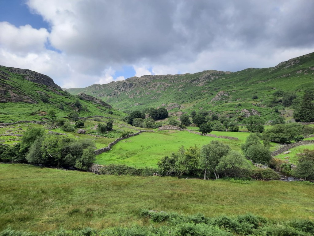
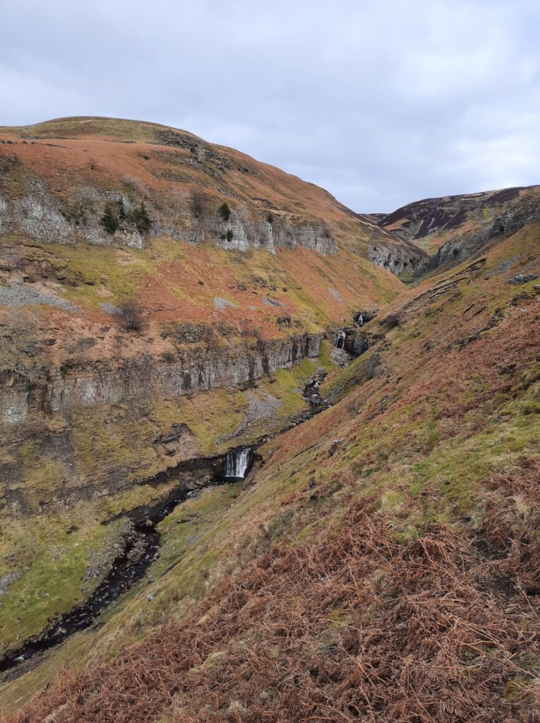
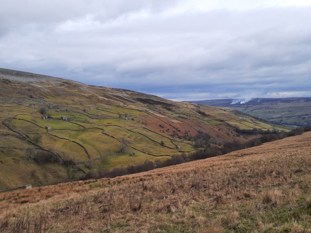
Claire’s nearest unbagged Wainwrights to Little Langdale were actually in Eskdale, so we drove over the Wrynose and Hardknott passes in the morning to tackle a long-ish horseshoe there. Our first objective was Hard Knott, which we ascended via the Roman Fort and Border End. We continued down the broad north ridge with good views of Crinkle Crags and Bow Fell to the right, and the Scafell range to the left. Lingcove Beck was easily crossed (more hesitantly by Claire!) after a few dry days, to reach the long, gentle south ridge of Esk Pike. I hadn’t taken that route before – great views of upper Eskdale but it felt a long way and we had a well-earned first lunch near the summit. This was also the first place we saw any others walking, except on the road in Eskdale!


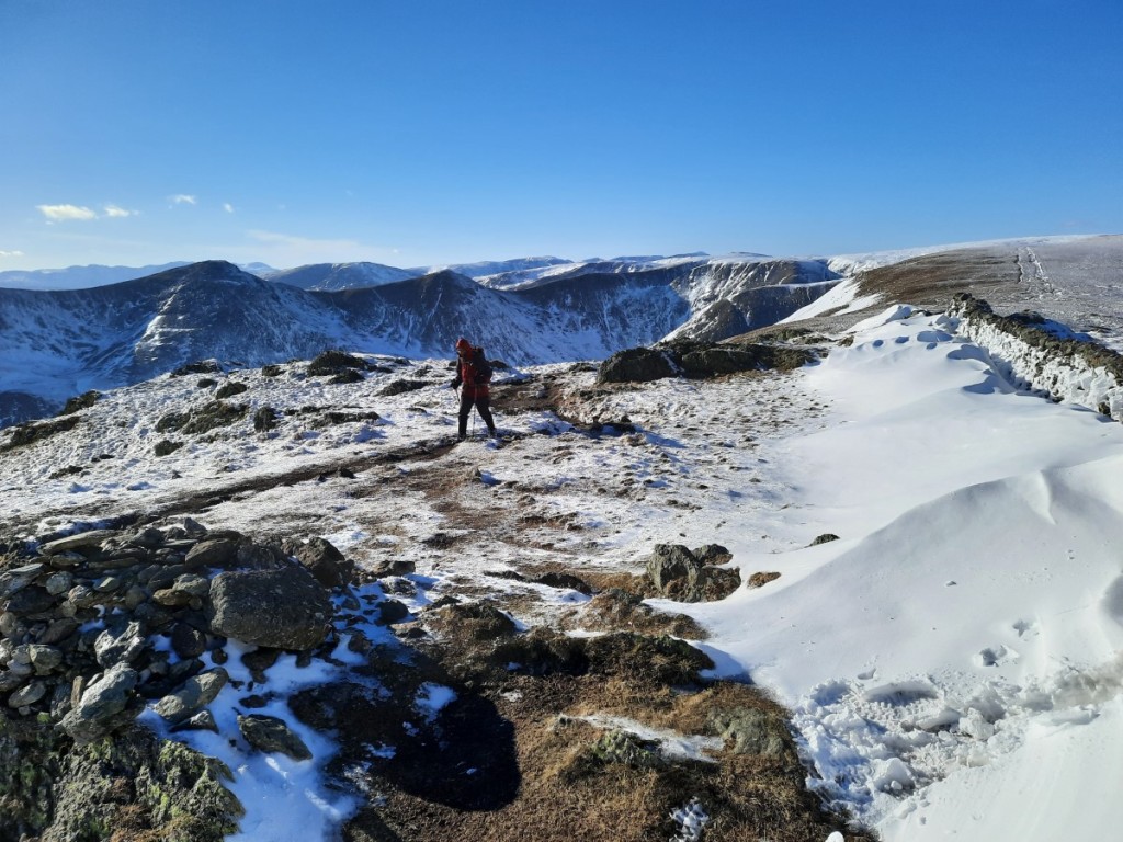
We continued over Esk Hause and along the well-trodden bouldery ridge to Scafell Pike – more pleasant than often thanks to the reduced crowds of a Friday afternoon. There were great views towards Great Gable and Pillar in particular, although haze reduced the clarity. Soon we continued down to Mickledore where we opted for the Lord’s Rake route to Scafell as there was no significant snow on the ground. Ruth had suggested the ‘West Wall Traverse’ variant and it looked more appealing than the loose upper parts of the Rake so we gave that a go – I would recommend it as the rock is generally more solid and you emerge closer to the summit of Scafell.


After second lunch we pressed on south to Slight Side, our final Wainwright of the day. It was already around 4pm so we tried not to faff much on the long, grassy descent of the quiet footpath above Cowcove Beck and into Eskdale, and finally got back to the car around 6pm. That just left a short drive back over the two passes to the hut, where we arrived just before dark. We were surprised to find nobody in residence – turned out the others had gone to the pub for a drink. The evening was spent over dinner, a couple of drinks and lots of conversation, as usual.
Route map: https://www.plotaroute.com/route/3259277


Saturday started with the traditional group breakfast of porridge and toast. Hoping to attract a few companions for the day, I proposed a medium walk from the hut around Greenburn onto the Coniston Fells. Julia, Teena, Simon and Jayne, plus the ever-reliable Claire, opted to join me. The overnight frost soon cleared in the warm sunshine, but the air was even hazier than on Friday. Our first destination was Great Intake – rough going on small paths and some tussocky ground, but a decent viewpoint towards the Langdale Pikes and Wetherlam, and there were some interesting old slate workings.


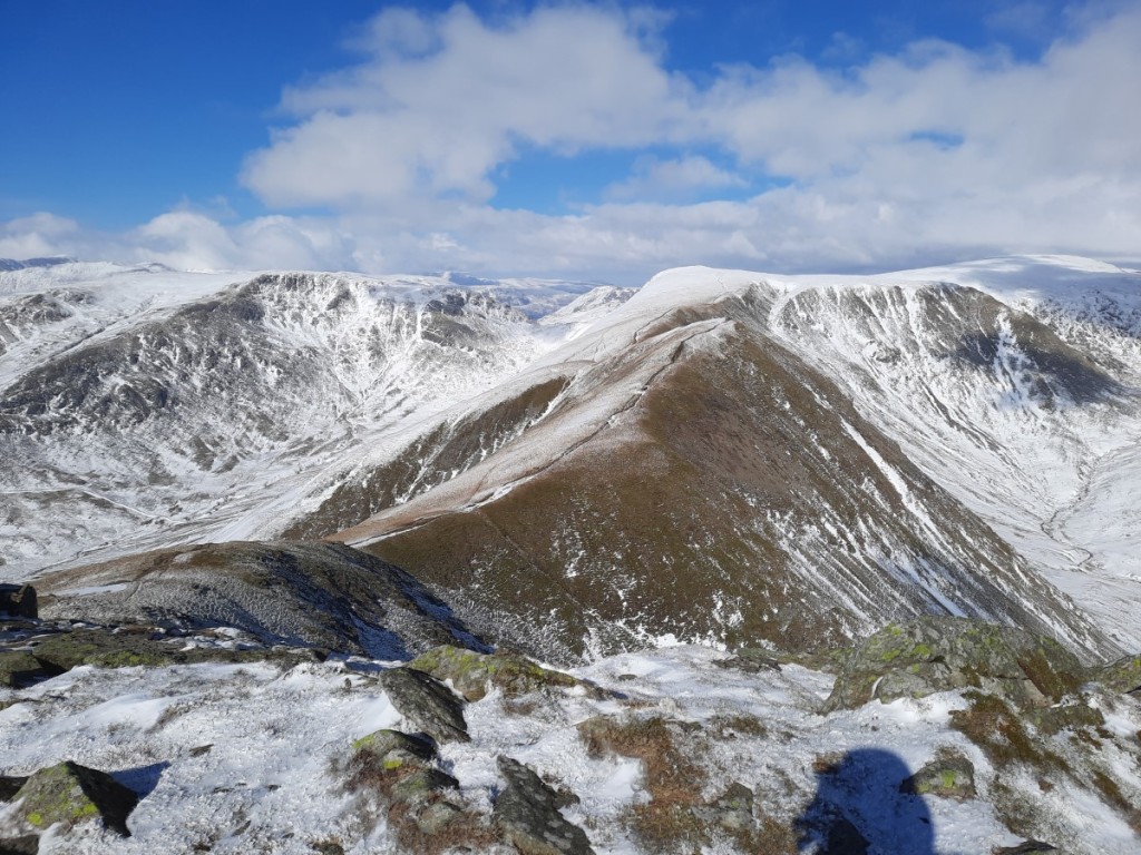
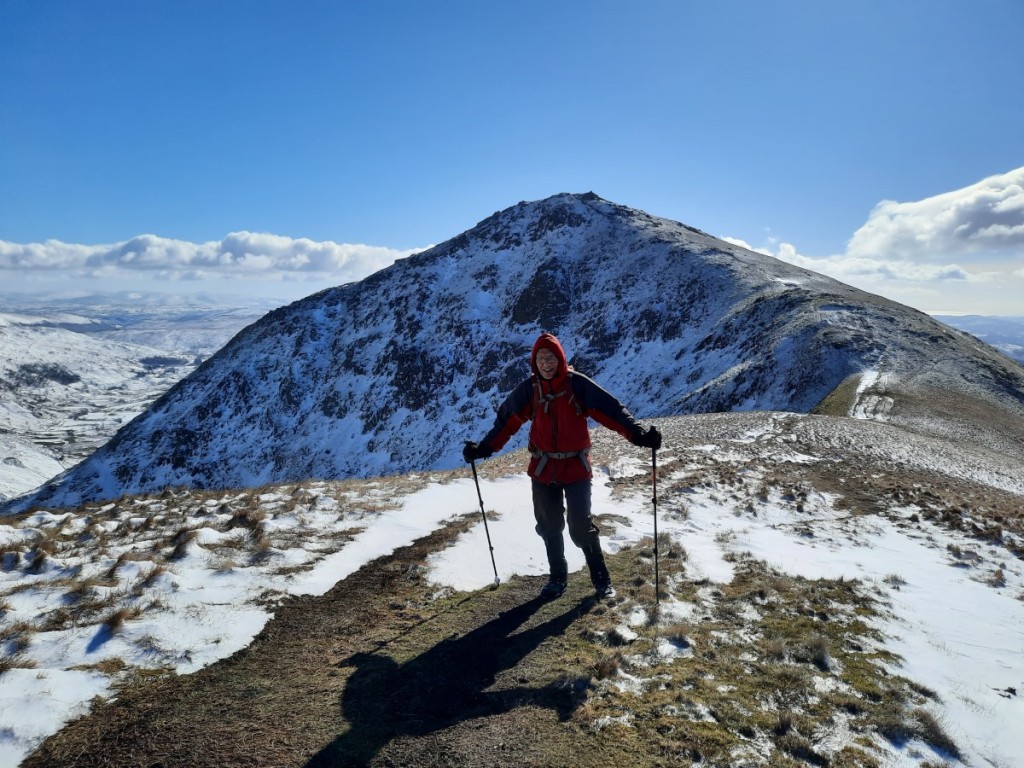
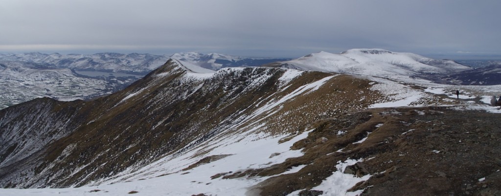
We joined some better paths on the ridge of Birk Fell, which made for quicker going, then there was a little easy scrambling on the steeper climb up Wetherlam Edge. We had a bite to eat at the summit, then continued via Black Sails (Simon and Jayne took the direct path) to Prison Band and up to Swirl How. After lunch near the summit, we continued across the gentle saddle to Great Carrs and its air crash memorial. Simon and Jayne opted to continue directly down Wet Side Edge while the rest of us took the scenic detour to Grey Friar and the Matterhorn Rock. Wet Side Edge gave an easy, grassy descent back into Greenburn, with a slight detour to the Birkett summit of Hell Gill Pike, which offered unfamiliar views over Wrynose Bottom. We had a quick look around Cathedral Cavern before returning to the hut for the usual tea, cake, showers, dinner and drinks.
Route map: https://www.plotaroute.com/route/3259875


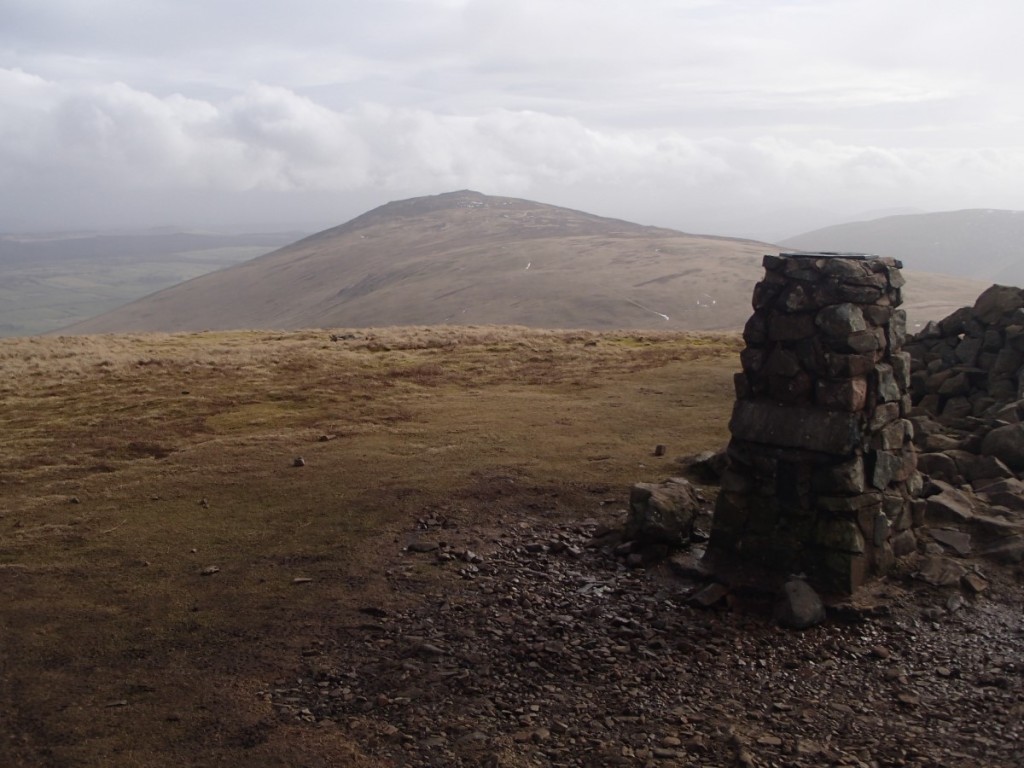
Sunday started with breakfast together, than some packing and cleaning and tidying of the hut. As usual, most of the group wanted short walks before the drive home on Sunday. Claire and I went for a fuller day out, ticking off a few more of her unbagged Wainwrights on a walk from Dunmail Raise. First up was Seat Sandal, where we were surprised to gain views over a cloud inversion to Steel Fell, the Langdale Fells and the distant Scafell range.

A short but steep descent brought us to Grisedale Tarn, always a pretty spot, then well-pitched zigzags led up to Dollywaggon Pike for some grand views of Saint Sunday Crag and across Ruthwaite Cove. It was easy walking from there over Nethermost Pike and we paused for lunch in a surprisingly sheltered spot overlooking Striding Edge.


At the summit of Helvellyn, a member of the Patterdale Mountain Rescue Team sold us a couple of tickets for the upcoming duck race, and supported my suggestion that we add a loop of Swirral and Striding Edges to our itinerary! Claire was motivated by a visit to Catstycam, of course, while I fancied the scrambling on the nice dry rock. About 1h45 later we were back on the summit of Helvellyn, but without views this time as the cloud had dropped to around 750m. We descended the well-built Birk Side path in light drizzle, but pretty much dried out again on the final traverse back to the car at Dunmail Raise.
Route map: https://www.plotaroute.com/route/3261033


We decided to take up Ruth’s offer of roast chicken dinner in Hale, then had an easy drive back to Hilton, arriving at mine by 9pm. Another fun weekend away with the Gentians, with three contrasting walks and a first taste of summery weather for the year. Claire bagged seven new Wainwrights, and I realised we also visited the highest three (Scafell Pike, Scafell and Helvellyn)! My full photo album can be found here.