Gentian Bannau Brycheiniog Trip (21st-23rd April 2023)

Hard to believe it’s almost six months since the last Gentian trip to South Wales (the Annual Dinner meet in November)! This time we were based further southwest, at the well-appointed Clyngwyn Bunkhouse near Ystradfellte. With quite a few other long weekends coming up, I decided not to take the Friday off work this time, and didn’t regret that decision when Friday morning was a very wet one in Derby! Nonetheless, I was able to get away from work reasonably promptly, just before 4pm, and it was a very welcome surprise that I didn’t encounter any major delays on my journey down the M42 and M5 at rush hour!

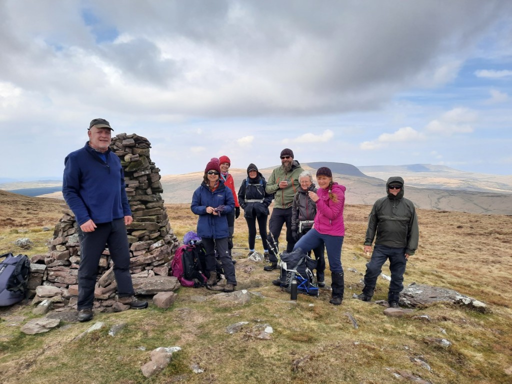
I paused for dinner at Ross-on-Wye and arrived at the bunkhouse soon after 7:30. Most of the others had already arrived – some having walked on Pen y Fan – but a few were out at the pub for dinner. As usual, the evening passed quickly with good conversation over a couple of glasses of wine. It was good to meet a couple of enthusiastic new members – Claire and Julia – on their first meet.

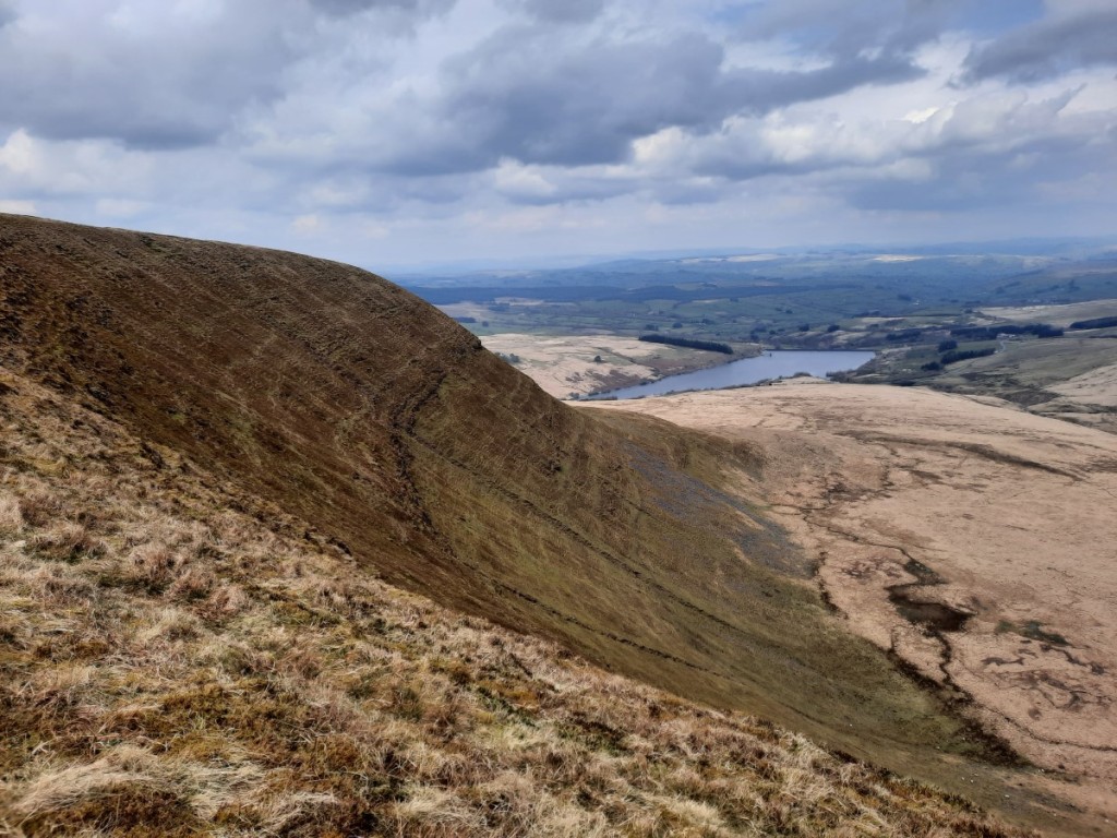
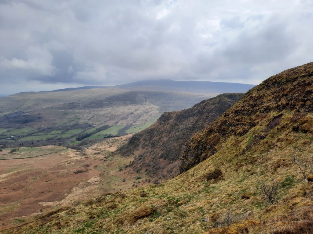
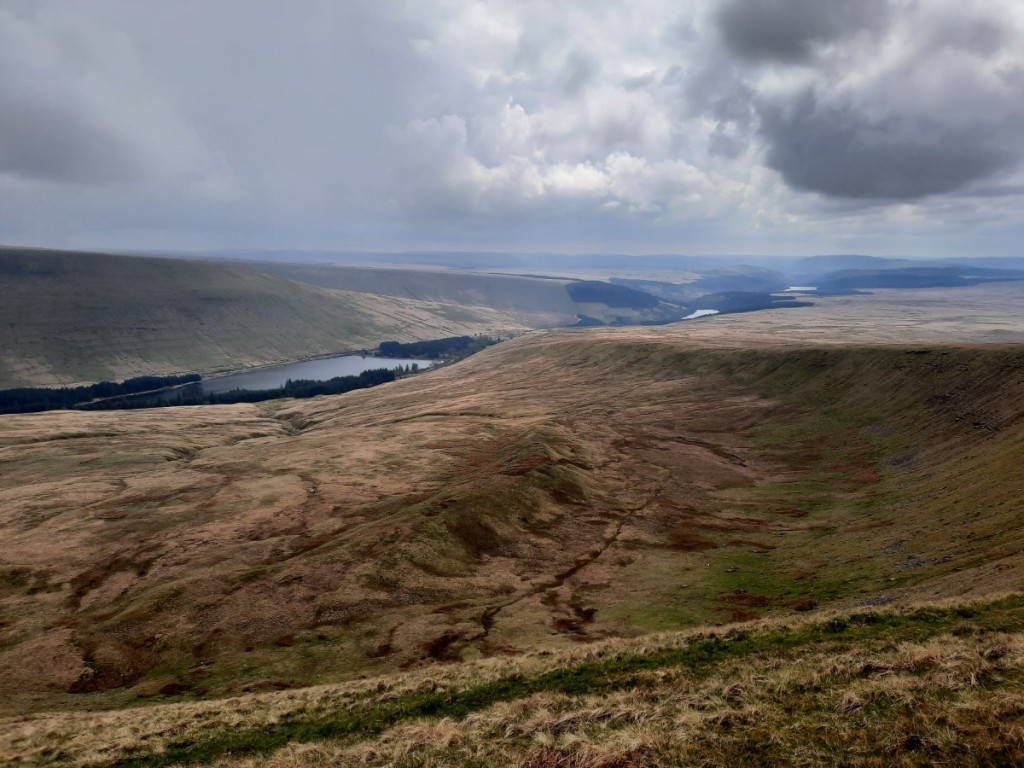
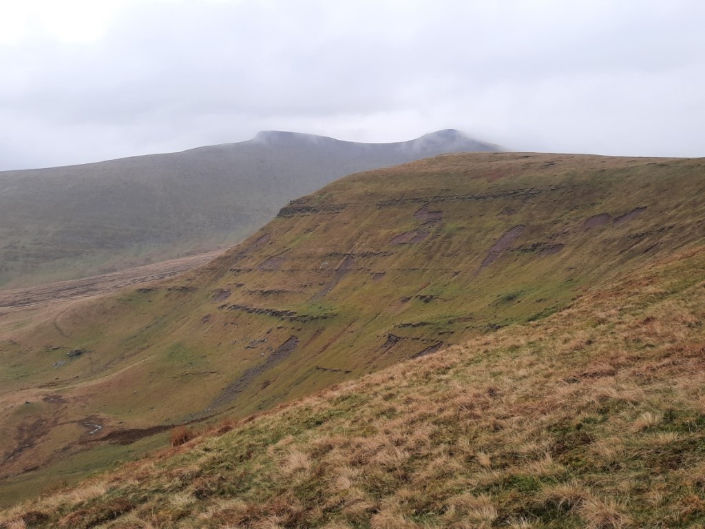
With the forecast showing dry weather until mid afternoon, my proposed Saturday walk taking in three of the nearby central-Beacons hills proved pretty popular, with eight others signing up. We started a few miles up the lane at Plas-y-gors, and walked up easy grassy slopes to our first objective, Fan Llia, and its slightly lower neighbour, Fan Dringarth. A post-glacial landslip on the east side of the ridge gave a nice foreground for photos looking towards Pen y Fan and down to Ystradfellte Reservoir.

Looking towards Pen y Fan, from Fan Dringarth

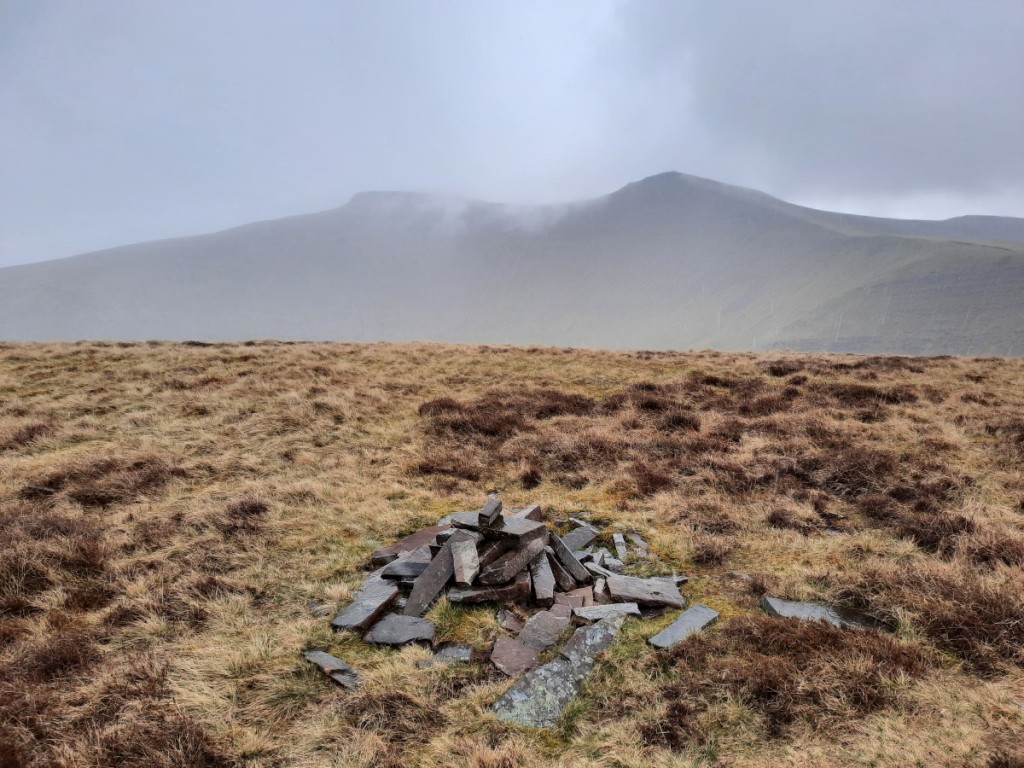
Our descent onto the spur of Bryn Melyn was pathless but pretty easy ground, picking up sheep trods further down. Once we’d crossed the lane, it was a fairly steep ascent back up to Fan Nedd via its northeast ridge, topped with a large cairn where we paused for a snack.

Looking towards Fan Gyhirych from the northeast ridge of Fan Nedd
The group on Fan Nedd (Simon, Julia, Claire, Wendy, Simon, Sheena, Petra and Martin)

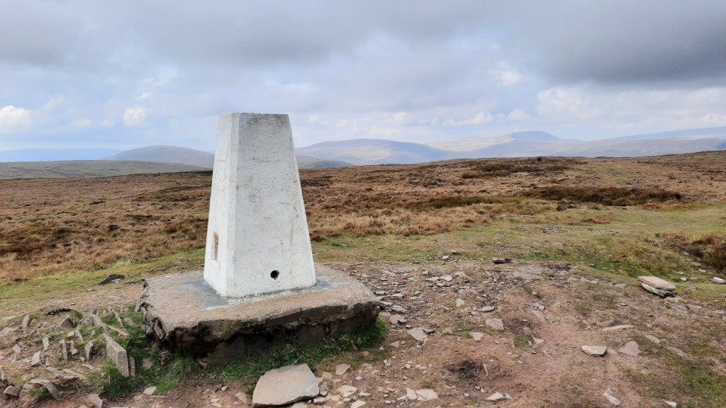
After a short detour to the summit, with its dragon-emblazoned trig point, we continued down to Bwlch y Duwynt to join the large track onto Fan Gyhirych. Further up, we struck off to the right to keep on the crest of the northern cwm, where we stopped for lunch with great views looking back past the morning’s hills towards Pen y Fan.

Looking down to Cray Reservoir
Looking back from our lunch spot

After visiting the trig point, we headed south on the surprisingly large and well-maintained gravel track, passing a couple of small quarries before climbing back up slightly and over the fence onto Carreg Cadno. This area has many limestone outcrops on the hilltop, and a huge network of caves beneath! The Beacons Way provided easy walking from there down to the River Nedd, where we joined the Sarn Helen Roman Road for the final stretch back to the cars. A few spots of rain fell now and then over the final hour or so, but never justified waterproofs.

Sarn Helen Roman Road

We returned to the bunkhouse and had a couple of hours to shower and relax over a few cups of tea before the club AGM at 6pm. This was an uncontroversial meeting, all done in less than half an hour, but did include election of a new Chair and Meet Booking Secretary. Dinner followed, with Greek salad to start, then a very tasty beef bourguignon for the meat-eaters, followed by pashka prepared by Wendy – apparently a traditional Easter dessert in Eastern Europe and Russia.

Sunday’s mountain forecast was a bit more showery, but we rose to find blue skies and the regular forecast showing it should stay dry until lunchtime. I thought that would be enough to tempt a few others to join my planned walk around the Glyn Tarell skyline over Fan Fawr. I was mistaken though, and ended up doing the walk solo while most others just did a short stroll around the classic waterfalls walk. The lack of enthusiasm among hillwalkers for making the most of all opportunities to walk up hills, having driven many hours from home to do so for the weekend, continues to bemuse me, even if I’ve learned not to be surprised by it! The phenomenon is certainly not unique to the Gentian Club!

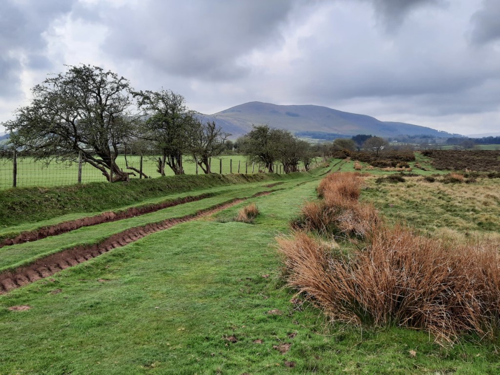
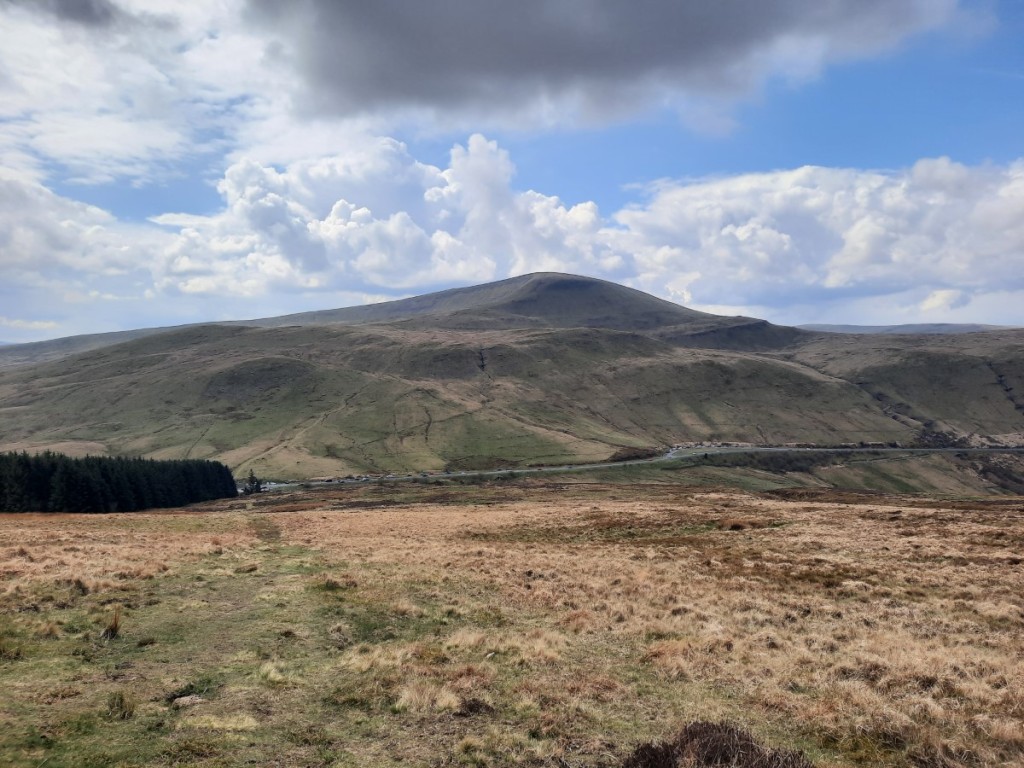
Once all the cleaning, tidying and packing was done after breakfast, I said my goodbyes and set off for Libanus, a drive of about 30 minutes. I started off by ascending the bridleway onto the ridge of Mynydd Illtud to pick up the Sarn Helen Roman Road again, and follow it southwest for a bit, with views of my route for the day. Pen y Fan was in-and-out of cloud, which continued all day, but everything else stayed clear. Once across the main road, I ascended the attractive northeast ridge of Fan Frynych, which has a good path all the way. The summit was a good viewpoint for the previous day’s three hills, with the Black Mountain beyond to the right.

Fan Frynych from Mynydd Illtud
The summit of Fan Frynych, with Fan Llia, Fan Nedd and Fan Gyhirych in the sunshine

From there, I headed south, skirting around the crest of the impressive Craig Cerrig-gleisiad before following the broad grassy ridge towards Fan Fawr. A steep final ascent of 100m brought me directly to the summit, with good views over the eastern crags into Cwm Tae with its reservoirs.

Looking along Craig Cerrig-gleisiad towards Pen y Fan (just in the cloud)
Three reservoirs in Cwm Tae

Corn Du and Pen y Fan did not look far away, the other side of Storey Arms, and the grassy descent to the outdoor centre did not take long. Then it was an easy climb back up to the minor summit of Y Gyrn, following a grassy path to the left of the main path to Pen y Fan and thus avoiding all the descending crowds! I ate my lunch by the cairn in the sunshine, wondering whether I might add the higher hills to my route for the afternoon. Then I looked north and saw grey clouds and rain approaching and resolved to stick with my original plan of descending directly via Pen Milan!

Looking back to Fan Fawr

It did rain fairly heavily for 15 minutes as I made my way northeast from Y Gyrn to the main ridge, but then stayed mostly dry again for the remainder of the walk, with sunny spells returning to give some excellent views up Cwm Llwch to Pen y Fan. A short section on lanes brought me back to Libanus at around 2:30pm, and clear roads (except for lots of heavy showers) got me back home by 5:30 without delay or incident.

A shower over Pen y Fan and Corn Du
Pen y Fan from Pen Milan
Cwm Llwch

Another very enjoyable weekend away, not really marred by the lack of company on Day Two. I definitely felt like it had been the right choice to head back into the hills rather than joining in with the waterfall walk! Looking forward to the next meet, in mid-Wales in June.

Maps of my routes are available here:
Fan Llia to Fan Gyhirych
Fan Fawr
More photographs can be found on Google Photos here.

Gentian Brecon Beacons Trip (4th-6th November 2022)

This weekend was the Annual Dinner meet of the Gentian Mountaineering and Hill Walking Club, the first such occasion since I joined the club, held this year in the Brecon Beacons. Our accommodation was the well-equipped and comfortable Star Bunkhouse in Bwlch. I got a prompt finish from work, paused briefly at home to pack the car, and had a surprisingly good journey down the M42 and M5, with no more than half an hour of delays despite travelling in the height of the Friday rush hour. After stopping for dinner at Strensham services, it was only another hour or so to go, and I arrived at around 7:30pm. A few had gone to the pub across the road but most of us spent the evening chatting over drinks in the bunkhouse. It was good to meet a few more of the regular members whose paths I hadn’t crossed on other trips this year.

Saturday began with the standard group breakfast of porridge, toast and cereal. The forecast was for quite a wet and windy day. I offered to lead a walk starting a few miles down the road in Crickhowell, up onto the hills to the north, and six of the group elected to join me. We ascended via the Beacons Way up the unexpectedly pretty Cwm Cumbeth, with lovely autumn colours and an attractive stream cascading down. Once above the intake wall at around 400m, we traversed around to the hill fort at Table Mountain, known in Welsh as Crug Hywel – presumably the town below was named after the fort. The defensive earthworks are still clearly visible, and the hill gave good views both ways along the Usk valley as well as towards the Sugar Loaf and Crug Mawr.

Looking back over Crickhowell
Cwm Cumbeth
Looking towards the Sugar Loaf, from Crug Hywel fort

We continued north up the ridge to Pen Cerrig-calch, which I had previously climbed from the east, and entered the cloud at around 500m. The paths were clear though, so navigation was straightforward up to the trig point, and onward along the ridge to Pen Allt-mawr, where the trig point is lying on its side. Some showers blew through, but the rain was never very intense and the wind was not severe either. We had lunch in the shelter of the cairn before heading back south along the ridge, but this time keeping to the paths on the west side. After a few hundred metres, we passed Mick’s group going the other way. Soon we were on the rocky outcrops of Pen Gloch-y-pibwr, from where we had fleeting views down into the valley as the clouds parted.

We descended by the southwest ridge, mostly pathless, and initially over very slippery limestone, but later on short grass and heather. On the crags at Bryniog, we dropped back out of the mist and had views into the valley again. The rest of the descent to the Beacons Way was rougher, but we found a relatively painless route through the bracken. The path then traversed across Cwm-gu and over the next spur to drop back into Crickhowell. It had been a surprisingly pleasant day, considering the poor forecast, and a good scenic walk.
Route map: https://www.plotaroute.com/route/2080105

The linestone crags of Bryniog
Back on the Beacons Way

We were back at the bunkhouse soon after 3pm, leaving plenty of time to shower, rehydrate with a few cups of tea, and then get changed into smarter clothes for dinner. We gathered in the hut dining room for prosecco from 5pm, and were then picked up by our coach at 6pm to head back into Crickhowell, where our dinner venue was the Bear Hotel, an attractive 18th century coaching inn. The hotel served a tasty meal, which we enjoyed over good conversation. Afterwards, our special guest Alan Bowring, a geologist at the Brecon Beacons National Park and Geopark, gave us a very interesting and engaging presentation on the geological history of the region – a complex mixture of different sedimentary rocks laid down as what is now the Beacons drifted from 60 degrees south of the equator to where it now lies, 52 degrees north! The coach came to return us to Bwlch at 11pm and, like most others, I didn’t hang around long before getting to bed.

The Bear Hotel, Crickhowell

Sunday started dry, and the forecast showed heavy showers. Feeling optimistic, I planned a longer walk from Talybont Reservoir up onto Allt Lwyd then around the horseshoe via Pant y Creigiau. Simon and Sheena opted to join me again. The first rain arrived just as were finishing putting our boots on, but we set off undaunted. A reasonable, grassy path led us up to the southwest onto the ridge of Allt Lwyd – a route I had not taken before – with good views initially back down to the lake and Tor y Foel. I was surprised to find that, higher up, the path was in the process of being surfaced with shale and sandstone. As the rain intensified, we soon entered the mist, but the many bags of helicopter-dropped materials marked the way!

Looking back over Talybont Reservoir to Tor y Foel
Sheena and Simon in the rain

Beyond the summit, we continued along the well-defined ridge northwest, wishing that the views either side were visible to us. By the time we’d reached the large cairn at the eastern end of Waun Rydd, we were pretty damp and, 90 minutes in, the rain was showing no sign of abating, so we made the decision to take the shorter, direct route down via Twyn Du. Typically, half an hour later it was brightening up a lot, and the cloud had cleared the tops, and we wished we had pushed on a little longer into the rain! Anyway, we got some good views over the Usk valley towards the Black Mountains, and again across the reservoir to Tor y Foel, and the autumn colours were beautiful.
Route map: https://www.plotaroute.com/route/2080784

Views towards the Black Mountains on the descent
Autumn leaves and berries

We had our lunch in the dry on a picnic table near the reservoir shore, then changed out of our damp waterproofs and headed home. My drive went smoothly, taking 2h40 without needing a break. Overall, despite the persistently damp and grey weather, a very enjoyable weekend, sharing good company both on the hill and at the dinner. A fitting end to my first year in the Gentian club. There was talk of perhaps making the 50th Anniversary Dinner (in 2024) a black tie event, which would be more akin to the CUHWC Annual Dinners of student days! Let’s see what the future brings.

My full photo album is available here: https://photos.app.goo.gl/hQwgcnPi5uH9A7eS7

Dragon’s Back Backpack. Part 3: Brecon Beacons (4th-6th August 2021)

The final three days of our trip were heading through the Brecon Beacons National Park: steeper, more mountainous terrain after the rolling, grassy hills of mid-Wales, but shorter distances per day, so not too strenuous.

Day 12: Black Mountain

Route map: https://www.plotaroute.com/route/1652705

With a planned wild campsite that we thought would be quite busy with passing walkers, we didn’t want to arrive early, so we had a leisurely start to the day in Llandovery. This also gave chance for the tent to dry out pretty thoroughly before we packed it away, which was welcome with three days of food in the bag. The first hour or so was on lanes, gradually uphill towards Mynydd Myddfai. This gave good views towards the Black Mountain, particularly as we started descending to Usk Reservoir.

The Black Mountain over Usk Reservoir

Lanes and tracks led us easily through the forests, which just led us with a long grassy ascent onto the mountain: an attractive route with good views of the steep escarpments both sides of Fan Foel.

Ruth below the Black Mountain
Fan Brycheiniog

There were plenty of people around on Fan Brycheiniog, and plenty following the path from there down to Llyn y Fan Fawr, where we planned to camp. I had seen from above, on my recent previous visit with Bec, that this looked like ideal camping ground, and so it proved. Quite a few people were wild swimming in the lake, so we just sat and enjoyed the place for a while, pitching our tent when it had got a little quieter. It was much more pleasant in the evening, once the tourists had gone home!

Our seventh and final wild campsite, by Llyn y Fan Fawr

Day 13: Central Beacons

Route map: https://www.plotaroute.com/route/1652711

Rain was forecast for much of the day, but particularly for the afternoon, so we got a very early start in hope of avoiding the worst of it. We set the alarm for 5am, and broke camp pretty efficiently, having had our breakfast and got everything packed up by 5:40, just as the first drops of drizzle arrived – already worth it just to be carrying a dry tent!

With the drizzle came the mist, and the start of the path beside Nant y Llyn was a little awkward to follow in the gloom. It soon brightened up though, and the valley below was in the clear. A steep, pathless ascent brought us up to the misty summit of Waun Leuci, which turns out to be a HuMP that I hadn’t previously bagged! An equally pathless descent took us down out of the cloud to the main road, followed by the steepest climb of the day, up to Fan Gyhirych. We were pleased that the rain still hadn’t amounted to more than a few short showers on this strenuous section of the day’s walk.

The summit of Fan Gyhirych

From the summit, we picked up reasonable paths all the way along the ridge, down and back up to Fan Nedd, although most of the way was in the cloud. Another steep descent and reascent brought us to Fan Llia, where more significant rain set in for the next hour or so as we traversed around the head of the valley to Fan Fawr, the day’s highpoint. The summit was a particularly exposed spot, with the wind whipping up the crags and driving the rain horizontally. We were glad to turn back to the north and have it on our backs as we continued to the day’s final summit, Craig Cerrig-gleisiad.

Looking down the Senni valley
Ruth below Craig Cerrig-gleisiad

From there, it was just a short descent to YHA Brecon Beacons, our accommodation for the night. Arriving around noon, we were disappointed to find that check-in didn’t open until 5pm. However, a very friendly and helpful member of staff allowed us to put our bags inside in the meantime and gave us a lift down to Brecon where we could spend the afternoon out of the rain! We spent the afternoon relaxing in a couple of cafes, then caught the bus back up to the hostel. Our four-bed room gave plenty of space to spread out our slightly damp gear to dry fully, and the hostel meal of bangers and mash went down very well in the evening!

Day 14: Pen y Fan

Route map: https://www.plotaroute.com/route/1652712

Our plans to use public transport to get back to our cars in Conwy that afternoon necessitated another very early start, out of the hostel door at 5am this time, just at the start of twilight. We used headtorches to guide our way the first kilometre or so across the valley to the Taff Trail, which was a large enough track to see clearly.

By the time we reached the Storey Arms, it was pretty much fully light. We continued straight up Corn Du and Pen y Fan, making quick progress up the well-surfaced tourist path, and appreciating the lack of rain! Mist obscured any views above about 600m though, and a heavy shower passed over as we traversed down and back up to Cribyn. However, it then brightened up for a spell as we continued over the next bwlch to Fan y Big, with the cloud-base rising enough to give good views of the sandstone cliffs.

A clear spell as we headed to Fan y Big
Looking down Cwm Cynwyn

There followed an hour or so of pretty heavy rain, so we kept our heads down and didn’t pause much as we continued to Waun Rydd. It began to ease as we descended the good path down the Twyn Du ridge, and actually our waterproofs were well on the way to drying out by the time we had got down to the bottom and followed the lanes down to Talybont-on-Usk village.

Ruth on Twyn Du

We had made quick progress, and arrived with an hour to spare before our bus. Disappointingly, an hour and three quarters later, it still hadn’t arrived, so we gave up on that plan and ordered a taxi that would pick us up half an hour later and take us to Abergavenny. We had bacon sandwiches from the cafe in Talybont while we waited, and then got second lunch at Greggs in Abergavenny when we found we still had an hour or so to fill before our train.

The remainder of the journey went more smoothly, the first train to Shrewsbury running just a few minutes late, and the second one to Llandudno Junction almost on time. A short walk over the bridge led us back to our start point in Conwy, where we enjoyed a fish and chip supper before saying our goodbyes and driving back to our two homes.

All in all, an excellent fortnight’s adventure, and a worthy substitution for our more usual trip to the Alps. The total distance was around 330km, with over 16000m of ascent (and descent!), much of it over tricky rocky or rough terrain with only small paths and trods. We had enjoyed seven wild camps, four campsite camps, an Airbnb and a Youth Hostel over the fortnight.

The Dragon’s Back is definitely a formidible challenge for the race participants, who complete our 14-day expedition in just five days, albeit without backpacking gear. We didn’t feel we’d missed out on too much by omitting the sixth day of the race route, down through Merthyr Tydfil and the valleys to Cardiff – much less wild and mountainous country. Regardless, this was my longest ever backpacking expedition, in terms of days as well as distance and ascent.

My full photo album is available on Google Photos:
https://photos.app.goo.gl/z6UL2qFZp3q5Xkjn6

Brecon Beacons (11th-13th October 2019)

I organised Rolls-Royce (Derby) Band’s fifth biannual hillwalking trip, this time to the Brecon Beacons, with seven others joining me for the weekend this time. We stayed at the remote and rustic but friendly YHA Brecon Beacons hostel near Libanus.

Saturday started with a spot of parkrun tourism at Bryn Bach just outside Tredegar (of brass band fame, appropriately!). Despite being the UK’s highest-altitude parkrun (based on start location), this was a flat and fast course, two and a half times around an attractive lake.

We then headed a few miles northwest for a horseshoe walk from Taf Fechan Forest up Pen y Fan, the highest peak in the National Park. Construction works on the lower Neuadd Reservoir forced us onto a boggy diversion path below the dam, but we soon reached the more solid ground of the steep pitched path up to the Graig Fan Ddu ridge. The morning mist gradually rose to give good views up the valley to Cribyn, with Pen y Fan itself coming into view as we continued up the gentle ridge path.

The group on the ridge below Graig Fan Ddu: Alex, Ian, Jo, Jeff, Helen, Amina and Heather

Sadly the cloud had dropped back down onto the tops and a few showers passed by as we traversed Corn Du and Pen y Fan, so we didn’t linger long at the top. However, conditions improved again as we descended above Craig Cwm Sere, giving great views back across the northern cliffs of Pen y Fan and ahead to our next objective, Cribyn.

The grassy cliffs of Pen y Fan

Once over Cribyn, we continued east to Fan y Big before retracing our steps to the bwlch and descending the good track south across Tor Glas to the cars. Then it was back to the hostel for a few welcome cups of tea, a hot shower, and then a feast of chilli, spag bol, sticky toffee pudding and jam roly poly kindly prepared by Helen!

Sunday’s forecast was wetter, but the reality was actually drier than Saturday! After a leisurely start and breakfast, we opted for a shorter walk up the Sugar Loaf above Abergavenny. We ascended by the Rholben ridge then traversed west before approaching the summit from the southwest, enjoying views most of the way but entering the cloud near the summit. Our descent route was along the Deri ridge then down through the attractive oak woodlands to Twyn-yr-allt.

Looking up towards the Sugar Loaf

My full photo album is available on Google Photos here: https://photos.app.goo.gl/uw9rcxzze6gbvgkG8

All-in-all, this was the dampest band hillwalking trip yet, but this did nothing to dampen spirits and we had a relaxing time in great company exploring these attractive hills. Only six months until the next one!

Brecon Beacons (26th-27th November 2016)

I made an “emergency” weekend trip to the Brecon Beacons to re-complete my Nuttalls (English and Welsh 2000ft hills) following the recent promotion of Craig Gwaun Taf to the list. As well as the re-completion, I was rewarded with a spectacular cloud inversion around the high Beacons, and some snow on the tops. On the Sunday I bagged a few Marilyns on the western edge of the Black Mountains.

https://photos.app.goo.gl/gGaRYjRrMHF9gbkG9

The snowy ridge to Pen y Fan

Brecon Beacons (11th-13th April 2014)

I met up with eight other Duffers for a weekend in the west of the Brecon Beacons National Park, staying at Ynysmarchog Bunkhouse in Trecastle. Good walks on the Black Mountain on Saturday and above Heol Senni on Sunday allowed me to tick off all my remaining South-Welsh Nuttalls, and I also managed to fit in ascents of the Sugar Loaf on Friday evening and Ysgyryd Fawr on the way home!

https://photos.app.goo.gl/FkxN6geDexYBXmAJ8

Looking west from Fan Nedd’s northern cairn to Fan Gyhirych and the Black Mountain

Brecon Beacons (6th-7th July 2013)

To make the most of the sunny weather, I spent the weekend in the Brecon Beacons – my first visit since 2004! On Saturday I did a long-ish walk to tick off a few Nuttalls and Deweys in the east of the range. On Sunday I opted for a shorter walk near Storey Arms, so I could head home in time to watch Andy Murray triumph in the Wimbledon final.

https://photos.app.goo.gl/9pBV3SSRZPyoP8FJ6

Looking past Fan y Big and Cribyn to Pen y Fan

CUHWC Brecon Beacons Trip (23rd-25th January 2004)

The first weekend trip of Lent term ’04 was to the Brecon Beacons National Park, staying at the South Wales Caving Club’s bunkhouse at Penwyllt. I spent Saturday walking on the Brecon Beacons, doing Pen y Fan, Corn Du, Cribyn and Fan y Big, and on Sunday four of us enjoyed an excellent walk on Black Mountain. Much time was also spent squeezing through improbably small gaps in benches, fences etc.: an activity befitting a weekend staying with cavers!

https://photos.app.goo.gl/hT7P3svJdQh9TcnDA

Looking back from Waun Lefrith